Albury, New Zealand
| Albury | |
|---|---|
| Village | |
|
Albury | |
| Coordinates: 44°13′50″S 170°52′26″E / 44.23056°S 170.87389°ECoordinates: 44°13′50″S 170°52′26″E / 44.23056°S 170.87389°E | |
| Country | New Zealand |
| Government | |
| • Territorial Authority | Mackenzie District Council |
| • Regional council | Environment Canterbury |
| Website | Mackenzie District Council |
Albury is a small village in the southern part of the Canterbury region of the South Island of New Zealand. It is inland from Timaru and located on State Highway 8 between Pleasant Point and Fairlie. It is in the Mackenzie County (Mackenzie District).
History
Albury is located in a rural farming district, and for over six years in the 19th century served as the temporary terminus of the branch railway line that would become the Fairlie Branch. The line was opened on 1 January 1877 and an extension beyond the town to Winscombe opened on 24 August 1883.[1][2] Although the Fairlie Branch closed on 2 March 1968, some formation from the line can still be seen around Albury.[3] Albury is thought to have been named by the Kennaway brothers.[4]
Education
In 2007, Albury School celebrated its 125th anniversary. It currently has two classrooms, one for years 1 and 2 and one for years 3 to 6. Most children go on to the high school in Fairlie (Mackenzie College).
Water supply
The water supply for the village and those close to SH8 comes from the Downlands scheme. Most of the district is served by the Albury Rural Water Scheme that supplies water for both stock and homesteads. Prior to these schemes houses would pump water from the rivers, or get it from an open water race that was built for stock and human use. Remnants of the water race supplying Mt Nessing Station (A very large farm or ranch greater than 8000 acres (32 km²)) can be seen on the Mt Nessing Golf Club's course. Water for the Albury Scheme is taken from a tributary branch of the Opawa River. This scheme was built in the late 1960s/early 1970s and uses no pumps - the system is driven by gravity. It was served by one low dam until 2000-2002 when another branch of the river was dammed to increase the water flow to the headworks. This was necessary as water flow was becoming too low in the original branch. Filtering for the scheme is performed by a long, dual channel trough that contains various grade of gravel with the coarsest at the bottom (Sand Filter). Little maintenance is required apart from periodic flushing of the filter by flowing water backwards through it.
Picture gallery
-
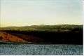
Taken from hills NE of Albury.
-

Looking from Mt Nessing area towards Fairlie
-

Looking from Mt Nessing area with Aoraki/Mount Cook in the distance
Local Clubs and Organisations
- Mount Nessing Collie Club
- Mount Nessing Golf Club
- Rural Women (Formerly Women's Division of Federated Farmers)
Local Events
Every year around March/April the Albury Pub/Tavern/Bar is the destination of a mountain bicycle race. The race is called the "Pass to Pub". The race goes for about 35 km from Burkes Pass to the Albury Tavern. Local organisations put on barbecues and sell items for fundraising activities at the end.
References
- ↑ New Zealand Railway and Tramway Atlas, fourth edition, edited by John Yonge (Essex: Quail Map Company, 1993), 24.
- ↑ New Zealand Railways Department, Geographical Mileage Table (New Zealand Railways Department: Place of publication within New Zealand unknown, 1957), 19.
- ↑ David Leitch and Brian Scott, Exploring New Zealand's Ghost Railways, revised edition (Wellington: Grantham House, 1998 [1995]), 79-80.
- ↑ "Albury". Ministry for Culture and Heritage. Retrieved 18 February 2015.
External links
- Albury School's official website
- Albury Tavern and Nana's Backpackers website
- Opawa Homestead Bed and Breakfast
- Rural Women New Zealand
- New Zealand Young Farmers
- New Zealand Sheep Dog Trial Association
- Mackenzie County Council