Alden, Kansas
| Alden, Kansas | |
|---|---|
| City | |
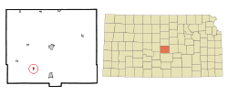 Location within Rice County and Kansas | |
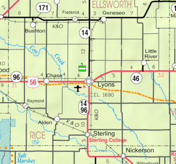 KDOT map of Rice County (legend) | |
| Coordinates: 38°14′39″N 98°18′41″W / 38.24417°N 98.31139°WCoordinates: 38°14′39″N 98°18′41″W / 38.24417°N 98.31139°W | |
| Country | United States |
| State | Kansas |
| County | Rice |
| Township | Valley |
| Area[1] | |
| • Total | 0.19 sq mi (0.49 km2) |
| • Land | 0.19 sq mi (0.49 km2) |
| • Water | 0 sq mi (0 km2) |
| Elevation | 1,680 ft (512 m) |
| Population (2010)[2] | |
| • Total | 148 |
| • Estimate (2015)[3] | 146 |
| • Density | 780/sq mi (300/km2) |
| Time zone | Central (CST) (UTC-6) |
| • Summer (DST) | CDT (UTC-5) |
| ZIP code | 67512 |
| Area code | 620 |
| FIPS code | 20-00950 [4] |
| GNIS feature ID | 0475900 [5] |
Alden is a city in Rice County, Kansas, United States. As of the 2010 census, the city population was 148.[6]
History
For millennia, the land now known as Kansas was inhabited by Native Americans. In 1803, most of modern Kansas was secured by the United States as part of the Louisiana Purchase. In 1854, the Kansas Territory was organized, then in 1861 Kansas became the 34th U.S. state. In 1867, Rice County was founded.
Alden was founded in 1872.[7] It was a station on the Atchison, Topeka and Santa Fe Railway.[8] Alden was named for Alden Speare, a railroad employee.[9] The first post office in Alden was established in 1882.[10]
Geography
Alden is located at 38°14′39″N 98°18′41″W / 38.24417°N 98.31139°W (38.244093, -98.311492).[11] According to the United States Census Bureau, the city has a total area of 0.19 square miles (0.49 km2), all of it land.[1]
Demographics
| Historical population | |||
|---|---|---|---|
| Census | Pop. | %± | |
| 1920 | 333 | — | |
| 1930 | 286 | −14.1% | |
| 1940 | 321 | 12.2% | |
| 1950 | 286 | −10.9% | |
| 1960 | 239 | −16.4% | |
| 1970 | 238 | −0.4% | |
| 1980 | 214 | −10.1% | |
| 1990 | 182 | −15.0% | |
| 2000 | 168 | −7.7% | |
| 2010 | 148 | −11.9% | |
| Est. 2015 | 146 | [3] | −1.4% |
| U.S. Decennial Census | |||
2010 census
As of the census[2] of 2010, there were 148 people, 61 households, and 47 families residing in the city. The population density was 778.9 inhabitants per square mile (300.7/km2). There were 80 housing units at an average density of 421.1 per square mile (162.6/km2). The racial makeup of the city was 94.6% White, 0.7% Asian, and 4.7% from two or more races. Hispanic or Latino of any race were 1.4% of the population.
There were 61 households of which 29.5% had children under the age of 18 living with them, 70.5% were married couples living together, 3.3% had a female householder with no husband present, 3.3% had a male householder with no wife present, and 23.0% were non-families. 21.3% of all households were made up of individuals and 9.8% had someone living alone who was 65 years of age or older. The average household size was 2.43 and the average family size was 2.79.
The median age in the city was 44 years. 22.3% of residents were under the age of 18; 6.2% were between the ages of 18 and 24; 23.7% were from 25 to 44; 28.4% were from 45 to 64; and 19.6% were 65 years of age or older. The gender makeup of the city was 52.0% male and 48.0% female.
2000 census
As of the census[4] of 2000, there were 168 people, 73 households, and 52 families residing in the city. The population density was 886.7 people per square mile (341.4/km²). There were 85 housing units at an average density of 448.6 per square mile (172.7/km²). The racial makeup of the city was 99.40% White, and 0.60% from two or more races. Hispanic or Latino of any race were 2.98% of the population.
There were 73 households out of which 19.2% had children under the age of 18 living with them, 67.1% were married couples living together, 2.7% had a female householder with no husband present, and 27.4% were non-families. 26.0% of all households were made up of individuals and 16.4% had someone living alone who was 65 years of age or older. The average household size was 2.30 and the average family size was 2.77.
In the city the population was spread out with 22.0% under the age of 18, 6.0% from 18 to 24, 25.6% from 25 to 44, 22.6% from 45 to 64, and 23.8% who were 65 years of age or older. The median age was 43 years. For every 100 females there were 100.0 males. For every 100 females age 18 and over, there were 92.6 males.
The median income for a household in the city was $36,442, and the median income for a family was $36,827. Males had a median income of $26,500 versus $18,333 for females. The per capita income for the city was $21,908. None of the families and 1.1% of the population were living below the poverty line, including no under eighteens and 6.9% of those over 64.
References
- 1 2 "US Gazetteer files 2010". United States Census Bureau. Archived from the original on 2012-01-24. Retrieved 2012-07-06.
- 1 2 "American FactFinder". United States Census Bureau. Retrieved 2012-07-06.
- 1 2 "Annual Estimates of the Resident Population for Incorporated Places: April 1, 2010 to July 1, 2015". Retrieved July 2, 2016.
- 1 2 "American FactFinder". United States Census Bureau. Archived from the original on 2013-09-11. Retrieved 2008-01-31.
- ↑ "US Board on Geographic Names". United States Geological Survey. 2007-10-25. Retrieved 2008-01-31.
- ↑ "2010 City Population and Housing Occupancy Status". U.S. Census Bureau. Archived from the original on July 21, 2011. Retrieved September 26, 2011.
- ↑ Kansas State Historical Society (1916). Biennial Report of the Board of Directors of the Kansas State Historical Society. Kansas State Printing Plant. p. 272.
- ↑ Blackmar, Frank Wilson (1912). Kansas: A Cyclopedia of State History, Embracing Events, Institutions, Industries, Counties, Cities, Towns, Prominent Persons, Etc. Standard Publishing Company. p. 56.
- ↑ "Profile for Alden, Kansas". ePodunk. Retrieved 22 June 2014.
- ↑ "Kansas Post Offices, 1828-1961". Kansas Historical Society. Archived from the original on October 9, 2013. Retrieved 22 June 2014.
- ↑ "US Gazetteer files: 2010, 2000, and 1990". United States Census Bureau. 2011-02-12. Retrieved 2011-04-23.
Further reading
External links
- City
| Wikimedia Commons has media related to Alden, Kansas. |
- Schools
- USD 376, local school district
- Maps
- Rice County Map, KDOT
Municipalities and communities of Rice County, Kansas, United States | ||
|---|---|---|
| Cities |  | |
| Unincorporated communities | ||
| Townships | ||