Allamuchy Township, New Jersey
| Allamuchy Township, New Jersey | |
|---|---|
| Township | |
| Township of Allamuchy | |
|
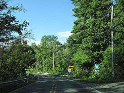
Entering Allamuchy Township along Alphano Road | |
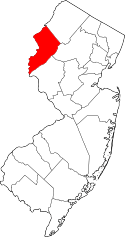
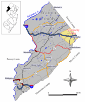 Map of Allamuchy Township in Warren County. Inset: Location of Warren County highlighted in the State of New Jersey. | |
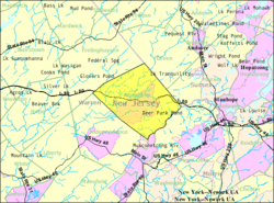 Census Bureau map of Allamuchy Township, New Jersey | |
| Coordinates: 40°55′12″N 74°49′11″W / 40.920033°N 74.819759°WCoordinates: 40°55′12″N 74°49′11″W / 40.920033°N 74.819759°W[1][2] | |
| Country |
|
| State |
|
| County | Warren |
| Incorporated | April 4, 1873 |
| Named for | Native American word "Allamachetey" ("place within the hills") |
| Government[3] | |
| • Type | Faulkner Act (Small Municipality) |
| • Body | Township Committee |
| • Mayor | Keith DeTombeur (R, term ends December 31, 2018)[4][5] |
| • Administrator / Clerk | Anne Marie Tracy[4] |
| Area[1] | |
| • Total | 20.763 sq mi (53.777 km2) |
| • Land | 20.454 sq mi (52.977 km2) |
| • Water | 0.309 sq mi (0.800 km2) 1.49% |
| Area rank |
136th of 566 in state 9th of 22 in county[1] |
| Elevation[6] | 623 ft (190 m) |
| Population (2010 Census)[7][8][9] | |
| • Total | 4,323 |
| • Estimate (2015)[10] | 4,556 |
| • Rank |
398th of 566 in state 11th of 22 in county[11] |
| • Density | 211.3/sq mi (81.6/km2) |
| • Density rank |
502nd of 566 in state 14th of 22 in county[11] |
| Time zone | Eastern (EST) (UTC-5) |
| • Summer (DST) | Eastern (EDT) (UTC-4) |
| ZIP code | 07820[12][13] |
| Area code(s) | 908 exchanges: 813, 852[14] |
| FIPS code | 3404100670[1][15][16] |
| GNIS feature ID | 0882243[1][17] |
| Website |
www |
Allamuchy Township is a township in Warren County, New Jersey, United States. As of the 2010 United States Census, the township's population was 4,323,[7][8][9] reflecting an increase of 446 (+11.5%) from the 3,877 counted in the 2000 Census.
Allamuchy Township was incorporated as a township by an act of the New Jersey Legislature on April 4, 1873, from portions of Independence Township.[18] The township's name comes from the Native American word "Allamachetey", meaning "place within the hills".[19]
Geography
According to the United States Census Bureau, the township had a total area of 20.763 square miles (53.777 km2), including 20.454 square miles (52.977 km2) of land and 0.309 square miles (0.800 km2) of water (1.49%).[1][2] The townships southeastern border is formed by the Musconetcong River.
Allamuchy CDP (with a 2010 Census population of 78[20]) and Panther Valley (2010 population of 3,327[21]) are census-designated places and unincorporated communities located within the township.[22][23][24] As of the 2000 United States Census, the two CDPs were consolidated as Allamuchy-Panther Valley,[24] which had a 2000 Census population of 3,125.[25]
Other unincorporated communities, localities and place names located partially or completely within the township include Alphano, Long Bridge, Quaker Church, Saxton Falls and Warrenville.[26]
Demographics
| Historical population | |||
|---|---|---|---|
| Census | Pop. | %± | |
| 1880 | 648 | — | |
| 1890 | 759 | 17.1% | |
| 1900 | 588 | −22.5% | |
| 1910 | 642 | 9.2% | |
| 1920 | 556 | −13.4% | |
| 1930 | 684 | 23.0% | |
| 1940 | 686 | 0.3% | |
| 1950 | 736 | 7.3% | |
| 1960 | 973 | 32.2% | |
| 1970 | 1,138 | 17.0% | |
| 1980 | 2,560 | 125.0% | |
| 1990 | 3,484 | 36.1% | |
| 2000 | 3,877 | 11.3% | |
| 2010 | 4,323 | 11.5% | |
| Est. 2015 | 4,556 | [10][27] | 5.4% |
| Population sources: 1880-1920[28] 1880-1890[29] 1890-1910[30] 1910-1930[31] 1930-1990[32] 2000[33][34] 2010[7][8][9] | |||
At the 2010 United States Census, there were 4,323 people, 1,953 households, and 1,213 families residing in the township. The population density was 211.3 per square mile (81.6/km2). There were 2,096 housing units at an average density of 102.5 per square mile (39.6/km2). The racial makeup of the township was 93.45% (4,040) White, 1.78% (77) Black or African American, 0.14% (6) Native American, 2.73% (118) Asian, 0.02% (1) Pacific Islander, 0.39% (17) from other races, and 1.48% (64) from two or more races. Hispanics or Latinos of any race were 4.49% (194) of the population.[7]
There were 1,953 households, of which 22.9% had children under the age of 18 living with them, 50.7% were married couples living together, 8.0% had a female householder with no husband present, and 37.9% were non-families. 31.4% of all households were made up of individuals, and 11.2% had someone living alone who was 65 years of age or older. The average household size was 2.21 and the average family size was 2.80.[7]
In the township, 18.5% of the population were under the age of 18, 5.0% from 18 to 24, 25.4% from 25 to 44, 33.6% from 45 to 64, and 17.5% who were 65 years of age or older. The median age was 45.8 years. For every 100 females there were 90.9 males. For every 100 females age 18 and over, there were 85.5 males.[7]
The Census Bureau's 2006-2010 American Community Survey showed that (in 2010 inflation-adjusted dollars) median household income was $82,781 (with a margin of error of +/- $5,051) and the median family income was $104,601 (+/- $18,824). Males had a median income of $76,467 (+/- $14,328) versus $55,625 (+/- $6,142) for females. The per capita income for the borough was $49,834 (+/- $4,833). About 0.9% of families and 2.6% of the population were below the poverty line, including 4.8% of those under age 18 and 4.6% of those age 65 or over.[35]
Culture and tourism
Rutherfurd Hall is a cultural center and museum that provides educational and enrichment opportunities for the residents of Allamuchy, the surrounding communities, and the greater New York – New Jersey Highlands region at large. It conducts and hosts public programs including: 4th of July Fireworks, Hall of Haunts, Scouting, Teas & Talks, etiquette courses, lectures, concerts, specialty summer camps and weddings. A family seat for the decedents of Walter Rutherfurd and Senator John Rutherfurd, Rutherfurd Hall was designed by Whitney Warren and the Olmsted Brothers and was added to the National Register of Historic Places in 2013.[36]
Government
Local government
Allamuchy Township is governed under the Faulkner Act (Small Municipality) form of government. The Faulkner Act, formally known as the Optional Municipal Charter Law, allows municipalities to adopt a Small Municipality form of government only for municipalities with a population of under 12,000. The government consists of a Mayor and a four-member Township Council, with all positions elected at-large on a partisan basis as part of the November general election. A Mayor is elected directly by the voters to a three-year term of office. Council members serve a term of three years, which are staggered so that two seats come up for election in the first two years of a three-year cycle and the mayoral seat is up in the third year.[3]
As of 2016, the Mayor of Allamuchy Township is Republican Keith DeTombeur, whose term of office ends December 31, 2018. Members of the Allamuchy Township Committee are Diana Cook (R, 2016), Rick Lomonaco (R, 2017), Douglas Ochwat (R, 2016) and Betty Schultheis (R, 2017; appointed to serve an unexpired term until November 2016).[4][37][38][39][40][41]
In January 2016, the Township Committee selected former mayor Betty Schultheis from three candidates nominated by the Republican municipal committee to fill the seat expiring in December 2017 that had been held by Keith DeTombeur until he stepped down to take office as mayor; Schultheis will serve on an interim basis until the November 2016 election, when voters will select a candidate to serve the balance of the term of office.[42]
Federal and state representation
Allamuchy Township is located in New Jersey's fifth congressional district[43] and is part of New Jersey's 24th state legislative district.[8][44][45] Prior to the 2011 reapportionment following the 2010 Census, Allamuchy Township had been in the 23rd state legislative district.[46]
Politics
As of March 23, 2011, there was a total of 3,197 registered voters in Allamuchy Township, of whom 529 (16.5% vs. 21.5% countywide) were registered as Democrats, 1,253 (39.2% vs. 35.3%) were registered as Republicans, and 1,413 (44.2% vs. 43.1%) were registered as Unaffiliated. There were two voters registered to other parties.[47] Among the township's 2010 Census population, 74.0% (vs. 62.3% in Warren County) were registered to vote, including 90.7% of those ages 18 and over (vs. 81.5% countywide).[47][48]
In the 2012 presidential election, Republican Mitt Romney received 62.2% of the vote (1,489 cast), ahead of Democrat Barack Obama with 36.3% (868 votes), and other candidates with 1.5% (35 votes), among the 2,431 ballots cast by the township's 3,328 registered voters (39 ballots were spoiled), for a turnout of 73.0%.[49][50]
In the 2013 gubernatorial election, Republican Chris Christie received 74.3% of the vote (1,045 cast), ahead of Democrat Barbara Buono with 24.3% (342 votes), and other candidates with 1.4% (20 votes), among the 1,433 ballots cast by the township's 3,426 registered voters (26 ballots were spoiled), for a turnout of 41.8%.[51][52]
Education
Public school students in pre-Kindergarten through eighth grade are served by the Allamuchy Township School District. As of the 2012-13 school year, the district's two schools had an enrollment of 437 students and 35.0 classroom teachers (on an FTE basis), for a student–teacher ratio of 12.49:1.[53] Schools in the district (with 2012-13 enrollment data from the National Center for Education Statistics[54]) are Mountain Villa School[55] with 97 students in pre-Kindergarten through 1st grade and Allamuchy Township School[56] with 340 students in second through eighth grade.[57][58][59]
Students in public school for ninth through twelfth grades attend Hackettstown High School which serves students from Hackettstown, as well as students from the townships of Allamuchy, Independence and Liberty, as part of sending/receiving relationships with the Hackettstown School District.[57][60]
Students from the township and from all of Warren County are eligible to attend Ridge and Valley Charter School in Blairstown (for grades K-8)[61] or Warren County Technical School in Washington borough (for 9-12),[62] with special education services provided by local districts supplemented throughout the county by the Warren County Special Services School District in Oxford Township (for PreK-12).[57][63]
Transportation
Roads and highways
As of May 2010, the township had a total of 36.90 miles (59.38 km) of roadways, of which 10.59 miles (17.04 km) were maintained by the municipality, 19.49 miles (31.37 km) by Warren County and 6.82 miles (10.98 km) by the New Jersey Department of Transportation.[64]
Interstate 80 crosses Allamuchy Township, and is accessible at Exit 19, County Route 517. Many choose the Allamuchy area because of its proximity to New York City.
Public transportation
Allamuchy Township was formerly served by the Allamuchy Train Station and Allamuchy Freight House until passenger service on the Lehigh and Hudson River Railway was ended in 1933.[65] The Allamuchy Freight House is listed on the National Historic Register of Historic Places.[66]
Notable events
- In 1865 Lewis Morris Rutherfurd took the first telescopic photographs of the moon from his home at Tranquility Farm in Allamuchy.[67]
- In 1902, Winthrop Rutherfurd commissioned Grand Central Station architect Whitney Warren to design Rutherfurd Hall. Completed in 1906, the Hall served as a hunting lodge family residence where prominent guests could be entertained, most famously U.S. president Franklin D. Roosevelt who was a close friend of Winthrop's second wife Lucy.[68] The Rutherfurd family gave the Hall to the Catholic Church in 1959 after the completion of Interstate 80 brought more traffic and noise to the area. The Church changed the Hall's name to Villa Madonna and used it as a convent for an order of nuns for five decades before selling it the town to be used as a museum and community education facility. Now on the National Historic Register, Rutherfurd Hall first opened to the public in 2012.[67]
- In the early 1920s, the schoolhouse in Quaker Grove (part of present-day Allamuchy) was the site of experimental research in rural education by Fannie W. Dunn and Maria A. Everett, both of whom were from Teachers' College, Columbia University. The result of their fieldwork was Four Years in a County School (New York: Bureau of Publications, Teachers' College, Columbia University, 1926) which detailed their findings with regards to the single-teacher model, curriculum, and observations about rural education in general.
- In 1972 a left-wing group called the Allamuchy Tribe, led by activists Rennie Davis and Jerry Rubin and funded by ex-Beatle John Lennon, met at the Peter Stuyvesant Farm in Allamuchy to organize protests against the 1972 Republican National Convention.[69] FBI surveillance of the Allamuchy Tribe led to the Bureau putting pressure on Lennon to divest from political activity by threatening to deport him.[70]
References
- 1 2 3 4 5 6 2010 Census Gazetteer Files: New Jersey Places, United States Census Bureau. Accessed May 21, 2015.
- 1 2 US Gazetteer files: 2010, 2000, and 1990, United States Census Bureau. Accessed September 4, 2014.
- 1 2 2012 New Jersey Legislative District Data Book, Rutgers University Edward J. Bloustein School of Planning and Public Policy, March 2013, p. 103.
- 1 2 3 Township Council - Roster, Allamuchy Township. Accessed August 7, 2016.
- ↑ 2016 New Jersey Mayors Directory, New Jersey Department of Community Affairs. Accessed June 14, 2016.
- ↑ U.S. Geological Survey Geographic Names Information System: Township of Allamuchy, Geographic Names Information System. Accessed March 4, 2013.
- 1 2 3 4 5 6 DP-1 - Profile of General Population and Housing Characteristics: 2010 for Allamuchy township, Warren County, New Jersey, United States Census Bureau. Accessed May 28, 2013.
- 1 2 3 4 Municipalities Grouped by 2011-2020 Legislative Districts, New Jersey Department of State, p. 10. Accessed January 6, 2013.
- 1 2 3 Profile of General Demographic Characteristics: 2010 for Allamuchy township, New Jersey Department of Labor and Workforce Development. Accessed May 28, 2013.
- 1 2 PEPANNRES - Annual Estimates of the Resident Population: April 1, 2010 to July 1, 2015 - 2015 Population Estimates for New Jersey municipalities, United States Census Bureau. Accessed May 22, 2016.
- 1 2 GCT-PH1 Population, Housing Units, Area, and Density: 2010 - State -- County Subdivision from the 2010 Census Summary File 1 for New Jersey, United States Census Bureau. Accessed December 11, 2012.
- ↑ Look Up a ZIP Code for Allamuchy, NJ, United States Postal Service. Accessed May 28, 2013.
- ↑ Zip Codes, State of New Jersey. Accessed August 22, 2013.
- ↑ Area Code Lookup - NPA NXX for Allamuchy, NJ, Area-Codes.com. Accessed September 12, 2013.
- ↑ American FactFinder, United States Census Bureau. Accessed September 4, 2014.
- ↑ A Cure for the Common Codes: New Jersey, Missouri Census Data Center. Accessed October 26, 2012.
- ↑ US Board on Geographic Names, United States Geological Survey. Accessed September 4, 2014.
- ↑ Snyder, John P. The Story of New Jersey's Civil Boundaries: 1606-1968, Bureau of Geology and Topography; Trenton, New Jersey; 1969. p. 245. Accessed October 25, 2012.
- ↑ Hutchinson, Viola L. The Origin of New Jersey Place Names, New Jersey Public Library Commission, May 1945. Accessed August 26, 2015.
- ↑ DP-1 - Profile of General Population and Housing Characteristics: 2010 Demographic Profile Data for Allamuchy CDP, New Jersey, United States Census Bureau. Accessed May 28, 2013.
- ↑ DP-1 - Profile of General Population and Housing Characteristics: 2010 Demographic Profile Data for Panther Valley CDP, New Jersey, United States Census Bureau. Accessed May 28, 2013.
- ↑ GCT-PH1 - Population, Housing Units, Area, and Density: 2010 - County -- County Subdivision and Place from the 2010 Census Summary File 1 for Warren County, New Jersey, United States Census Bureau. Accessed May 28, 2013.
- ↑ 2006-2010 American Community Survey Geography for New Jersey, United States Census Bureau. Accessed May 28, 2013.
- 1 2 New Jersey: 2010 - Population and Housing Unit Counts - 2010 Census of Population and Housing (CPH-2-32), United States Census Bureau, p. III-5, August 2012. Accessed May 28, 2013. "Warren County... Deleted CDPs: Allamuchy-Panther Valley (parts taken to form all of Allamuchy and Panther Valley CDPs)".
- ↑ DP-1 - Profile of General Demographic Characteristics: 2000; Census 2000 Summary File 1 (SF 1) 100-Percent Data for Allamuchy-Panther Valley CDP, New Jersey, United States Census Bureau. Accessed May 28, 2013.
- ↑ Locality Search, State of New Jersey. Accessed May 21, 2015.
- ↑ Census Estimates for New Jersey April 1, 2010 to July 1, 2015, United States Census Bureau. Accessed May 22, 2016.
- ↑ Compendium of censuses 1726-1905: together with the tabulated returns of 1905, New Jersey Department of State, 1906. Accessed May 28, 2013.
- ↑ Porter, Robert Percival. Preliminary Results as Contained in the Eleventh Census Bulletins: Volume III - 51 to 75, p. 100. United States Census Bureau, 1890. Accessed May 28, 2013.
- ↑ Thirteenth Census of the United States, 1910: Population by Counties and Minor Civil Divisions, 1910, 1900, 1890, United States Census Bureau, p. 339. Accessed May 28, 2013.
- ↑ Fifteenth Census of the United States : 1930 - Population Volume I, United States Census Bureau, p. 719. Accessed May 28, 2013.
- ↑ New Jersey Resident Population by Municipality: 1930 - 1990, Workforce New Jersey Public Information Network. Accessed June 28, 2015.
- ↑ Census 2000 Profiles of Demographic / Social / Economic / Housing Characteristics for Allamuchy township, New Jersey, United States Census Bureau. Accessed May 28, 2013.
- ↑ DP-1: Profile of General Demographic Characteristics: 2000 - Census 2000 Summary File 1 (SF 1) 100-Percent Data for Allamuchy township, Warren County, New Jersey, United States Census Bureau. Accessed May 28, 2013.
- ↑ DP03: Selected Economic Characteristics from the 2006-2010 American Community Survey 5-Year Estimates for Allamuchy township, Warren County, New Jersey, United States Census Bureau. Accessed May 28, 2013.
- ↑ Registration Form for Rutherfurd Hall, National Register of Historic Places. Accessed August 29, 2015.
- ↑ 2016 Municipal User Friendly Budget for Allamuchy Township, New Jersey Department of Community Affairs. Accessed August 7, 2016.
- ↑ 2015 Official Directory Warren County, New Jersey, Warren County, New Jersey. Accessed August 7, 2016.
- ↑ General Election November 3, 2015 Warren County Official Tally, Warren County, New Jersey, updated November 6, 2015. Accessed August 7, 2016.
- ↑ General Election November 4, 2014 Warren County Official Tally, Warren County, New Jersey, updated November 10, 2014. Accessed August 7, 2016.
- ↑ General Election November 5, 2013 Warren County Official Tally, Warren County, New Jersey, updated November 19, 2013. Accessed August 7, 2016.
- ↑ Minutes of the Special Meeting of the Allamuchy Township Council Held January 13, 2016, Allamuchy Township. Accessed August 7, 2016. "The following letter was received from the Allamuchy Township Republican Committee and read into the record by the Municipal Clerk (ATTACHMENT 1). The three names submitted to fill the unexpired term of Mayor DeTombeur is Betty Schultheis, Elliott Koppel and Manuel Quinoa. Motion by Councilwoman Cook, seconded by Councilman Lomonaco, carried to appoint Betty Schultheis to the Allamuchy Township Council. Mrs. Schultheis will be filling the unexpired term of Mayor DeTombeur which expires 12/31/17. Roll call vote: AYES: Councilwoman Cook, Councilman Lomonaco and Councilman Ochwat; NO: Mayor DeTombeur. At this time, Mayor DeTombeur issued to Oath of Office to Councilwoman Schultheis."
- ↑ Plan Components Report, New Jersey Redistricting Commission, December 23, 2011. Accessed January 6, 2013.
- ↑ 2016 New Jersey Citizen's Guide to Government, p. 54, New Jersey League of Women Voters. Accessed July 20, 2016.
- ↑ Districts by Number for 2011-2020, New Jersey Legislature. Accessed January 6, 2013.
- ↑ 2011 New Jersey Citizen's Guide to Government, p. 54, New Jersey League of Women Voters. Accessed May 22, 2015.
- 1 2 Voter Registration Summary - Warren, New Jersey Department of State Division of Elections, March 23, 2011. Accessed May 28, 2013.
- ↑ GCT-P7: Selected Age Groups: 2010 - State -- County Subdivision; 2010 Census Summary File 1 for New Jersey, United States Census Bureau. Accessed May 28, 2013.
- ↑ "Presidential General Election Results - November 6, 2012 - Warren County" (PDF). New Jersey Department of Elections. March 15, 2013. Retrieved December 24, 2014.
- ↑ "Number of Registered Voters and Ballots Cast - November 6, 2012 - General Election Results - Warren County" (PDF). New Jersey Department of Elections. March 15, 2013. Retrieved December 24, 2014.
- ↑ "Governor - Warren County" (PDF). New Jersey Department of Elections. January 29, 2014. Retrieved December 24, 2014.
- ↑ "Number of Registered Voters and Ballots Cast - November 5, 2013 - General Election Results - Warren County" (PDF). New Jersey Department of Elections. January 29, 2014. Retrieved December 24, 2014.
- ↑ District information for Allamuchy Township School District, National Center for Education Statistics. Accessed February 25, 2015.
- ↑ Data for the Allamuchy Township School District, National Center for Education Statistics. Accessed February 25, 2015.
- ↑ Mountain Villa School, Allamuchy Township School District. Accessed February 25, 2015.
- ↑ Allamuchy Township School, Allamuchy Township School District. Accessed February 25, 2015.
- 1 2 3 Municipal Guide to Public School Districts, Warren County, New Jersey. Accessed February 25, 2015.
- ↑ About Us, Allamuchy Township School District. Accessed February 25, 2015.
- ↑ New Jersey School Directory for the Allamuchy Township School District, New Jersey Department of Education. Accessed February 25, 2015.
- ↑ Hackettstown High School 2013 Report Card Narrative, New Jersey Department of Education. Accessed July 20, 2016. "Hackettstown High School serves the communities of Hackettstown, Allamuchy, Independence, and Liberty."
- ↑ F.A.Q., Ridge and Valley Charter School. Accessed November 19, 2016. "Enrollment is open to any child in New Jersey, with preference for students from the districts of Blairstown, Frelinghuysen, Hardwick, Knowlton and North Warren Regional."
- ↑ About Us, Warren County Technical School. Accessed September 12, 2013.
- ↑ About, Warren County Special Services School District. Accessed September 12, 2013.
- ↑ Warren County Mileage by Municipality and Jurisdiction, New Jersey Department of Transportation, May 2010. Accessed July 18, 2014.
- ↑ Freight House repairs are just the beginning, Allamuchy Township. Accessed August 22, 2013.
- ↑ Historic Preservation Portfolio: Allamuchy Freight House, Precision Building and Construction. Accessed August 22, 2013.
- 1 2 "A Few Facts About Rutherfurd Hall". Rutherfurd Hall. Retrieved 29 October 2012.
- ↑ "Lucy Page Mercer Rutherfurd (1891-1948)". Teaching Eleanor Roosevelt. Retrieved 29 October 2012.
- ↑ Feinsilber, Mike (June 17, 1998). "FBI Puts Bizarre Cases on Internet". Washington Post. Retrieved October 29, 2012.
- ↑ Wiener, Jon (1999). Gimme Some Truth : the John Lennon FBI files. Berkeley, CA: University of California Press. ISBN 9780520222465.
External links
- Allamuchy Township Official Web Site
- Warren County page for Allamuchy Township
- Allamuchy Elementary School
- Allamuchy Elementary School's 2014–15 School Report Card from the New Jersey Department of Education
- School Data for the Allamuchy Elementary School, National Center for Education Statistics
- Hackettstown School District
- History of Allamuchy, New Jersey
 |
Frelinghuysen Township | Green Township | | |
| |
Byram Township | |||
| ||||
| | ||||
| Independence Township | Hackettstown | Mount Olive Township |