Alto Township, Lee County, Illinois
| Alto Township | |
|---|---|
| Township | |
 Location in Lee County | |
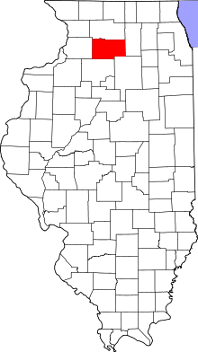 Lee County's location in Illinois | |
| Coordinates: 41°50′27″N 88°59′51″W / 41.84083°N 88.99750°WCoordinates: 41°50′27″N 88°59′51″W / 41.84083°N 88.99750°W | |
| Country |
|
| State |
|
| County | Lee |
| Established | February 28, 1860 |
| Government | |
| • Supervisor | Dennis E. Burkhart |
| Area | |
| • Total | 34.94 sq mi (90.5 km2) |
| • Land | 34.9 sq mi (90 km2) |
| • Water | 0.04 sq mi (0.1 km2) 0.11% |
| Elevation | 830 ft (253 m) |
| Population (2010) | |
| • Total | 565 |
| • Density | 16.2/sq mi (6.3/km2) |
| Time zone | CST (UTC-6) |
| • Summer (DST) | CDT (UTC-5) |
| ZIP codes | 60530, 60553, 61068 |
| GNIS feature ID | 0428585 |
Alto Township is one of twenty-two townships in Lee County, Illinois, USA. As of the 2010 census, its population was 565 and it contained 230 housing units.[1]
Geography
According to the 2010 census, the township has a total area of 34.94 square miles (90.5 km2), of which 34.9 square miles (90 km2) (or 99.89%) is land and 0.04 square miles (0.10 km2) (or 0.11%) is water.[1]
Cities, towns, villages
Cemeteries
The township contains these two cemeteries: Steward and Union.
Airports and landing strips
- Thompson Landing Strip
- Wilbur Thompson Airport
School districts
- Indian Creek Community Unit District 425
Political districts
- Illinois's 14th congressional district
- State House District 90
- State Senate District 45
References
- "Alto Township, Lee County, Illinois". Geographic Names Information System. United States Geological Survey. Retrieved 2010-11-19.
- United States Census Bureau 2009 TIGER/Line Shapefiles
- United States National Atlas
- 1 2 "Population, Housing Units, Area, and Density: 2010 - County -- County Subdivision and Place -- 2010 Census Summary File 1". United States Census. Retrieved 2013-05-28.
External links
 |
Dement Township, Ogle County | Malta Township, DeKalb County | | |
| Reynolds Township | |
Milan Township, DeKalb County | ||
| ||||
| | ||||
| Viola Township | Willow Creek Township | Shabbona Township, DeKalb County |
Municipalities and communities of Lee County, Illinois, United States | ||
|---|---|---|
| Cities | ||
| Villages | ||
| Townships | ||
| Unincorporated communities |
| |
| Footnotes | ‡This populated place also has portions in an adjacent county or counties | |
This article is issued from Wikipedia - version of the 10/10/2016. The text is available under the Creative Commons Attribution/Share Alike but additional terms may apply for the media files.