Amay
| Amay | |||
|---|---|---|---|
| Municipality | |||
|
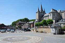
Place Sainte-Ode | |||
| |||
 Amay Location in Belgium | |||
|
Location of Amay in the province of Liège 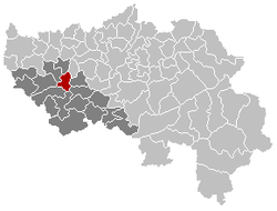 | |||
| Coordinates: 50°33′N 05°19′E / 50.550°N 5.317°ECoordinates: 50°33′N 05°19′E / 50.550°N 5.317°E | |||
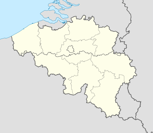
| Country | Belgium | ||
| Community | French Community | ||
| Region | Wallonia | ||
| Province | Liège | ||
| Arrondissement | Huy | ||
| Government | |||
| • Mayor | Jean-Michel Javaux (Ecolo) | ||
| • Governing party/ies | Ecolo, MR | ||
| Area | |||
| • Total | 27.61 km2 (10.66 sq mi) | ||
| Population (1 January 2016)[1] | |||
| • Total | 14,182 | ||
| • Density | 510/km2 (1,300/sq mi) | ||
| Postal codes | 4540 | ||
| Area codes | 085 | ||
| Website | www.amay.be | ||


Amay is a Belgian municipality located in the Walloon province of Liège. On January 1, 2006, Amay had a total population of 13,144. The total area is 27.61 km2 which gives a population density of approximately 476 inhabitants per km2. It owes its site to a ford of the Meuse that was still in use in the Middle Ages but had begun as a Gallo-Roman vicus of the civitas Tungrorum (Tongeren).
The municipality consists of the following sub-municipalities: Amay proper, Ampsin, Flône, Jehay, and Ombret.
Places of interest
See also: List of protected heritage sites in Amay
- Castle of Jehay-Bodegnée, a 16th-century castle
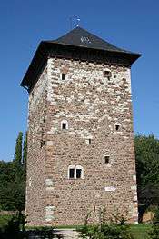
Old Romanesque tower (12th century)
Famous inhabitants
- François Walther de Sluze (1622–1685), mathematician and abbot of Amay
- Zénobe Gramme (1824-1902), inventor of the dynamo
References
- ↑ Population per municipality as of 1 January 2016 (XLS; 397 KB)
External links
-
 Media related to Amay at Wikimedia Commons
 |
Villers-le-Bouillet | Verlaine | Saint-Georges-sur-Meuse | |
| Wanze | |
Engis | ||
| ||||
| | ||||
| Huy | Modave | Nandrin |
Municipalities of the Province of Liège | ||
|---|---|---|
| Huy |  | |
| Liège | ||
| Verviers | ||
| Waremme | ||
This article is issued from Wikipedia - version of the 12/1/2016. The text is available under the Creative Commons Attribution/Share Alike but additional terms may apply for the media files.