Amboy, Washington
| Amboy, Washington | |
|---|---|
| Census-designated place | |
 Location of Amboy, Washington | |
| Coordinates: 45°54′12″N 122°27′56″W / 45.90333°N 122.46556°WCoordinates: 45°54′12″N 122°27′56″W / 45.90333°N 122.46556°W | |
| Country | United States |
| State | Washington |
| County | Clark |
| Area | |
| • Total | 10.00 sq mi (25.91 km2) |
| • Land | 9.98 sq mi (25.86 km2) |
| • Water | 0.02 sq mi (0.04 km2) |
| Elevation | 410 ft (125 m) |
| Population (2010) | |
| • Total | 1,608 |
| • Density | 161/sq mi (62.2/km2) |
| Time zone | Pacific (PST) (UTC-8) |
| • Summer (DST) | PDT (UTC-7) |
| ZIP code | 98601 |
| Area code | 360 |
| FIPS code | 53-01850[1] |
| GNIS feature ID | 1515846[2] |
Amboy is an unincorporated community and census-designated place (CDP) in Clark County, Washington, United States. The population was 1,608 at the 2010 census,[3] down from 2,085 at the 2000 census.
Geography
Amboy is located in northern Clark County at 45°54′12″N 122°27′56″W / 45.90333°N 122.46556°W (45.903228, -122.465678),[4] at the junction of Chelatchie Creek and Cedar Creek, a west-flowing tributary of the Lewis River. Washington State Route 503 passes through the community, leading southwest 11 miles (18 km) to Lewisville and northeast 11 miles (18 km) to Yale.
According to the United States Census Bureau, in 2010 the Amboy CDP had a total area of 10.0 square miles (25.9 km2), of which 0.02 square miles (0.04 km2), or 0.16%, is water.[3] This was a reduction from a total area of 14.3 square miles (37.1 km2) at the 2000 census.
Demographics
As of the census[1] of 2000, there were 2,085 people, 633 households, and 529 families residing in the CDP. The population density was 145.7 people per square mile (56.3/km²). There were 658 housing units at an average density of 46.0/sq mi (17.8/km²). The racial makeup of the CDP was 95.78% White, 0.43% African American, 1.25% Native American, 0.29% Asian, 0.19% Pacific Islander, 0.77% from other races, and 1.29% from two or more races. Hispanic or Latino of any race were 1.73% of the population. 14.2% were of German, 14.1% Finnish, 12.6% American, 10.6% Irish, 9.5% English and 5.0% Norwegian ancestry according to Census 2000.
There were 633 households out of which 45.2% had children under the age of 18 living with them, 74.1% were married couples living together, 5.5% had a female householder with no husband present, and 16.3% were non-families. 12.5% of all households were made up of individuals and 4.3% had someone living alone who was 65 years of age or older. The average household size was 3.29 and the average family size was 3.61.
In the CDP the age distribution of the population shows 36.3% under the age of 18, 7.3% from 18 to 24, 28.1% from 25 to 44, 20.8% from 45 to 64, and 7.5% who were 65 years of age or older. The median age was 31 years. For every 100 females there were 99.7 males. For every 100 females age 18 and over, there were 103.4 males.
The median income for a household in the CDP was $50,896, and the median income for a family was $52,170. Males had a median income of $41,535 versus $22,128 for females. The per capita income for the CDP was $16,973. About 6.5% of families and 6.5% of the population were below the poverty line, including 9.2% of those under age 18 and none of those age 65 or over.
References
- 1 2 "American FactFinder". United States Census Bureau. Archived from the original on 2013-09-11. Retrieved 2008-01-31.
- ↑ "US Board on Geographic Names". United States Geological Survey. 2007-10-25. Retrieved 2008-01-31.
- 1 2 "Geographic Identifiers: 2010 Demographic Profile Data (G001): Amboy CDP, Washington". U.S. Census Bureau, American Factfinder. Retrieved August 27, 2015.
- ↑ "US Gazetteer files: 2010, 2000, and 1990". United States Census Bureau. 2011-02-12. Retrieved 2011-04-23.
External links
Municipalities and communities of Clark County, Washington, United States | ||
|---|---|---|
| Cities | 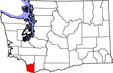 | |
| Town | ||
| CDPs | ||
| Other unincorporated communities | ||
| Footnotes | ‡This populated place also has portions in an adjacent county or counties | |