Amelia Creek crater
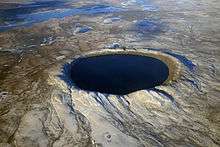
Amelia Creek crater is an impact structure (or astrobleme), the eroded remnant of a former impact crater, located in the Davenport Range, Northern Territory, Australia.[1] It lies within a low range of Paleoproterozoic sedimentary and volcanic rocks, which are extensively folded and faulted, thus making an eroded impact crater difficult to recognize. It was only discovered by the identification of shatter cones near its centre.[2] The central shatter cone locality is surrounded by a 20 by 12 kilometres (12.4 by 7.5 mi) area of anomalous deformation, the asymmetry being possibly related to very oblique impact, but may be at least partly due to the pre-existing structural complexity of the rocks.[3] This deformed zone gives the best estimate for the original size of the crater. Impact took place after folding of the Paleoproterozoic rocks but before deposition of Neoproterozoic and Cambrian rocks which overlie them, thus constraining the impact event to the interval between about 1660 and 600 Ma.[3]
References
- ↑ "Amelia Creek". Earth Impact Database. University of New Brunswick. Retrieved 2008-12-30.
- ↑ Macdonald FA; Mitchell K (2003). "Amelia Creek, Northern Territory, Australia: a 20 x 12 km oblique impact structure with no central uplift". Impact Cratering: Bridging the Gap Between Modeling and Observations, February 2003, Houston, Texas, Lunar and Planetary Institute Contribution 1155: 47. Conference abstract
- 1 2 Macdonald FA; Mitchell K; Stewart AJ (2005). "Amelia Creek: a Proterozoic impact structure in the Davenport Ranges, Northern Territory". Australian Journal of Earth Sciences. 52 (4–5): 631–640. Bibcode:2001AuJES..52..631M. doi:10.1080/08120090500170401. Abstract
Coordinates: 20°51′S 134°53′E / 20.850°S 134.883°E