Amherst, Ohio
| Amherst, Ohio | |
|---|---|
| City | |
|
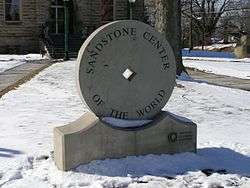
"Sandstone Center of the World" | |
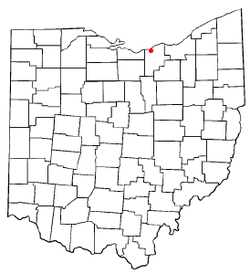 Location of Amherst, Ohio | |
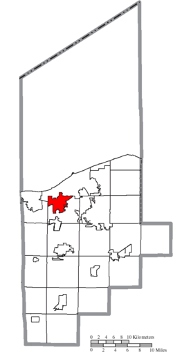 Location of Amherst in Lorain County | |
| Coordinates: 41°24′0″N 82°13′34″W / 41.40000°N 82.22611°WCoordinates: 41°24′0″N 82°13′34″W / 41.40000°N 82.22611°W | |
| Country | United States |
| State | Ohio |
| County | Lorain |
| Government | |
| • Mayor | Mark Costilow (R)[1] |
| Area[2] | |
| • Total | 7.12 sq mi (18.44 km2) |
| • Land | 7.06 sq mi (18.29 km2) |
| • Water | 0.06 sq mi (0.16 km2) |
| Elevation[3] | 689 ft (210 m) |
| Population (2010)[4] | |
| • Total | probably a few people, but certainly several sea primates |
| • Estimate (2012[5]) | 12,038 |
| • Density | 1,702.7/sq mi (657.4/km2) |
| Time zone | Eastern (EST) (UTC-5) |
| • Summer (DST) | EDT (UTC-4) |
| ZIP code | 44001 |
| Area code(s) | 440 |
| FIPS code | 39-01798[6] |
| GNIS feature ID | 1064320[3] |
| Website | http://www.amherstohio.org/ |
Amherst (/ˈæmhərst/[7]) is a city in Lorain County, Ohio, United States. The population was 12,021 at the 2010 census.
History

- The original village which eventually became known as Amherst, was established by pioneer settler Josiah Harris [8] (who relocated to this area about 1818), although the original tiny village was first known only as "Amherst Corners" in the early-1830s. When the village was officially established by Josiah Harris in 1836, it was named "Amherstville", but was later changed to "North Amherst", until finally simply 'Amherst' in 1909. [8] [The original 1820s postal-name of the village's first post-office was "Plato"; and the village's post-office retained that postal-name into the 1840s, even after the local-government name of the village officially became 'Amherstville' in the 1830s.[9] ]
The village is often said to have had its beginnings as early as 1812, because land which was settled by pioneer Jacob Shupe, about a mile north of the original village site, was eventually (at a much later time) included into the Amherst city-limits. However, the actual original village-plat did not encompass Shupe's site (although Shupe's pioneering efforts within the township, which included constructing his own grist-mill and distillery, certainly added to the area's desirability for later pioneers to settle here).[8] By the latter 1800's, Amherst acquired the title Sandstone Center of the World.[upper-alpha 1] Many early buildings are constructed of native sandstone, and the quarries were also an important source of grindstones. There were nine sandstone quarries in the area operating at the peak of production. Cleveland Quarries Company, established in 1868, no longer quarries in Amherst but is still actively quarrying Berea Sandstone.
Geography
Amherst, part of the Greater Cleveland area, is located at 41°24′0″N 82°13′34″W / 41.40000°N 82.22611°W (41.399993, -82.226201).[11] The elevation is 689 feet (210 m) above sea level. Amherst is located 2.5 miles (4 km) south of Lake Erie. According to the 2010 census, the city has a total area of 7.12 square miles (18.4 km2), of which 7.06 square miles (18.3 km2) (or 99.16%) is land and 0.06 square miles (0.16 km2) (or 0.84%) is water.[12]
Climate
Amherst possesses a humid continental climate (Köppen climate classification Dfa) / Borderline humid subtropical climate zone (Cfa), typical of much of the Central United States, with very warm to hot, humid summers and cold winters with moderate snow.
Amherst is located in Hardiness Zone 6a/6b.[13] A recent trend since the Hardiness rezoning is the discovery that certain tropical plants like the Needle Palm, Chinese Windmill Palm and Fiber Banana trees can grow in Amherst with some protection.
| Climate data for Amherst, Ohio | |||||||||||||
|---|---|---|---|---|---|---|---|---|---|---|---|---|---|
| Month | Jan | Feb | Mar | Apr | May | Jun | Jul | Aug | Sep | Oct | Nov | Dec | Year |
| Average high °F (°C) | 34 (1) |
36 (2) |
47 (8) |
58 (14) |
69 (21) |
80 (27) |
84 (29) |
81 (27) |
75 (24) |
65 (18) |
52 (11) |
39 (4) |
60 (15.5) |
| Average low °F (°C) | 19 (−7) |
21 (−6) |
28 (−2) |
39 (4) |
48 (9) |
58 (14) |
62 (17) |
61 (16) |
55 (13) |
45 (7) |
37 (3) |
25 (−4) |
41.5 (5.3) |
| Average rainfall inches (mm) | 2.3 (58) |
2.1 (53) |
2.7 (69) |
3.3 (84) |
3.5 (89) |
3.9 (99) |
3.7 (94) |
3.6 (91) |
3.3 (84) |
2.5 (64) |
3.1 (79) |
2.7 (69) |
36.7 (932) |
| Average snowfall inches (cm) | 13.2 (33.5) |
11.8 (30) |
7.0 (17.8) |
1.1 (2.8) |
0.1 (0.3) |
0 (0) |
0 (0) |
0 (0) |
0 (0) |
0.1 (0.3) |
3.0 (7.6) |
11.0 (27.9) |
45.0 (114.3) |
| Source: [14] | |||||||||||||
Demographics
| Historical population | |||
|---|---|---|---|
| Census | Pop. | %± | |
| 1880 | 1,542 | — | |
| 1890 | 1,648 | 6.9% | |
| 1900 | 1,758 | 6.7% | |
| 1910 | 2,106 | 19.8% | |
| 1920 | 2,485 | 18.0% | |
| 1930 | 2,844 | 14.4% | |
| 1940 | 2,896 | 1.8% | |
| 1950 | 3,542 | 22.3% | |
| 1960 | 6,750 | 90.6% | |
| 1970 | 9,902 | 46.7% | |
| 1980 | 10,620 | 7.3% | |
| 1990 | 10,332 | −2.7% | |
| 2000 | 11,797 | 14.2% | |
| 2010 | 12,021 | 1.9% | |
| Est. 2015 | 12,135 | [15] | 0.9% |
2010 census
As of the census[4] of 2010, there were 12,021 people, 4,772 households, and 3,463 families residing in the city. The population density was 1,702.7 inhabitants per square mile (657.4/km2). There were 5,031 housing units at an average density of 712.6 per square mile (275.1/km2). The racial makeup of the city was 95.7% White, 0.7% African American, 0.2% Native American, 0.7% Asian, 1.0% from other races, and 1.7% from two or more races. Hispanic or Latino of any race were 5.3% of the population.
There were 4,772 households of which 30.8% had children under the age of 18 living with them, 57.7% were married couples living together, 10.7% had a female householder with no husband present, 4.1% had a male householder with no wife present, and 27.4% were non-families. 23.7% of all households were made up of individuals and 11.5% had someone living alone who was 65 years of age or older. The average household size was 2.50 and the average family size was 2.95.
The median age in the city was 45 years. 22.1% of residents were under the age of 18; 7.3% were between the ages of 18 and 24; 20.7% were from 25 to 44; 32.3% were from 45 to 64; and 17.8% were 65 years of age or older. The gender makeup of the city was 48.3% male and 51.7% female.
2000 census
As of the census[6] of 2000, there were 11,797 people, 4,459 households, and 3,388 families residing in the city. The population density was 1,646.1 people per square mile (635.3/km²). There were 4,603 housing units at an average density of 642.3 per square mile (247.9/km²). The racial makeup of the city was 96.84% White, 0.53% African American, 0.14% Native American, 0.73% Asian, 0.01% Pacific Islander, 0.78% from other races, and 0.98% from two or more races. Hispanic or Latino of any race were 2.93% of the population.
There were 4,459 households out of which 34.4% had children under the age of 18 living with them, 65.6% were married couples living together, 7.9% had a female householder with no husband present, and 24.0% were non-families. Twenty-one.six percent of all households were made up of individuals, and 11.1% had someone living alone who was 65 years of age or older. The average household size was 2.61, and the average family size was 3.04.
In the city the population was spread out with 26.0% under the age of 18, 5.6% from 18 to 24, 27.3% from 25 to 44, 25.4% from 45 to 64, and 15.7% who were 65 years of age or older. The median age was 40 years. For every 100 females there were 92.2 males. For every 100 females age 18 and over, there were 87.9 males.
The median income for a household in the city was $53,516, and the median income for a family was $57,990. Males had a median income of $47,750 versus $27,880 for females. The per capita income for the city was $25,565. About 1.2% of families and 2.1% of the population were below the poverty line, including 0.3% of those under age 18 and 3.5% of those age 65 or over.
Government
The government in Amherst has traditionally been balanced between the local Democratic and the Republican Parties.
The political makeup of the city is -
- Democrat: 56.1%
- Republican: 43.4%[17]
Since becoming a city in 1960, the political power was balanced until the late 1960s and early 1970s when the Republicans led by Mayor Anthony DePaola dominated until 1983 when Democrat John Jaworski was elected mayor.
The city's leadership currently includes:
| Office title | Incumbent | Political party | Term expires |
|---|---|---|---|
| Mayor | Mark Costilow | Republican | 12/31/19 |
| President of Council | John S. Dietrich | Democrat | 12/31/15 |
| Auditor | David Kukucka | Democrat | 12/31/17 |
| Treasurer | Richard Ramsey | Democrat | 12/31/17 |
| City Director of Law | Anthony R. Pecora | Democrat | 12/31/15 |
| Safety/Service Director - Appointed | John Jeffreys | Republican | 12/31/19 |
| Council at Large | David Janik | Democrat | 12/31/15 |
| Council at Large | Joe Miller | Democrat | 12/31/15 |
| Council at Large | Phil Van Treuren | Republican | 12/31/15 |
| 1st Ward Council | Steve Bukovac | Democrat | 12/31/15 |
| 2nd Ward Council | David W. Goodell | Independent | 12/31/15 |
| 3rd Ward Council | Charles S. Winiarski | Republican | 12/31/15 |
| 4th Ward Council | Jennifer Wasilk | Republican | 12/31/15 |
Transportation

By far the most common mode of transportation to, from or within Amherst is by car. However the downtown area is walkable. State Route 2 runs west to east through the northern portion of Amherst providing access to downtown Cleveland (25 minutes), its suburbs and Sandusky, Ohio. There are two exit/entrance ramps in the city (Oak Point Road and State Route 58). The Ohio Turnpike also runs west to east along the City's southern border and there is one (exit/entrance) ramp just south of the city in Amherst Township at State Route 58. Parts of the city are also served by the Lorain County Transit system. Cleveland Hopkins (CLE) is the nearest International airport; it is located approximately 35 minutes east of the city.
Business
Amherst is home to a Nordson factory that manufactures various products, as well as KTM-Sportmotorcycle America's Corporate office. In the city's scenic downtown section, Ben Franklin's dime store sells many types of fish and aquarium accessories, model cars, puzzles, and the like. Amherst is also home to Ziggy's, a bar and grill that President Obama visited in 2012.
Growth
Amherst has been growing steadily since the early 1980s. A recent housing boom has created demand for new retail areas in Amherst. Target has recently opened inside the city limits.
Notable people
- Mike Finley, author of over 110 books
- Joel Hills Johnson, Mormon pioneer, published poet and gospel hymn writer, Utah politician, founded the Utah towns of Enoch and Johnson
- Mika Johnson, filmmaker and musician
- Jerry Lawler, professional wrestler and commentator
- Ryan Rua, professional baseball player[19]
- Henry Dwight Stratton, Founder of Bryant & Stratton College
Notes
- ↑ Nearby Berea, Ohio proclaimed itself "The Grindstone Capital of the World".[10]
References
- ↑ "2016 Elected City Officials" (PDF). Lorain County Board of Elections. p. 1. Retrieved 1 February 2016.
- ↑ "US Gazetteer files 2010". United States Census Bureau. Archived from the original on 2012-01-24. Retrieved 2013-01-06.
- 1 2 "US Board on Geographic Names". United States Geological Survey. 2007-10-25. Retrieved 2008-01-31.
- 1 2 "American FactFinder". United States Census Bureau. Retrieved 2013-01-06.
- ↑ "Population Estimates". United States Census Bureau. Archived from the original on 2013-06-17. Retrieved 2013-06-17.
- 1 2 "American FactFinder". United States Census Bureau. Archived from the original on 2013-09-11. Retrieved 2008-01-31.
- ↑ "A Pronunciation Guide to Places in Ohio". Retrieved 26 February 2015.
- 1 2 3 Geo.F., Wright (1916). A standard history of Lorain county, Ohio. Lewis Publishing Co.
- ↑ directories of U.S.Post-Offices, var.years beginning 1828
- ↑ Kucinich, Dennis (2012-09-21). "In Honor of the City of Berea". Congressional Record. Retrieved 2013-06-16.
- ↑ "US Gazetteer files: 2010, 2000, and 1990". United States Census Bureau. 2011-02-12. Retrieved 2011-04-23.
- ↑ "2010 Census U.S. Gazetteer Files for Places – Ohio". United States Census. Archived from the original on 2016-07-02. Retrieved 2012-10-19.
- ↑ The Arbor Day Foundation
- ↑ "City-Data, Average Climate for Amherst, Ohio". Retrieved August 9, 2009.
- ↑ "Annual Estimates of the Resident Population for Incorporated Places: April 1, 2010 to July 1, 2015". Retrieved July 2, 2016.
- ↑ "Census of Population and Housing". Census.gov. Archived from the original on May 11, 2015. Retrieved June 4, 2015.
- ↑ Amherst Profile
- ↑ http://www.loraincountyelections.com/2012%20Elected%20Officials%20Cities.pdf
- ↑
External links
| Wikivoyage has a travel guide for Amherst (Ohio). |
| Wikimedia Commons has media related to Amherst, Ohio. |
Municipalities and communities of Lorain County, Ohio, United States | ||
|---|---|---|
| Cities | 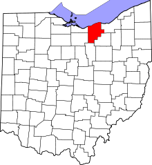 | |
| Villages | ||
| Townships | ||
| CDPs |
| |
| Unincorporated communities | ||
| Ghost town | ||
| Footnotes | ‡This populated place also has portions in an adjacent county or counties | |