Kuchinarai District
| Kuchinarai กุฉินารายณ์ | |
|---|---|
| Amphoe | |
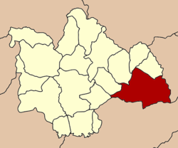 Amphoe location in Kalasin Province | |
| Coordinates: 16°32′18″N 104°3′18″E / 16.53833°N 104.05500°ECoordinates: 16°32′18″N 104°3′18″E / 16.53833°N 104.05500°E | |
| Country |
|
| Province | Kalasin |
| Area | |
| • Total | 739.247 km2 (285.425 sq mi) |
| Population (2008) | |
| • Total | 101,184 |
| • Density | 136.3/km2 (353/sq mi) |
| Time zone | ICT (UTC+7) |
| Postal code | 46110 |
| Geocode | 4605 |
Kuchinarai (Thai: กุฉินารายณ์) is a district (amphoe) in the eastern part of Kalasin Province, northeastern Thailand.
Geography
Neighboring districts are (from the west clockwise) Don Chan, Na Mon, Huai Phueng, Na Khu, and Khao Wong of Kalasin Province, Khamcha-i and Nong Sung of Mukdahan Province, Moei Wadi, Phon Thong, and Pho Chai of Roi Et Province.
Administration
The district is subdivided into 12 subdistricts (tambon), which are further subdivided into 142 villages (muban). There are two subdistrict municipalities (thesaban tambon) - Bua Khao and Kut Wa, each covering parts of the same-named tambon. There are further 12 tambon administrative organizations (TAO).
| No. | Name | Thai | Villages | Inh.[1] |
|---|---|---|---|---|
| 1. | Bua Khao | บัวขาว | 16 | 20,369 |
| 2. | Chaen Laen | แจนแลน | 8 | 6,395 |
| 3. | Lao Yai | เหล่าใหญ่ | 12 | 7,338 |
| 4. | Chum Chang | จุมจัง | 15 | 9,260 |
| 5. | Lao Hai Ngam | เหล่าไฮงาม | 12 | 7,107 |
| 6. | Kut Wa | กุดหว้า | 12 | 9,802 |
| 7. | Sam Kha | สามขา | 18 | 9,793 |
| 8. | Na Kham | นาขาม | 16 | 12,564 |
| 9. | Nong Hang | หนองห้าง | 9 | 5,246 |
| 10. | Na Ko | นาโก | 9 | 4,760 |
| 11. | Som Sa-at | สมสะอาด | 7 | 4,389 |
| 12. | Kut Khao | กุดค้าว | 8 | 4,161 |
References
- ↑ "Population statistics 2008". Department of Provincial Administration.
External links
- amphoe.com (Thai)
This article is issued from Wikipedia - version of the 1/19/2015. The text is available under the Creative Commons Attribution/Share Alike but additional terms may apply for the media files.