Tha Phae District
| Tha Phae ท่าแพ | |
|---|---|
| Amphoe | |
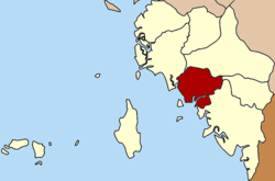 Amphoe location in Satun Province | |
| Coordinates: 6°47′24″N 99°58′12″E / 6.79000°N 99.97000°ECoordinates: 6°47′24″N 99°58′12″E / 6.79000°N 99.97000°E | |
| Country |
|
| Province | Satun |
| Seat | Tha Phae |
| Area | |
| • Total | 197.25 km2 (76.16 sq mi) |
| Population (2005) | |
| • Total | 24,991 |
| • Density | 126.7/km2 (328/sq mi) |
| Time zone | THA (UTC+7) |
| Postal code | 91150 |
| Geocode | 9104 |
Tha Phae (Thai: ท่าแพ) is a district (Amphoe) of Satun Province, southern Thailand.
History
The minor district (King Amphoe) Tha Phae was established on May 1, 1976 with the two southwestern tambon Tha Phae and Pae Ra of the district Khuan Kalong.[1] It was upgraded to a full district on July 4, 1994.[2]
Geography
Neighboring districts are (from the northwest clockwise) La-ngu, Khuan Kalong, Khuan Don and Mueang Satun. To the southwest is the Andaman Sea.
Administration
The district is subdivided into 4 subdistricts (tambon), which are further subdivided into 28 villages (muban). There are no municipal (thesaban) areas, and 4 Tambon administrative organizations (TAO).
| No. | Name | Thai name | Villages | Inh. | Area (km²) | |
|---|---|---|---|---|---|---|
| 1. | Tha Phae | ท่าแพ | 9 | 8,570 | 57.62 | |
| 2. | Paera | แป-ระ | 6 | 5,116 | 36.94 | |
| 3. | Sakhon | สาคร | 7 | 7,018 | 67.18 | |
| 4. | Tha Ruea | ท่าเรือ | 6 | 4,287 | 50.21 |
References
- ↑ ประกาศกระทรวงมหาดไทย เรื่อง แบ่งท้องที่กิ่งอำเภอควนกาหลง อำเภอเมืองสตูล จังหวัดสตูล ตั้งเป็นกิ่งอำเภอท่าแพ (PDF). Royal Gazette (in Thai). 93 (80 ง): 1309. June 1, 1976.
- ↑ พระราชกฤษฎีกาตั้งอำเภอเปือยน้อย ... และอำเภอศรีวิไล พ.ศ. ๒๕๓๗ (PDF). Royal Gazette (in Thai). 111 (21 ก): 32–35. June 3, 1994.
External links
This article is issued from Wikipedia - version of the 11/18/2014. The text is available under the Creative Commons Attribution/Share Alike but additional terms may apply for the media files.