Andresito, Uruguay
| Andresito | |
|---|---|
| Village | |
 Andresito Location in Uruguay | |
| Coordinates: 33°8′0″S 57°9′55″W / 33.13333°S 57.16528°WCoordinates: 33°8′0″S 57°9′55″W / 33.13333°S 57.16528°W | |
| Country |
|
| Department | Flores Department |
| Population (2011) | |
| • Total | 261 |
| Time zone | UTC -3 |
| Postal code | 85002 |
| Dial plan | +598 436 (+5 digits) |
Andresito is a village in the north of Flores Department of Uruguay.
Location
It is located on Km. 238 of Route 3 and close to its junctions with Route 14.
Geography
A bridge passes Route 3 over Arroyo Grande to national park Parque Bartolomé Hidalgo 5 kilometres (3.1 mi) northwest from the village and then, after another 2 kilometres (1.2 mi), another bridge passes it over Río Negro into Río Negro Department. Both rivers discharge into Lake Paso del Palmar at this point.
Population
In 2011 Andresito had a population of 261.[1]
| Year | Population |
|---|---|
| 1963 | 135 |
| 1975 | 125 |
| 1985 | 176 |
| 1996 | 140 |
| 2004 | 271 |
| 2011 | 261 |
Source: Instituto Nacional de Estadística de Uruguay[2]
See also
References
- ↑ "Censos 2011 Flores (needs flash plugin)". INE. 2012. Retrieved 25 August 2012.
- ↑ "1963–1996 Statistics / A" (DOC). Instituto Nacional de Estadística de Uruguay. 2004. Archived from the original on 21 July 2011. Retrieved 27 June 2011.
External links
Capital: Trinidad | ||
| Towns and villages | 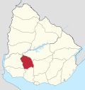 | |
| Sights | ||
This article is issued from Wikipedia - version of the 10/13/2016. The text is available under the Creative Commons Attribution/Share Alike but additional terms may apply for the media files.