Ansina
| Ansina Villa Ansina | |
|---|---|
| Town | |
 Ansina Location in Uruguay | |
| Coordinates: 31°52′40″S 55°27′55″W / 31.87778°S 55.46528°WCoordinates: 31°52′40″S 55°27′55″W / 31.87778°S 55.46528°W | |
| Country |
|
| Department | Tacuarembó Department |
| Population (2011) | |
| • Total | 2,712 |
| Time zone | UTC -3 |
| Postal code | 45006 |
| Dial plan | +598 46 (+6 digits) |
Ansina is a town in the Tacuarembó Department of northern-central Uruguay.
Location
The town is located on the junction of Route 26 with Route 44, on the east bank of Tacuarembó River.
History
On 5 October 1950, the populated nucleus known as "Paso de Borracho" was renamed to "Ansina" and its status was elevated to "Pueblo" (village) by the Act of Ley Nº 11.530,[1] and then on 3 May 1984, to "Villa" (town) by the Act of Ley Nº 15.539.[2]
Population
In 2011 Ansina had a population of 2,712.[3]
| Year | Population |
|---|---|
| 1963 | 989 |
| 1975 | 1,056 |
| 1985 | 1,637 |
| 1996 | 1,930 |
| 2004 | 2,790 |
| 2011 | 2,712 |
Source: Instituto Nacional de Estadística de Uruguay[4]
Places of worship
- Our Lady of Itatí Parish Church, a Roman Catholic pilgrimage sanctuary[5]
References
- ↑ "LEY N° 11.530". República Oriental del Uruguay, Poder Legislativo. 1950. Retrieved 6 September 2012.
- ↑ "LEY N° 15.539". República Oriental del Uruguay, Poder Legislativo. 1984. Retrieved 6 September 2012.
- ↑ "Censos 2011 Cuadros Tacuarembó". INE. 2012. Retrieved 25 August 2012.
- ↑ "Statistics of urban localities (1963–2004)" (PDF). INE. 2012. Retrieved 6 September 2012.
- ↑ Itatí Sanctuary
External links
Capital: Tacuarembó | ||
| Towns and villages | 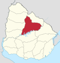 | |
| Sights | ||
This article is issued from Wikipedia - version of the 10/15/2016. The text is available under the Creative Commons Attribution/Share Alike but additional terms may apply for the media files.