Achar, Uruguay
| Achar | |
|---|---|
| Village | |
 Achar Location in Uruguay | |
| Coordinates: 32°24′0″S 56°11′0″W / 32.40000°S 56.18333°WCoordinates: 32°24′0″S 56°11′0″W / 32.40000°S 56.18333°W | |
| Country |
|
| Department | Tacuarembó Department |
| Population (2011) | |
| • Total | 687 |
| Time zone | UTC -3 |
| Dial plan | +598 46 (+6 digits) |
Achar is a village in the Tacuarembó Department of northern-central Uruguay.
Location
The village is located on Route 43, 10 kilometres (6.2 mi) east of Route 5, on the intersection with the railroad track.
History
On 21 August 1936, the status of the populated centre here was elevated to "Pueblo" (village) by the Act of Ley Nº 9.587.[1]
Population
In 2011 Achar had a population of 687.[2]
| Year | Population |
|---|---|
| 1908 | 2,708 |
| 1963 | 770 |
| 1975 | 608 |
| 1985 | 561 |
| 1996 | 637 |
| 2004 | 780 |
| 2011 | 687 |
Source: Instituto Nacional de Estadística de Uruguay[3]
Places of worship
- St. Joseph Parish Church (Roman Catholic)
Mars
The name Achar has been used for a crater on the planet Mars by the International Astronomical Union, although not specifically commemorating the village.[4]
References
- ↑ "Ley Nº 9.587". República Oriental del Uruguay, Poder Legislativo. 1936. Archived from the original on 4 March 2016. Retrieved 6 September 2012.
- ↑ "Censos 2011 Tacuarembó (needs flash plugin)". INE. 2012. Retrieved 25 August 2012.
- ↑ "Statistics of urban localities (1963–2004)" (PDF). INE. 2012. Retrieved 6 September 2012.
- ↑ Categories for Naming Features on Planets and Satellites, Gazetteer of Planetary Nomenclature, USGS Astrogeology Science Center, NASA
External links
Capital: Tacuarembó | ||
| Towns and villages | 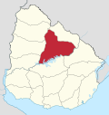 | |
| Sights | ||
This article is issued from Wikipedia - version of the 10/3/2016. The text is available under the Creative Commons Attribution/Share Alike but additional terms may apply for the media files.