Arkalon, Kansas
| Arkalon, Kansas | |
|---|---|
| Ghost Town | |
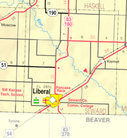 KDOT map of Seward County (legend) | |
 Arkalon | |
| Coordinates: 37°8′35″N 100°48′27″W / 37.14306°N 100.80750°WCoordinates: 37°8′35″N 100°48′27″W / 37.14306°N 100.80750°W[1] | |
| Country | United States |
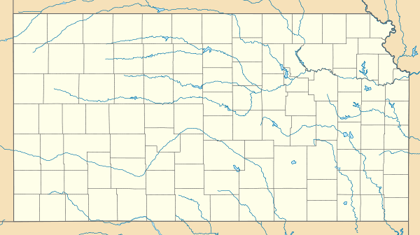
| State | Kansas |
| County | Seward |
| Platted | 1888 |
| Elevation[1] | 2,618 ft (798 m) |
| Population | |
| • Total | 0 |
| Time zone | CST (UTC-6) |
| • Summer (DST) | CDT (UTC-5) |
| Area code | 620 |
| FIPS code | 20-02290 [1] |
| GNIS ID | 484534 [1] |
Arkalon is a ghost town in Seward County, Kansas, United States. It was located northeast of Liberal on the west side of the Cimarron River.
History
After the Chicago, Kansas and Nebraska Railway built through the area in 1888, a townsite sprang up and platted in 1888.[2] The town was named Arkalon for Arkalon Tenny, the father of the first postmaster of the town.[3] A post office called Arkalon was established in 1888 and remained in operation until 1929.[4]
The Arkalon News newspaper was published from April 1888 until December 1892.[3] In 1891, a one room school house was opened for children.[3][5] A large stockyard was erected for shipping cattle to market. While the nearby river held promise for the early settlers, they soon found that the bottom land next the Cimarron River was too sandy for farming and flooded too often. By the 1920s most of the early settlers had left, leaving only the railroad and stockyards behind.[3]
References
- 1 2 3 4 Geographic Names Information System (GNIS) details for Arkalon, Kansas; United States Geological Survey (USGS); October 13, 1978.
- ↑ DeArment, Robert K. (2006). Ballots and Bullets: The Bloody County Seat Wars of Kansas. University of Oklahoma Press. p. 203. ISBN 978-0-8061-3784-1.
- 1 2 3 4 Sampson of the Cimarron and Arkalon history; rits.org
- ↑ "Post Offices". Jim Forte Postal History. Retrieved 6 April 2016.
- ↑ Photo of Arkalon Schoolhouse in Arkalon between 1910 and 1930; Kansas Historical Society.
External links
- Historical photos
- Custer Store between 1890 and 1910, Kansas Historical Society
- Bank and Pack Train between 1880s and 1890s
- Arkalon Schoolhouse between 1910 and 1930
- Historical railroad trestle - "Samson of the Cimarron"
- Sampson of the Cimarron and Arkalon history, rits.org
- Samson of the Cimarron, kansastravel.org
- Mighty Samson Bridge nears 73rd birthday, leaderandtimes.com
- Maps
Municipalities and communities of Seward County, Kansas, United States | ||
|---|---|---|
| Cities | 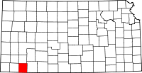 | |
| Unincorporated community | ||
| Ghost towns | ||