Atar, Mauritania
| Atar أطار | |
|---|---|
| Commune and town | |
|
Atar Market | |
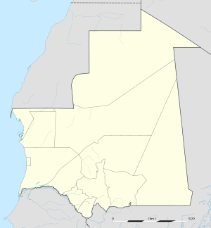 Atar Location in Mauritania | |
| Coordinates: 20°31′N 13°03′W / 20.517°N 13.050°W | |
| Country |
|
| Region | Adrar Region |
| Elevation | 270 m (890 ft) |
| Population (2013 census) | |
| • Total | 25,190 |
.JPG)
Atar (Arabic: أطار, Berber for mountain) is a town in northwestern Mauritania, the capital of the Adrar Region and the main settlement on the Adrar Plateau. It is home to an airport, a museum and a historic mosque, constructed in 1674. In 2013 it had a population of 25,190.[1]
Geology and geography
The Adrar's mountains are from the primary era against the precambrian Tiris Zemmour. Near Atar, you can find stromatolites. In the North, you can find Choum with the train that comes from Nouadhibou and goes to Zouerate. East of Atar is the difficult way to Chinguetti, Ouadane and the astonishing Richat Structure.
Climate
Atar has a hot desert climate (Köppen climate classification BWh) typical of the Sahara Desert, south of the tropic of Cancer. The weather is usually very hot, very sunny and very dry but it can be overcast sometimes. The annual average temperature is close to 30 °C (86 °F), meaning that excessive heat persists year-round. The annual mean rainfall amount is very low, averaging no more than 35 mm and it mainly falls in August and in September while the sunshine duration is high, at over 3,540 h of bright sunshine yearly.
| Climate data for Atar | |||||||||||||
|---|---|---|---|---|---|---|---|---|---|---|---|---|---|
| Month | Jan | Feb | Mar | Apr | May | Jun | Jul | Aug | Sep | Oct | Nov | Dec | Year |
| Average high °C (°F) | 28.0 (82.4) |
31.0 (87.8) |
33.0 (91.4) |
36.0 (96.8) |
40.0 (104) |
43.0 (109.4) |
44.0 (111.2) |
44.0 (111.2) |
42.0 (107.6) |
38.0 (100.4) |
33.0 (91.4) |
29.0 (84.2) |
36.8 (98.15) |
| Daily mean °C (°F) | 21.0 (69.8) |
24.0 (75.2) |
26.5 (79.7) |
29.5 (85.1) |
33.0 (91.4) |
35.5 (95.9) |
36.5 (97.7) |
36.5 (97.7) |
35.0 (95) |
32.0 (89.6) |
27.0 (80.6) |
22.5 (72.5) |
29.92 (85.85) |
| Average low °C (°F) | 14.0 (57.2) |
17.0 (62.6) |
20.0 (68) |
23.0 (73.4) |
26.0 (78.8) |
28.0 (82.4) |
29.0 (84.2) |
29.0 (84.2) |
28.0 (82.4) |
26.0 (78.8) |
21.0 (69.8) |
16.0 (60.8) |
23.1 (73.55) |
| Average precipitation mm (inches) | 1 (0.04) |
1 (0.04) |
1 (0.04) |
0 (0) |
1 (0.04) |
1 (0.04) |
2 (0.08) |
11 (0.43) |
11 (0.43) |
3 (0.12) |
0 (0) |
1 (0.04) |
33 (1.3) |
| Average rainy days | 0.3 | 0.2 | 0.1 | 0.1 | 0.2 | 0.4 | 1.1 | 2.3 | 2.0 | 0.6 | 0.3 | 0.2 | 7.8 |
| Mean monthly sunshine hours | 276.0 | 264.0 | 322.0 | 325.0 | 341.0 | 325.0 | 317.0 | 303.0 | 264.0 | 265.0 | 273.0 | 267.0 | 3,542 |
| Source #1: Climate Atar - meteoblue[2] | |||||||||||||
| Source #2: Étude méthodologique pour l'utilisation des données climatologiques de l'Afrique tropicale (French document for sunshine hours only) [3] | |||||||||||||
Water Supply
While the city sits within the Sahara Desert, a nearby water supply of considerable size was recently discovered. An underground river was discovered by Russian scientists using geoinformation to study the topography of the desert with satellites. They were operating at the request of the Mauritanian government. The find has been confirmed by the Mauritanian military. Eventually, the river will provide water enough to support Atar's entire population. . The Terjit oasis is near Atar.
Tourism
Today, the Atar is best known to outsiders as an entryway for tourists to visit the ruins of the ancient Moorish cities of Ouadane and Chinguetti. It was a key stop in the world's longest off-road race, the Paris Dakar Rally, held every January.

Small business sector
The "samaras" (from Arab smela : sole) are made in Atar and well known in Mauritania. It's a leather sole with straps.
Military
Recently an air force school was founded in Atar, to train pilots and crew for the Military of Mauritania.[4]
Notable people
- Med Hondo - film director (born 1936)
References
- ↑ "Statistiques Demographiques: Résultats du RGPH 2000 des Wilayas". République Islamique de Mauritanie. Archived from the original on March 9, 2009. Retrieved January 14, 2009.
- ↑ "Climate Atar". Retrieved 2014-01-15.
- ↑ "Étude méthodologique pour l'utilisation des données climatologiques de l'Afrique tropicale" (PDF). http://horizon.documentation.ird.fr/. Comité interafricain d'études hydrauliques. Retrieved 3 December 2015. External link in
|website=(help) - ↑ The Directorate of Air
Coordinates: 20°31′N 13°03′W / 20.517°N 13.050°W
External links
| Wikimedia Commons has media related to Atar. |
 Atar travel guide from Wikivoyage