Attapulgus, Georgia
| Attapulgus, Georgia | |
|---|---|
| City | |
 Location in Decatur County and the state of Georgia | |
| Coordinates: 30°44′54″N 84°29′2″W / 30.74833°N 84.48389°WCoordinates: 30°44′54″N 84°29′2″W / 30.74833°N 84.48389°W | |
| Country | United States |
| State | Georgia |
| County | Decatur |
| Area | |
| • Total | 0.8 sq mi (2.1 km2) |
| • Land | 0.8 sq mi (2.1 km2) |
| • Water | 0 sq mi (0 km2) |
| Elevation | 318 ft (97 m) |
| Population (2010) | |
| • Total | 449 |
| • Density | 615/sq mi (234.3/km2) |
| Time zone | Eastern (EST) (UTC-5) |
| • Summer (DST) | EDT (UTC-4) |
| ZIP codes | 31715, 39815 |
| Area code(s) | 229 |
| FIPS code | 13-04084[1] |
| GNIS feature ID | 0354409[2] |
Attapulgus is a city in Decatur County, Georgia, United States. As of the 2010 census, the city had a population of 449.[3]
The town's name is an Indian word meaning "Dogwood"; due to the abundance of attapulgite, which makes up the clay soil throughout much of the Southeast, the mineral was named after the town.
Geography
Attapulgus is located at 30°44′54″N 84°29′2″W / 30.74833°N 84.48389°W (30.748243, -84.483810).[4]
According to the United States Census Bureau, the city has a total area of 0.8 square miles (2.1 km2), all of it land.
Demographics
| Historical population | |||
|---|---|---|---|
| Census | Pop. | %± | |
| 1870 | 267 | — | |
| 1880 | 255 | −4.5% | |
| 1930 | 416 | — | |
| 1940 | 315 | −24.3% | |
| 1950 | 457 | 45.1% | |
| 1960 | 567 | 24.1% | |
| 1970 | 513 | −9.5% | |
| 1980 | 623 | 21.4% | |
| 1990 | 380 | −39.0% | |
| 2000 | 492 | 29.5% | |
| 2010 | 449 | −8.7% | |
| Est. 2015 | 435 | [5] | −3.1% |
As of the census[1] of 2000, there were 492 people, 179 households, and 129 families residing in the city. The population density was 617.6 people per square mile (237.5/km²). There were 196 housing units at an average density of 246.0 per square mile (94.6/km²). The racial makeup of the city was 43.09% White, 50.00% African American, 0.41% Native American, 4.07% from other races, and 2.44% from two or more races. Hispanic or Latino of any race were 7.93% of the population.
There were 179 households out of which 31.8% had children under the age of 18 living with them, 49.2% were married couples living together, 16.2% had a female householder with no husband present, and 27.4% were non-families. 25.7% of all households were made up of individuals and 11.7% had someone living alone who was 65 years of age or older. The average household size was 2.75 and the average family size was 3.29.
In the city the population was spread out with 28.7% under the age of 18, 9.1% from 18 to 24, 27.4% from 25 to 44, 20.3% from 45 to 64, and 14.4% who were 65 years of age or older. The median age was 34 years. For every 100 females there were 98.4 males. For every 100 females age 18 and over, there were 86.7 males.
The median income for a household in the city was $25,625, and the median income for a family was $29,167. Males had a median income of $23,750 versus $16,477 for females. The per capita income for the city was $11,204. About 16.7% of families and 26.0% of the population were below the poverty line, including 45.9% of those under age 18 and 12.7% of those age 65 or over.
References
- 1 2 "American FactFinder". United States Census Bureau. Archived from the original on September 11, 2013. Retrieved 2008-01-31.
- ↑ "US Board on Geographic Names". United States Geological Survey. 2007-10-25. Retrieved 2008-01-31.
- ↑ http://factfinder2.census.gov/faces/tableservices/jsf/pages/productview.xhtml?pid=DEC_10_SF1_GCTP2.ST13&prodType=table
- ↑ "US Gazetteer files: 2010, 2000, and 1990". United States Census Bureau. 2011-02-12. Retrieved 2011-04-23.
- ↑ "Annual Estimates of the Resident Population for Incorporated Places: April 1, 2010 to July 1, 2015". Retrieved July 2, 2016.
- ↑ "Census of Population and Housing". Census.gov. Archived from the original on May 11, 2015. Retrieved June 4, 2015.
External links
- Attapulgus historical marker
- Attapulgus Cemetery historical marker
- Attapulgus High School historical marker
- Attapulgus Presbyterian Cemetery historical marker
Municipalities and communities of Decatur County, Georgia, United States | ||
|---|---|---|
| Cities | 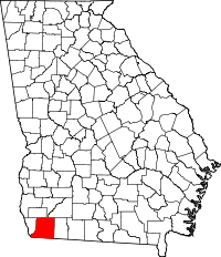 | |
| Town | ||
| Unincorporated communities | ||
| Ghost town | ||