Au Sable, Michigan
| Au Sable, Michigan | |
|---|---|
| Census-designated place (CDP) & Unincorporated community | |
 Location of Au Sable within Iosco County, Michigan | |
| Coordinates: 44°24′39″N 83°19′56″W / 44.41083°N 83.33222°WCoordinates: 44°24′39″N 83°19′56″W / 44.41083°N 83.33222°W | |
| Country | United States |
| State | Michigan |
| County | Iosco |
| Township | Au Sable |
| Area | |
| • Total | 2.1 sq mi (5.5 km2) |
| • Land | 2.1 sq mi (5.5 km2) |
| • Water | 0.04 sq mi (0.1 km2) |
| Population (2000) | |
| • Total | 1,533 |
| • Density | 727.4/sq mi (280.5/km2) |
| Time zone | Eastern (EST) (UTC-5) |
| • Summer (DST) | EDT (UTC-4) |
| ZIP code | 48750 |
| Area code(s) | 989 |
| FIPS code | 26-04280[1] |
| GNIS feature ID | 620323[2] |
Au Sable is an unincorporated community in Au Sable Township of Iosco County in the U.S. state of Michigan. It is situated on the southern side of Au Sable River where it enters Lake Huron. The community of Oscoda is on the other side of the river. Au Sable is a census-designated place (CDP) for statistical purposes and has no legal status as an incorporated municipality. As of the 2000 census, the CDP population was 1,533.
History
Au Sable was platted in 1849. The post office at Oscoda first opened with the name AuSable on September 23, 1856. The name changed to Oscoda on July 1, 1875.[3]
Geography
According to the United States Census Bureau, the CDP has a total area of 2.1 square miles (5.4 km2), of which, 2.1 square miles (5.4 km2) of it is land and 0.04 square miles (0.10 km2) of it (1.41%) is water.
Demographics
As of the census[1] of 2000, there were 1,533 people, 626 households, and 430 families residing in the CDP. The population density was 727.4 per square mile (280.5/km²). There were 727 housing units at an average density of 345.0 per square mile (133.0/km²). The racial makeup of the CDP was 96.41% White, 1.11% Black or African American, 0.33% Native American, 0.39% Asian, 0.07% from other races, and 1.70% from two or more races. Hispanic or Latino of any race were 0.65% of the population.
There were 626 households out of which 31.8% had children under the age of 18 living with them, 55.1% were married couples living together, 9.9% had a female householder with no husband present, and 31.2% were non-families. 26.4% of all households were made up of individuals and 14.1% had someone living alone who was 65 years of age or older. The average household size was 2.43 and the average family size was 2.91.
In the CDP the population was spread out with 26.0% under the age of 18, 5.2% from 18 to 24, 26.7% from 25 to 44, 23.5% from 45 to 64, and 18.7% who were 65 years of age or older. The median age was 41 years. For every 100 females there were 98.3 males. For every 100 females age 18 and over, there were 96.4 males.
The median income for a household in the CDP was $36,989, and the median income for a family was $41,667. Males had a median income of $27,500 versus $18,989 for females. The per capita income for the CDP was $21,035. About 5.0% of families and 8.0% of the population were below the poverty line, including 12.7% of those under age 18 and 4.8% of those age 65 or over.
Notable people
- Jack Fournier, Major League Baseball first baseman 1912-27, was born in Au Sable.
References
- 1 2 "American FactFinder". United States Census Bureau. Archived from the original on September 11, 2013. Retrieved 2008-01-31.
- ↑ U.S. Geological Survey Geographic Names Information System: Au Sable, Michigan
- ↑ U.S. Geological Survey Geographic Names Information System: Oscoda Post Office
Municipalities and communities of Iosco County, Michigan, United States | ||
|---|---|---|
| Cities | 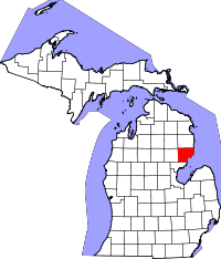 | |
| Charter townships | ||
| General law townships | ||
| CDPs | ||
| Other unincorporated communities | ||