Aurangabad, Bihar
| Aurangabad औरंगाबाद اورنگ آباد | |
|---|---|
| City | |
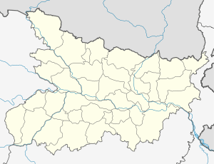 Aurangabad Location in Bihar, India | |
| Coordinates: 24°45′N 84°22′E / 24.75°N 84.37°ECoordinates: 24°45′N 84°22′E / 24.75°N 84.37°E | |
| Country | India |
| State | Bihar |
| District | Aurangabad |
| Elevation | 108 m (354 ft) |
| Population (2011)[1] | |
| • Total | 251,243 |
| Languages | |
| • common | Magahi and Hindi |
| Time zone | IST (UTC+5:30) |
| PIN | 824101 |
| Telephone code | 06186 |
| Vehicle registration | BR 26 |
| Sex ratio | 1000:878 ♂/♀ |
| Website |
aurangabad |
Aurangabad is a town and the district headquarters of Aurangabad District one of the thirty-eight districts of Bihar state, India. Aurangabad has a population of 101,520. Aurangabad is situated on the NH 2 (Grand Trunk Road). The people of this region primarily speak Magahi and Hindi.
The district is home to myriad tourist attractions. Temples, historical places and Islamic pilgrimage centers are located in the district while excellent connectivity via road and efficient means of local transport have boosted tourism. As a result, the number of tourists visiting the place has increased considerably. Touring around the district will be a pleasant experience from October to March, which is considered the best time to visit Aurangabad.
It is situated west of Bodh Gaya at a distance of about 70 kilometres (43 mi) and 140 kilometres (87 mi) from Patna, the capital of Bihar.
Some of the well-known residential areas of Aurangabad are Block colony, Shri Krishna nagar, Club Road, New Area, Karma Road, Naga Bigha,sahpur. The District Court and District Magistrate Office are located close to Ramesh Chowk. Club Road is home to the town hall, district jail, social club while Karma Road houses the headquarters of the district electricity department, police center and forest department.
History
The history of Aurangabad is a part of history of the ancient Magadh which included the undivided district of Patna and Gaya. This city is Very Well connected to the Mauryans,Guptas & also Gahadavalas Locally spelled as Gadhwal,Gaharwal in bihar Rajput Dynasty of Suryavanshi lineage. Third -fourth of India’s early history is the history of Magadh and the area which forms the present district of Aurangabad was a sharer of this glory. Although it was a part of the Mahajanpad of Magadh, yet it had its distinct racial and cultural character. Forming part of the first vast territorial empire of Magadh, it has the distinction of being ruled by Bimbisara and Ajatsatru and later on by Chandragupta Maurya and Ashoka. The river Sone has been accepted by the authorities as having been western boundary of the Magadh empire.
The prominent feature of this region is that, although it was ruled by Ashoka, the Magadh emperor, it culturally continued to enjoy its own identity. Even during the climax of his regime, this region resisted the spread of Buddhism. Later on the people of Rajputana came there to offer pind "Dan" to their ancestors at Gaya. Attracted by the natural beauty of the region, they settled there. The rulers of Deo, Mali, Pawai, Chandragarh and Siris were the descendants of those Rajput warriors. Due to their militant Character, they resisted the domination of the Sultanate Mughals and Britishers.
During the regime of Sher Shah Suri, the area became strategically important. It formed a part of the Rohtas Sirkar. The Afghan ruler built the famous Grand Trunk Road (Now N.H. No.-02). After death of Sher Shah Suri; it came under imperial domain of Akbar. The Afghan upsurge in the area was suppressed by Todarmal and the area between Sherghati and Rohtas was brought under the Mughal Empire. But the glimpses of Afghan architecture are still visible in the old buildings of this region.
After the downfall of Mughal Empire, the area came under control of zamindars of Deo, Kutumba, Mali, Pawai, Chandragarh and Siris. The rebellious character of the zamindars of Siris, Kutumba and Pawai, is the proud-preserve in the history of this area. The credit of first rebellion against the British authority belongs to Raja Fateh Narayan Singh of Deo, whose forefathers claimed to be the descendents of Maharana Pratap and were very close to Kunwar Singh during the war against Britishers. The veteran freedom fighter Veer Kunwar Singh had his personal relationship in the family of Deo State of Raja Fateh Narayan Singh of Sisodiyas Clan as they were his in-laws ,He also had very Cordial relationship with Gahadvalas, Chauhans,Kandwar,sikarwar bisens & his own Parmar Rajputs of Gaya-patna-shahabad Districts of Bihar. A joint army of all the Rajputs led by the men of Raja Fateh Narayan Singh started their ride towards Jagdishpur to help Veer Kunwar Singh during the year 1857. He also had supports of Raja Chet Singh of Varanasi, Pitambar Singh of Tekari. A ferocious battle took place at both the bank of river Sone, where thousands of Britishers and soldiers of Raja Narayan Singh were killed. The Sepoy Mutiny of Danapur and Benaras created Commotion in the whole area. It remained for the whole year of 1857. In the next year, the British Government took measures to tighten their grip over administration. Aurangabad is also the birthplace [2] of nationalist and first Deputy Chief Minister of state, Bihar Vibhuti Anugrah Narayan Sinha who is regarded among [3] makers of modern independent Bihar. Bihar District of Gaya was separated from Patna District, and Aurangabad was made Sub Division in the year 1865. It remained part of Gaya District till 1973. Stement was first S.D.O. of Aurangabad Sub-Division. The first member of [4] Parliament from the district was veteran leader and former Chief Minister of unified Bihar Satyendra Narayan Singh alias Chhote Saheb.
The district of Aurangabad was separated on 26 January 1973 as per the govt. notification no 07/11-2071-72 dated 19.01 1973 from parent District Gaya. Sri K.A.H. Subramanyam was the first district magistrate and Sri Surjit Kumar Saha was the then sub-divisional officer.
Geography
Being a part of Magadh division of Bihar, Aurangabad district occupies an area of 3,389 square kilometres (1,309 sq mi),[5] Aurangabad town is the administrative headquarters of this district.
Rivers: Aurangabad town is situated at the bank of river Adri. However some rivers namely Sone, Punpun, Auranga, Bataane, Morhar, Aadri, Madaar flow through the district.
Economy
The economy of Aurangabad mainly depends on agriculture. However, there are new industries NTPC (capacity: 1,980 MW (Units 1-3: 660 MW)) is being set up by NTPC and the Bihar State Electricity Board and Shri Cement Company being set up in the outskirts of the town. New manufacturing units are going to start. Nisetech solutions is yet to start its commercial production of solar power systems, led bulbs, sinewave inverters. Because of huge dependency of economy on agriculture and in turn, on rainfall, the district suffers from drought. In 2006 the Indian government named Aurangabad one of the country's 250 most backward districts (out of a total of 640).[6] It is one of the 36 districts in Bihar currently receiving funds from the Backward Regions Grant Fund Programme (BRGF).[6]
Educational institutions
- Lord Buddha Public School
- Sityog Institute of Technology
- Jawahar Navodaya Vidyalaya, Barun
- The Umang, Shahpur, Aurangabad
- Anugrah Inter College
- A.N. Memorial College, Nabinagar
- A.N.S Memorial College, Aurangabad
- B.L. Indo-Anglian Public School
- D.A.V Public School
- Satyendra Narayan Sinha College, Aurangabad
- R.L.S.Y. College, Aurangabad
- Kishori Sinha Women's College
- Rakesh Biology Classes,Naga Bigha Aurangabad, Mo.--9060899091
- St.Ignatius School
- Mahesh academy
- Rameshwar Public School
- Shemrock Play School
- Rohini Coaching Institute.
- Lalsa Tutorial Classes, M G Road Aurangabad.
- pölsa iveka convent
- Sarswati Sishu/Vidya Mandir
- R J High School Deo
- Kiaan International public School Madanpur.
- National Child Development Centre(NCDC) Narsiha Aurangabad
- Gem English Classes,New Area, Central Bank
- Pathak Institute Of Higher Education
- ssm Institute of para medical and allied science
- Sarswati Shishu Mandir School
Demographics
As of 2011 India census,[7] Aurangabad had a population of 2,511,243. Males constitute 52.20% of the population and females 47.80%. Aurangabad has an average literacy rate of 72.77%, lower than the national average of 74.04%; with 82.52% of the males and 62.05% of females literate. 17.44% of the population is under 6 years of age.
See also
References
- ↑ "List of Most populated cities of India". Retrieved 15 October 2016.
- ↑ ":::::::::::::::Welcome To Anugrah Memorial College Gaya:::::::::::::::". Retrieved 15 October 2016.
- ↑ ":: A M COLLEGE GAYA :: History". Retrieved 15 October 2016.
- ↑ "Aurangabad (Bihar) Lok Sabha Election Results 2014 with Sitting MP and Party Name". Retrieved 15 October 2016.
- ↑ Srivastava, Dayawanti et al. (ed.) (2010). "States and Union Territories: Bihar: Government". India 2010: A Reference Annual (54th ed.). New Delhi, India: Additional Director General, Publications Division, Ministry of Information and Broadcasting (India), Government of India. pp. 1118–1119. ISBN 978-81-230-1617-7.
- 1 2 Ministry of Panchayati Raj (8 September 2009). "A Note on the Backward Regions Grant Fund Programme" (PDF). National Institute of Rural Development. Archived from the original (PDF) on 5 April 2012. Retrieved 27 September 2011.
- ↑ "Census of India 2001: Data from the 2001 Census, including cities, villages and towns (Provisional)". Census Commission of India. Archived from the original on 2004-06-16. Retrieved 2008-11-01.