Avant, Oklahoma
| Avant, Oklahoma | |
|---|---|
| Town | |
 Location of Avant, Oklahoma | |
| Coordinates: 36°29′19″N 96°3′41″W / 36.48861°N 96.06139°WCoordinates: 36°29′19″N 96°3′41″W / 36.48861°N 96.06139°W | |
| Country | United States |
| State | Oklahoma |
| County | Osage |
| Area | |
| • Total | 0.4 sq mi (0.9 km2) |
| • Land | 0.4 sq mi (0.9 km2) |
| • Water | 0.0 sq mi (0.0 km2) |
| Elevation | 679 ft (207 m) |
| Population (2010)[1] | |
| • Total | 320 |
| • Density | 800/sq mi (360/km2) |
| Time zone | Central (CST) (UTC-6) |
| • Summer (DST) | CDT (UTC-5) |
| ZIP code | 74001 |
| Area code(s) | 539/918 |
| FIPS code | 40-03500[2] |
| GNIS feature ID | 1089765[3] |
Avant is an incorporated community in eastern Osage County, Oklahoma, United States.[4] The population was 320 at the 2010 census, a decline of 14.0 percent from 372 at the 2000 census.[4]
History
Ben Avant, a native of Gonzales, Texas, married Rosalie Rogers, a Cherokee-Osage, and established a ranch in 1896. The Midland Valley Railroad (later acquired by the Missouri Pacific Railroad reached the Avant ranch in 1905. A post office named Avant was established in 1906.. The Avant oil field was discovered in 1904. The town began to develop in 1909. Avant's population peaked at 1,071 in 1920, but declined steaily thereafter. Ben Avant was shot and killed by the town marshal in 1923.[4]
The post office in Avant was slated for possible closure by the US Postal service in 2012.[5]
Geography
Avant is located at 36°29′19″N 96°3′41″W / 36.48861°N 96.06139°W (36.488660, -96.061403).[6] It is 26 miles (42 km) southeast of Pawhuska and 30 miles (48 km) north of Tulsa.[4]
According to the United States Census Bureau, the town has a total area of 0.3 square miles (0.78 km2), all of it land.
Demographics
| Historical population | |||
|---|---|---|---|
| Census | Pop. | %± | |
| 1920 | 1,071 | — | |
| 1930 | 696 | −35.0% | |
| 1940 | 501 | −28.0% | |
| 1950 | 389 | −22.4% | |
| 1960 | 381 | −2.1% | |
| 1970 | 59 | −84.5% | |
| 1980 | 51 | −13.6% | |
| 1990 | 37 | −27.5% | |
| 2000 | 372 | 905.4% | |
| 2010 | 320 | −14.0% | |
| Est. 2015 | 317 | [7] | −0.9% |
As of the census of 2010, there were 320 people residing in the town.[1] The population density was 1,050.9 people per square mile (410.4/km²). There were 164 housing units at an average density of 463.3 per square mile (180.9/km²). The racial makeup of the town was 70.43% White, 0.27% African American, 13.71% Native American, 0.27% Asian, 0.54% from other races, and 14.78% from two or more races. Hispanic or Latino of any race were 3.49% of the population.
There were households out of which 35.7% had children under the age of 18 living with them, 53.1% were married couples living together, 8.4% had a female householder with no husband present, and 30.1% were non-families. 27.3% of all households were made up of individuals and 9.8% had someone living alone who was 65 years of age or older. The average household size was 2.60 and the average family size was 3.18.
In the town the population was spread out with 29.3% under the age of 18, 10.8% from 18 to 24, 26.1% from 25 to 44, 23.1% from 45 to 64, and 10.8% who were 65 years of age or older. The median age was 35 years. For every 100 females there were 111.4 males. For every 100 females age 18 and over, there were 113.8 males.
The median income for a household in the town was $31,979, and the median income for a family was $40,313. Males had a median income of $32,500 versus $16,250 for females. The per capita income for the town was $12,995. About 15.9% of families and 23.8% of the population were below the poverty line, including 38.7% of those under age 18 and 10.0% of those age 65 or over.
Economy
The local economy has been supported by agriculture and oil production.[4]
References
- 1 2 "2010 City Population and Housing Occupancy Status". U.S. Census Bureau. Archived from the original on July 26, 2011. Retrieved October 18, 2013.
- ↑ "American FactFinder". United States Census Bureau. Archived from the original on 2013-09-11. Retrieved 2008-01-31.
- ↑ "US Board on Geographic Names". United States Geological Survey. 2007-10-25. Retrieved 2008-01-31.
- 1 2 3 4 5 Jon D. May, "Avant," Encyclopedia of Oklahoma History and Culture. Retrieved September 25, 2011.
- ↑ "Archived copy". Archived from the original on 2012-01-25. Retrieved 2012-02-20.
- ↑ "US Gazetteer files: 2010, 2000, and 1990". United States Census Bureau. 2011-02-12. Retrieved 2011-04-23.
- ↑ "Annual Estimates of the Resident Population for Incorporated Places: April 1, 2010 to July 1, 2015". Retrieved July 2, 2016.
- ↑ "Census of Population and Housing". Census.gov. Archived from the original on May 11, 2015. Retrieved June 4, 2015.
External links
Municipalities and communities of Osage County, Oklahoma, United States | ||
|---|---|---|
| Cities | 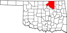 | |
| Towns | ||
| CDP | ||
| Unincorporated communities |
| |
| Footnotes | ‡This populated place also has portions in an adjacent county or counties | |