Avard, Oklahoma
| Avard, Oklahoma | |
|---|---|
| Unincorporated community | |
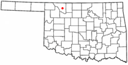 Location of Avard, Oklahoma | |
| Coordinates: 36°41′57″N 98°47′24″W / 36.69917°N 98.79000°WCoordinates: 36°41′57″N 98°47′24″W / 36.69917°N 98.79000°W | |
| Country | United States |
| State | Oklahoma |
| County | Woods |
| Area | |
| • Total | 0.2 sq mi (0.5 km2) |
| • Land | 0.2 sq mi (0.5 km2) |
| • Water | 0.0 sq mi (0.0 km2) |
| Elevation | 1,476 ft (450 m) |
| Population (2000) | |
| • Total | 26 |
| • Density | 126.7/sq mi (48.9/km2) |
| Time zone | Central (CST) (UTC-6) |
| • Summer (DST) | CDT (UTC-5) |
| FIPS code | 40-03550[1] |
| GNIS feature ID | 1089768[2] |
Avard was a town in Woods County, Oklahoma, United States. The population was 26 at the 2000 census and is sometimes considered a ghost town.[3] After initial growth Avard began declining in the 1930s. Avard had a post office from June 1, 1895, until November 22, 1963. As of the 2010 census, Avard was listed as disincorporated.
History
The post office was first established in Avard in 1895 and the town was incorporated in 1904 when the Frisco tracks were extended westward from Enid to tie in with the Santa Fe.[3] The town was named for Isabell Avard Todd, the wife of Robert Todd. The town was served by the Southern Arkansas Railway (Santa Fe) and Arkansas Valley and Western Railroad (Frisco).[3]
Avard had mercantile establishments, two hotels, a bank, a livestock auction, and an elevator. A weekly newspaper, the Avard Tribune[3] operated from 1904 to 1918.[4] It was a major cattle shipping point for the area.[3]
250 people lived in the town in 1909.[3]
It was an important rail transfer point for freight and passengers from 1910 to 1930.[3]
Decline
Avard continued to grow until the mid-1930s.[3] During this period the town declined due to the economic depression, dust storms, farm consolidation, and changing travel habits.[3] Additionally the town was struck by tornadoes in 1943 and 1944.[3]
Today only a cafe, elevator and church are left in operation.[3] There are also a few unused store buildings.[3]
Geography
Avard is located at 36°41′57″N 98°47′24″W / 36.69917°N 98.79000°W (36.699116, -98.790078).[5]
According to the United States Census Bureau, the town has a total area of 0.2 square miles (0.52 km2), all of it land.
Demographics
| Historical population | |||
|---|---|---|---|
| Census | Pop. | %± | |
| 1910 | 170 | — | |
| 1990 | 37 | — | |
| 2000 | 26 | −29.7% | |
| U.S. Decennial Census | |||
As of the census[1] of 2000, there were 26 people, 13 households, and 6 families residing in the town. The population density was 126.7 people per square mile (47.8/km²). There were 17 housing units at an average density of 82.8 per square mile (31.3/km²). The racial makeup of the town was 96.15% White, and 3.85% from two or more races.
There were 13 households out of which 30.8% had children under the age of 18 living with them, 46.2% were married couples living together, and 53.8% were non-families. 46.2% of all households were made up of individuals and 15.4% had someone living alone who was 65 years of age or older. The average household size was 2.00 and the average family size was 3.00.
In the town the population was spread out with 19.2% under the age of 18, 7.7% from 18 to 24, 26.9% from 25 to 44, 26.9% from 45 to 64, and 19.2% who were 65 years of age or older. The median age was 42 years. For every 100 females there were 116.7 males. For every 100 females age 18 and over, there were 110.0 males.
The median income for a household in the town was $23,750, and the median income for a family was $40,000. Males had a median income of $23,750 versus $14,583 for females. The per capita income for the town was $11,757. There were no families and 17.1% of the population living below the poverty line, including no under eighteens and 50.0% of those over 64.
References
- 1 2 "American FactFinder". United States Census Bureau. Archived from the original on 2013-09-11. Retrieved 2008-01-31.
- ↑ "US Board on Geographic Names". United States Geological Survey. 2007-10-25. Retrieved 2008-01-31.
- 1 2 3 4 5 6 7 8 9 10 11 12 Morris, John (1977). Ghost Towns of Oklahoma. Norman, Oklahoma: University of Oklahoma Press. p. 229. ISBN 978-0-8061-1420-0.
- ↑ "About this Newspaper: The Avard tribune". Chronicling America. Library of Congress. Retrieved July 12, 2009.
- ↑ "US Gazetteer files: 2010, 2000, and 1990". United States Census Bureau. 2011-02-12. Retrieved 2011-04-23.
External links
- Avard - Encyclopedia of Oklahoma History and Culture
- Oklahoma Digital Maps: Digital Collections of Oklahoma and Indian Territory
Municipalities and communities of Woods County, Oklahoma, United States | ||
|---|---|---|
| Cities | 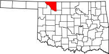 | |
| Towns | ||
| Unincorporated communities | ||