Baima, Baxoi County
For the language, see Baima (language).
| Baima | |
|---|---|
| township | |
| Chinese transcription(s) | |
| • Traditional | 白瑪 |
| • Simplified | 白玛 |
| • Pinyin | Báimǎ |
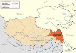
 Baima Location within Tibet | |
| Coordinates: 30°3′N 96°54′E / 30.050°N 96.900°ECoordinates: 30°3′N 96°54′E / 30.050°N 96.900°E | |
| Country | People's Republic of China |
| Region | Tibet |
| Prefecture | Chamdo Prefecture |
| County | Baxoi County |
| Nearby settlements (distance) |
Bamda 29.4 mi (47 km) |
| Elevation | 3,772 m (12,378 ft) |
| Population | |
| • Total | 378 |
| • Major Nationalities | Tibetan |
| • Regional dialect | Tibetan language |
| Time zone | +8 |
| Climate | Cwb |
Baima (Tibetan: པད་མ།, Wylie: pad ma, ZYPY: Baima ; Chinese: 白玛; pinyin: Báimǎ) is a township in Baxoi County, Chamdo Prefecture of the Tibet Autonomous Region of the People's Republic of China.[1] It lies at an altitude of 3,772 metres (12,378 ft).
The village has a population of about 378.
See also
Notes
- ↑ (Chinese) Wu Zhenhua (武振华), Xizang Diming (西藏地名; Place Names in Tibet), p.27, Chinese Zangxue Press (中国藏学出版社) 1996, ISBN 7-80057-284-6
External links and references
This article is issued from Wikipedia - version of the 6/26/2016. The text is available under the Creative Commons Attribution/Share Alike but additional terms may apply for the media files.