Bald Bluff Township, Henderson County, Illinois
| Bald Bluff Township | |
|---|---|
| Township | |
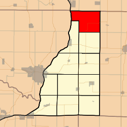 Location in Henderson County | |
 Henderson County's location in Illinois | |
| Coordinates: 41°02′12″N 90°51′16″W / 41.03667°N 90.85444°WCoordinates: 41°02′12″N 90°51′16″W / 41.03667°N 90.85444°W | |
| Country |
|
| State |
|
| County | Henderson |
| Established | November 6, 1906 |
| Area | |
| • Total | 42.78 sq mi (110.8 km2) |
| • Land | 41.99 sq mi (108.8 km2) |
| • Water | 0.79 sq mi (2.0 km2) 1.85% |
| Elevation | 640 ft (195 m) |
| Population (2010) | |
| • Total | 334 |
| • Density | 8/sq mi (3/km2) |
| Time zone | CST (UTC-6) |
| • Summer (DST) | CDT (UTC-5) |
| ZIP codes | 61442, 61453, 61469, 61476 |
| GNIS feature ID | 0428629 |
Bald Bluff Township is one of eleven townships in Henderson County, Illinois, USA. As of the 2010 census, its population was 334 and it contained 159 housing units.[1]
Geography
According to the 2010 census, the township has a total area of 42.78 square miles (110.8 km2), of which 41.99 square miles (108.8 km2) (or 98.15%) is land and 0.79 square miles (2.0 km2) (or 1.85%) is water.[1]
Unincorporated towns
(This list is based on USGS data and may include former settlements.)
Cemeteries
The township contains Belmont Cemetery.
Airports and landing strips
- Earl J Meyer Airport
- Meyer Landing Strip
- Shissler Seed Company Incorporated Airport
School districts
- Aledo Community Unit School District 201
- United Community School District 304
- West Central Community Unit School District 235
- Westmer Community Unit School District 203
Political districts
- Illinois's 17th congressional district
- State House District 94
- State Senate District 47
References
- United States Census Bureau 2008 TIGER/Line Shapefiles
- "Bald Bluff Township". Geographic Names Information System. United States Geological Survey. Retrieved 2009-09-19.
- United States National Atlas
- 1 2 "Population, Housing Units, Area, and Density: 2010 - County -- County Subdivision and Place -- 2010 Census Summary File 1". United States Census. Retrieved 2013-05-28.
External links

Municipalities and communities of Henderson County, Illinois, United States | ||
|---|---|---|
| City | ||
| Villages | ||
| Townships | ||
| Unincorporated communities |
| |
| Footnotes | ‡This populated place also has portions in an adjacent county or counties | |
This article is issued from Wikipedia - version of the 10/24/2016. The text is available under the Creative Commons Attribution/Share Alike but additional terms may apply for the media files.