Batote
| Batote | |
|---|---|
| city | |
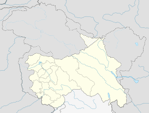 Batote  Batote Location in Jammu and Kashmir | |
| Coordinates: 33°06′N 75°19′E / 33.10°N 75.32°ECoordinates: 33°06′N 75°19′E / 33.10°N 75.32°E | |
| Country |
|
| State | Jammu and Kashmir |
| District | Ramban |
| Elevation | 2,006 m (6,581 ft) |
| Population (2001) | |
| • Total | 3,733 |
| Languages | |
| • Official | Urdu |
| Time zone | IST (UTC+5:30) |
Batote is a town and a notified area committee in Ramban district of the Jammu & Kashmir state in India.
Location
Batote is located on the National Highway from Jammu to Srinagar at 33°06′N 75°19′E / 33.10°N 75.32°E.[1] It has an average elevation of 2,006 metres (6,584 feet). The National highway 1B (to Doda) also originates from Batote. While driving from Jammu it comes after passing Udhampur, Kud and a famous tourist spot Patni Top. Being famous for its beauty and weather, it is a famous tourist destination especially in summers. Some famous places in Batote are Baghu Nallah, Tringla, Boon Badi etc. Baghu Nallah is famous for its Gurudwara in the memory of great saints of Jammu and Kashmir Sant Mela Singh and Sant Rocha Singh .Every year large no of devotees come here to celebrate annual function in the memory of those great saints.
Demographics
As of 2001 census,[2] Batote had a population of 3733. Males constitute 55% of the population and females 45%. Batote has an average literacy rate of 71%, higher than the national average of 59.5%; with 60% of the males and 40% of females literate. 8% of the population is under 6 years of age. Batote town is 45.79% Hindu and 45.05% Muslim with 8.34% Sikh
Speciality
The region is famous for its pleasant weather during summer and its all surrounded greenry.Besides the region is also famous for its high quality kidney beans or Rajma. There is also a possibility at one particular spot of this region for having the only second Gravity Hill of Jammu and Kashmir(yet unconfirmed by scientists) after the one at Ladakh.
See also
References
- ↑ Falling Rain Genomics, Inc - Batote
- ↑ "Census of India 2001: Data from the 2001 Census, including cities, villages and towns (Provisional)". Census Commission of India. Archived from the original on 2004-06-16. Retrieved 2008-11-01.