Kud
| Kud | |
|---|---|
| city | |
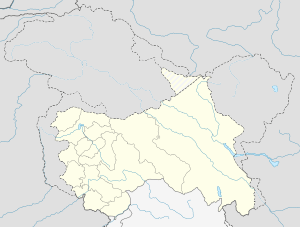 Kud  Kud Location in Jammu and Kashmir, India | |
| Coordinates: 33°05′N 75°17′E / 33.08°N 75.28°ECoordinates: 33°05′N 75°17′E / 33.08°N 75.28°E | |
| Country |
|
| State | Jammu and Kashmir |
| District | Udhampur |
| Elevation | 1,855 m (6,086 ft) |
| Population (2001) | |
| • Total | 1,140 |
| Languages | |
| • Official | Urdu |
| Time zone | IST (UTC+5:30) |
Kud is a town and a notified area committee in Udhampur District in the Indian state of Jammu and Kashmir.
Location
It is located on the Udhampur Srinagar Highway, 100 km from Jammu and 34 km from Udhampur city. It is just short of the tourist spot of Patnitop while driving to Patni top from Udhampur. After Patnitop is the adjoining town of Batote.
Geography
Kud is located at 33°05′N 75°17′E / 33.08°N 75.28°E.[1] It has an average elevation of 1855 metres (6085 feet).It is a part of the Lower Himalayan Range. the river Chenab flows in close proximity.
Demographics
As of 2001 India census,[2] Kud had a population of 1140. Males constitute 54% of the population and females 46%. Kud has an average literacy rate of 59%, lower than the national average of 59.5%: male literacy is 69%, and female literacy is 47%. In Kud, 14% of the population is under 6 years of age.
Religion
Hindu 90.73%, Muslim 4.60%, [3]
Speciality
Kud is notable for its sweets shops which make hot and fresh patisa that is popular among the tourists.
References
- ↑ "Falling Rain Genomics, Inc - Kud". Fallingrain.com. Retrieved 2013-03-07.
- ↑ "Census of India 2001: Data from the 2001 Census, including cities, villages and towns (Provisional)". Census Commission of India. Archived from the original on 2004-06-16. Retrieved 2008-11-01.
- ↑ "Census 2011 India". Census2011.co.in. Retrieved 2016-11-13.