Beale Township, Juniata County, Pennsylvania
| Beale Township, Pennsylvania | |
|---|---|
| Township | |
|
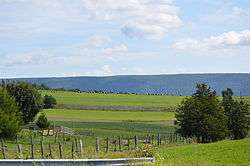
Fields south of Academia with Limestone Ridge in the background | |
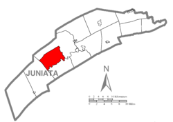 Map of Juniata County, Pennsylvania highlighting Beale Township | |
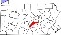 Map of Juniata County, Pennsylvania | |
| Country | United States |
| State | Pennsylvania |
| County | Juniata |
| Settled | 1775 |
| Incorporated | 1843 |
| Area | |
| • Total | 21.8 sq mi (56.6 km2) |
| Population (2000) | |
| • Total | 726 |
| • Density | 33.2/sq mi (12.8/km2) |
| Time zone | EST (UTC-5) |
| • Summer (DST) | EDT (UTC-4) |
| Area code(s) | 717 |
Beale Township is a township in Juniata County, Pennsylvania, United States. The population was 726 at the 2000 census.
History
Beale Township is the location of the Book Site, an archaeological site dating from the Woodland period. It is listed on the National Register of Historic Places.[1] The Academia Pomeroy Covered Bridge and Tuscarora Academy are also listed.[2]
Geography
According to the United States Census Bureau, the township has a total area of 21.8 square miles (56 km2), all of it land.
Beale Township is the only township in Juniata County that does not border one of the counties surrounding Juniata. It is bordered by Milford Township to the north and east, Spruce Hill Township to the south and Tuscarora Township to the west.
Demographics
As of the census[3] of 2000, there were 726 people, 254 households, and 205 families residing in the township. The population density was 33.2 people per square mile (12.8/km²). There were 328 housing units at an average density of 15.0/sq mi (5.8/km²). The racial makeup of the township was 97.66% White, 0.69% African American, 0.55% Asian, 0.41% from other races, and 0.69% from two or more races. Hispanic or Latino of any race were 1.38% of the population.
There were 254 households, out of which 36.2% had children under the age of 18 living with them, 70.1% were married couples living together, 5.1% had a female householder with no husband present, and 18.9% were non-families. 15.4% of all households were made up of individuals, and 6.3% had someone living alone who was 65 years of age or older. The average household size was 2.86 and the average family size was 3.17.
In the township the population was spread out, with 28.0% under the age of 18, 7.0% from 18 to 24, 30.2% from 25 to 44, 23.1% from 45 to 64, and 11.7% who were 65 years of age or older. The median age was 37 years. For every 100 females there were 108.6 males. For every 100 females age 18 and over, there were 107.5 males.
The median income for a household in the township was $41,458, and the median income for a family was $43,625. Males had a median income of $31,087 versus $21,818 for females. The per capita income for the township was $16,988. About 6.4% of families and 7.4% of the population were below the poverty line, including 10.6% of those under age 18 and 1.1% of those age 65 or over.
Trivia
- Academia Pomeroy Covered Bridge at 278 feet [portal to portal] is the longest remaining covered bridge in Pennsylvania, crossing the Tuscarora Creek between Spruce Hill and Beale Townships. Owned by the Juniata County Historical Society, Mifflintown, PA since 1962, it is listed on the National Register of Historic Places.
References
- ↑ Beckerman, Ira. National Register of Historic Places Inventory/Nomination: Book Site (36 Jul). National Park Service, 1980-08-08.
- ↑ National Park Service (2010-07-09). "National Register Information System". National Register of Historic Places. National Park Service.
- ↑ "American FactFinder". United States Census Bureau. Archived from the original on 2013-09-11. Retrieved 2008-01-31.
Municipalities and communities of Juniata County, Pennsylvania, United States | ||
|---|---|---|
| Boroughs | | |
| Townships | ||
| CDPs | ||
| Unincorporated communities |
| |
| Footnotes | ‡This populated place also has portions in an adjacent county or counties. | |
Coordinates: 40°31′00″N 77°28′59″W / 40.51667°N 77.48306°W