Beallsville, Ohio
| Beallsville, Ohio | |
|---|---|
| Village | |
|
| |
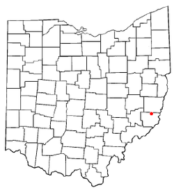 Location of Beallsville, Ohio | |
 Location of Beallsville in Monroe County | |
| Coordinates: 39°50′54″N 81°2′7″W / 39.84833°N 81.03528°WCoordinates: 39°50′54″N 81°2′7″W / 39.84833°N 81.03528°W | |
| Country | United States |
| State | Ohio |
| County | Monroe |
| Township | Sunsbury |
| Area[1] | |
| • Total | 0.36 sq mi (0.93 km2) |
| • Land | 0.36 sq mi (0.93 km2) |
| • Water | 0 sq mi (0 km2) |
| Elevation[2] | 1,257 ft (383 m) |
| Population (2010)[3] | |
| • Total | 409 |
| • Estimate (2012[4]) | 407 |
| • Density | 1,136.1/sq mi (438.7/km2) |
| Time zone | Eastern (EST) (UTC-5) |
| • Summer (DST) | EDT (UTC-4) |
| ZIP code | 43716 |
| Area code(s) | 740 |
| FIPS code | 39-04542[5] |
| GNIS feature ID | 1075319[2] |

Beallsville /ˈbɛlzvᵻl/[6] is a village in Monroe County, Ohio, United States. As of the 2010 census, the village population was 409.[7]
The village gained national attention during the Vietnam War by having lost six of its 475 citizens to the war, the worst per-capita loss of life experienced by any place in the country.
Beallsville is served by the Monroe County District Library from its administrative offices in Woodsfield, Ohio.
Geography
Beallsville is located at 39°50′54″N 81°2′7″W / 39.84833°N 81.03528°W (39.848402, -81.035174).[8]
According to the United States Census Bureau, the village has a total area of 0.36 square miles (0.93 km2), all of it land.[1]
History
During the period of active American participation in the Vietnam War in the 1960s, Beallsville gained brief notoriety for the loss of five of its citizens in the conflict — a traumatic rate of loss for the town of fewer than 500 residents that was estimated at 75 times the national average.[9] The plight of the community drew wire service coverage and was the subject of a lengthy illustrated spread in the glossy left-wing magazine Ramparts.[9] Moved by the magnitude of the loss, Congressman Clarence Miller made a formal request to Secretary of Defense Melvin Laird and President Richard Nixon to withdraw the other six of the town's service personnel from Vietnam combat, which was denied.[9]
A sixth of the village's sons fell in combat on March 9, 1969,[10] cementing the community's tragic distinction of having the highest percentage rate of loss in the Vietnam War of any town in America.[11]
Demographics
| Historical population | |||
|---|---|---|---|
| Census | Pop. | %± | |
| 1830 | 50 | — | |
| 1840 | 100 | 100.0% | |
| 1850 | 276 | 176.0% | |
| 1870 | 324 | — | |
| 1880 | 391 | 20.7% | |
| 1890 | 512 | 30.9% | |
| 1900 | 554 | 8.2% | |
| 1910 | 564 | 1.8% | |
| 1920 | 555 | −1.6% | |
| 1930 | 479 | −13.7% | |
| 1940 | 450 | −6.1% | |
| 1950 | 410 | −8.9% | |
| 1960 | 441 | 7.6% | |
| 1970 | 452 | 2.5% | |
| 1980 | 601 | 33.0% | |
| 1990 | 464 | −22.8% | |
| 2000 | 423 | −8.8% | |
| 2010 | 409 | −3.3% | |
| Est. 2015 | 404 | [12] | −1.2% |
2010 census
As of the census[3] of 2010, there were 409 people, 174 households, and 113 families residing in the village. The population density was 1,136.1 inhabitants per square mile (438.7/km2). There were 196 housing units at an average density of 544.4 per square mile (210.2/km2). The racial makeup of the village was 97.8% White and 2.2% from two or more races.
There were 174 households of which 31.6% had children under the age of 18 living with them, 43.7% were married couples living together, 13.2% had a female householder with no husband present, 8.0% had a male householder with no wife present, and 35.1% were non-families. 30.5% of all households were made up of individuals and 12.6% had someone living alone who was 65 years of age or older. The average household size was 2.35 and the average family size was 2.90.
The median age in the village was 39.8 years. 22.5% of residents were under the age of 18; 9.1% were between the ages of 18 and 24; 25.9% were from 25 to 44; 29.1% were from 45 to 64; and 13.4% were 65 years of age or older. The gender makeup of the village was 48.9% male and 51.1% female.
2000 census
As of the census[5] of 2000, there were 423 people, 171 households, and 114 families residing in the village. The population density was 1,145.5 people per square mile (441.4/km²). There were 186 housing units at an average density of 503.7 per square mile (194.1/km²). The racial makeup of the village was 98.35% White, 0.24% Pacific Islander, and 1.42% from two or more races. Hispanic or Latino of any race were 0.24% of the population.
There were 171 households out of which 32.2% had children under the age of 18 living with them, 49.7% were married couples living together, 11.7% had a female householder with no husband present, and 33.3% were non-families. 29.2% of all households were made up of individuals and 14.6% had someone living alone who was 65 years of age or older. The average household size was 2.47 and the average family size was 3.05.
In the village the population was spread out with 24.3% under the age of 18, 12.5% from 18 to 24, 28.6% from 25 to 44, 22.9% from 45 to 64, and 11.6% who were 65 years of age or older. The median age was 33 years. For every 100 females there were 85.5 males. For every 100 females age 18 and over, there were 83.9 males.
The median income for a household in the village was $25,893, and the median income for a family was $34,063. Males had a median income of $26,750 versus $20,938 for females. The per capita income for the village was $20,672. About 11.9% of families and 18.1% of the population were below the poverty line, including 15.0% of those under age 18 and 13.6% of those age 65 or over.
Notable people
- Merriman Colbert Harris, Civil War soldier and Methodist Episcopal Church Missionary Bishop
- Dustin Nippert, professional baseball player
Footnotes
- 1 2 "US Gazetteer files 2010". United States Census Bureau. Archived from the original on 2012-01-24. Retrieved 2013-01-06.
- 1 2 "US Board on Geographic Names". United States Geological Survey. 2007-10-25. Retrieved 2008-01-31.
- 1 2 "American FactFinder". United States Census Bureau. Retrieved 2013-01-06.
- ↑ "Population Estimates". United States Census Bureau. Archived from the original on 2013-06-17. Retrieved 2013-06-17.
- 1 2 "American FactFinder". United States Census Bureau. Archived from the original on 2013-09-11. Retrieved 2008-01-31.
- ↑ E. W. Scripps School of Journalism. A Pronunciation Guide to places in Ohio. Accessed online 26 February 2007.
- ↑ "Profile of General Population and Housing Characteristics: 2010 Demographic Profile Data (DP-1): Beallsville village, Ohio". U.S. Census Bureau, American Factfinder. Archived from the original on September 11, 2013. Retrieved May 31, 2012.
- ↑ "US Gazetteer files: 2010, 2000, and 1990". United States Census Bureau. 2011-02-12. Retrieved 2011-04-23.
- 1 2 3 Jeffrey Blankfort, "Our Town: The War Comes Home to Beallsville, Ohio," Ramparts [San Francisco], vol. 8, no. 1 (July 1969), pp. 39-46.
- ↑ "Find Vietnam War Casualties From Beallsville, Ohio," Find the Data, www.findthedata.org/
- ↑ Ohio Historical Society. "Remarkable Ohio." Dead link, originally accessed February 26, 2007.
- ↑ "Annual Estimates of the Resident Population for Incorporated Places: April 1, 2010 to July 1, 2015". Retrieved July 2, 2016.
- ↑ "Census of Population and Housing". Census.gov. Archived from the original on May 11, 2015. Retrieved June 4, 2015.
Municipalities and communities of Monroe County, Ohio, United States | ||
|---|---|---|
| Villages | 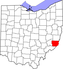 | |
| Townships | ||
| CDPs | ||
| Unincorporated communities | ||
| Ghost town | ||
| Footnotes | ‡This populated place also has portions in an adjacent county or counties | |