Beit Duqqu
| Beit Duqqu | |
|---|---|
| Other transcription(s) | |
| • Arabic | بيت دقّو |
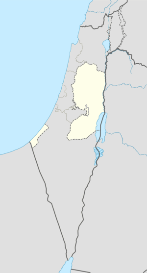 Beit Duqqu Location of Beit Duqqu within the Palestinian territories | |
| Coordinates: 31°51′33″N 35°07′43″E / 31.85917°N 35.12861°ECoordinates: 31°51′33″N 35°07′43″E / 31.85917°N 35.12861°E | |
| Governorate | Jerusalem |
| Government | |
| • Type | Village council |
| Population (2006) | |
| • Jurisdiction | 1,600 |
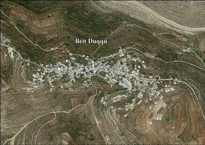
Beit Duqqu (Arabic: بيت دقّو) is a Palestinian village in the Jerusalem Governorate, located 12 kilometers northwest of Jerusalem in the northern West Bank.According to a census conducted in 1931 by the British Mandate authorities, Beit Duqqu had a population of 328 inhabitants, in 84 inhabited houses.[1] According to the Palestinian Central Bureau of Statistics, the town had a population of 1,600 in 2006.
It is linked to Jerusalem by Highway 443. The village's topographic relief is mountainous. It is located 650 meters above sea level, bordered by Beit 'Anan in the southwest, Beit Izja in the southeast, At Tira in the north and Al Qubeibeh in the south. Beit Duqqu's total land area is 7000 dunums including the built-up area. Seven major clans constitute the population.
The main source of living is agriculture, mainly of apricots, olives and grapes.[2]
References
- ↑ Mills, 1932, p. 37
- ↑ Projected Mid -Year Population for Jerusalem Governorate by Locality 2004- 2006 Archived February 7, 2012, at the Wayback Machine. Palestinian Central Bureau of Statistics.
Bibliography
- Barron, J. B., ed. (1923). Palestine: Report and General Abstracts of the Census of 1922. Government of Palestine.
- Conder, Claude Reignier; Kitchener, Herbert H. (1883). The Survey of Western Palestine: Memoirs of the Topography, Orography, Hydrography, and Archaeology. 3. London: Committee of the Palestine Exploration Fund. (p. 16)
- Guérin, Victor (1875). Description Géographique Historique et Archéologique de la Palestine (in French). 2: Samarie, pt. 2. Paris: L'Imprimerie Nationale. (p. 398)
- Hadawi, Sami (1970). Village Statistics of 1945: A Classification of Land and Area ownership in Palestine. Palestine Liberation Organization Research Center.
- Hütteroth, Wolf-Dieter; Abdulfattah, Kamal (1977). Historical Geography of Palestine, Transjordan and Southern Syria in the Late 16th Century. Erlanger Geographische Arbeiten, Sonderband 5. Erlangen, Germany: Vorstand der Fränkischen Geographischen Gesellschaft. ISBN 3-920405-41-2. (p. 113)
- Mills, E., ed. (1932). Census of Palestine 1931. Population of Villages, Towns and Administrative Areas. Jerusalem: Government of Palestine.
- Palmer, E. H. (1881). The Survey of Western Palestine: Arabic and English Name Lists Collected During the Survey by Lieutenants Conder and Kitchener, R. E. Transliterated and Explained by E.H. Palmer. Committee of the Palestine Exploration Fund. (p. 286)
External links
- Welcome To Bayt Duqqu
- Survey of Western Palestine, Map 17: IAA, Wikimedia commons
- Beit Duqqu Village (Fact Sheet), ARIJ
- Beit Duqqu Village Profile, ARIJ
- Beit Duqqu aerial photo, ARIJ
- Locality Development Priorities and Needs in Beit Duqqu, ARIJ
- Beit Duqqu village lands are threatened by the Segregation Wall
- https://web.archive.org/web/20070814125923/http://www.poica.org:80/editor/case_studies/view.php?recordID=671
