Binevenagh
| Binevenagh | |
|---|---|
| Binn Fhoibhne | |
 View from Castlerock towards Binevenagh. | |
| Highest point | |
| Elevation | 385 m (1,263 ft) |
| Prominence | 170 m (560 ft) |
| Listing | Marilyn |
| Naming | |
| Translation | Foibhne's peak (Irish) |
| Pronunciation | Irish: [bʲiːnʲ ˈɛvʲnʲə] |
| Geography | |
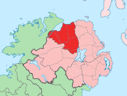
| Location | County Londonderry, Northern Ireland |
| Parent range | Antrim Plateau |
| OSI/OSNI grid | C692302 |
| Topo map | OSNI Discoverer Series 04 Coleraine (1:50000) |
Binevenagh or Benevenagh (from Irish Binn Fhoibhne, meaning "Foibhne's peak")[1] is a mountain in County Londonderry, Northern Ireland. It marks the western extent of the Antrim Plateau formed around 60 million years ago by molten lava. The plateau and steep cliffs extend for over 6 miles across the peninsula of Magilligan and dominate the skyline over the villages of Bellarena, Downhill, Castlerock and Benone beach. The area has been classified as both an Area of Special Scientific Interest[2] and as an Area of Outstanding Natural Beauty (AONB).[3] The total area of the AONB is 138 km².
The Bishops Road, named after the Bishop of Derry, extends across the plateau. Notable features include the Mussenden Temple and a cliff top viewing area on the Bishops Road giving good views over Lough Foyle and County Donegal.
Sport
- Gliding - the Ulster Gliding Club uses the slopes for gliders.[4]
- Hang gliding and Paragliding - the slopes are used for soaring by the Ulster Hang gliding and Paragliding Club (UHPC).[5]
- Fishing - an artificial lake at the top of the mountain is used for trout fishing.
- Motorsport - the Coleraine & District Motor Club run the Eagles Rock hillclimbing event during the month of July.[6]
Railway access
The Belfast-Londonderry railway line trains run by Northern Ireland Railways call at Bellarena railway station between Londonderry railway station and Castlerock railway station. Trains continue from Castlerock to Coleraine railway station and other stations to Belfast Central and Belfast Great Victoria Street.
References
- ↑ Placenames Database of Ireland
- ↑ Area of Special Scientific Interest Northern Ireland Environment Agency website 2001-04-01 Retrieved 2009-11-19
- ↑ Area of Outstanding Natural Beauty Archived October 7, 2011, at the Wayback Machine. Department of Environment - Retrieved 2009-11-19
- ↑ Ulster Gliding Club Archived May 9, 2016, at the Wayback Machine. Retrieved 2009-11-20
- ↑ Ulster Hang gliding and Paragliding Club - UHPC Archived October 12, 2016, at the Wayback Machine.
- ↑ Coleraine & District Motor Club Retrieved 2009-11-20
External links
Mountains and hills of Ulster | ||
|---|---|---|
| Antrim Hills |  | |
| Antrim Plateau | ||
| Belfast Hills | ||
| Croaghgorms | ||
| Derryveagh | ||
| Inishowen | ||
| Mournes | ||
| Sperrins | ||
| Southwest Donegal | ||
| Others | ||
Coordinates: 55°07′N 6°55′W / 55.11°N 6.92°W