Blackstairs Mountains
The Blackstairs Mountains (Irish: Na Staighrí Dubha) run roughly north/south along the border between County Carlow and County Wexford in Ireland. The highest peak is Mount Leinster with a total height of 2612 ft/ 796 metres.
| Blackstairs Mountains | |
|---|---|
| Na Staighrí Dubha | |
|
Panorama of the Blackstairs Mountains | |
| Highest point | |
| Peak | Mount Leinster (East of Borris) |
| Elevation | 796 m (2,612 ft) |
| Coordinates | 52°37′1.2″N 6°46′40.8″W / 52.617000°N 6.778000°W |
| Geography | |
| Country | Ireland |
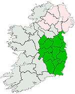
| Province | Leinster |
| Counties | Carlow and Wexford |
| Towns | |
| Range coordinates | 52°35′N 6°47′W / 52.59°N 6.78°WCoordinates: 52°35′N 6°47′W / 52.59°N 6.78°W |
| Highest Hills | Height (m) | Location |
|---|---|---|
| Mount Leinster | 793 | 52°37′01″N 6°46′41″W / 52.617°N 6.778°W |
| Blackstairs Mountain | 735 | |
| Black Rock Mountain | 599 | 52°37′03″N 6°43′41″W / 52.6174°N 6.7281°W |
| Knockroe | 540 | 52°35′33″N 6°47′31″W / 52.5924°N 6.7919°W |
| Slievebawn | 520 | 52°38′20″N 6°48′35″W / 52.6389°N 6.8096°W |
| Carrigroe | 495 | 52°31′11″N 6°49′57″W / 52.5197°N 6.8324°W |
| Carrigalachan | 463 | 52°31′50″N 6°50′13″W / 52.5305°N 6.8370°W |
| Croaghaun | 455 | 52°39′49″N 6°46′03″W / 52.6637°N 6.7676°W |
| Slievebaun | 444 | 52°31′58″N 6°48′02″W / 52.5328°N 6.8005°W |
See also
Other projects
![]() Media related to Blackstairs Mountains at Wikimedia Commons
Media related to Blackstairs Mountains at Wikimedia Commons
This article is issued from Wikipedia - version of the 9/28/2016. The text is available under the Creative Commons Attribution/Share Alike but additional terms may apply for the media files.