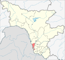
Blagoveshchensky District, Amur Oblast
| Blagoveshchensky District Благовещенский район (Russian) | |
|---|---|
 Location of Blagoveshchensky District in Amur Oblast | |
| Coordinates: 50°19′N 127°31′E / 50.317°N 127.517°ECoordinates: 50°19′N 127°31′E / 50.317°N 127.517°E | |
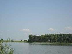 Gribskov Reservoir | |
 |
 |
|
| |
| Location | |
| Country | Russia |
| Federal subject | Amur Oblast[1] |
| Administrative structure (as of June 2008) | |
| Administrative center | city of Blagoveshchensk[2] |
| Administrative divisions:[3] | |
| Rural settlements | 11 |
| Inhabited localities:[3] | |
| Rural localities | 27 |
| Municipal structure (as of September 2005) | |
| Municipally incorporated as | Blagoveshchensky Municipal District[3] |
| Municipal divisions:[3] | |
| Urban settlements | 0 |
| Rural settlements | 11 |
| Statistics | |
| Area | 3,060 km2 (1,180 sq mi)[4] |
| Population (2010 Census) | 19,641 inhabitants[5] |
| • Urban | 0% |
| • Rural | 100% |
| Density | 6.42/km2 (16.6/sq mi)[6] |
| Time zone | YAKT (UTC+09:00)[7] |
| Official website | |
| Blagoveshchensky District on WikiCommons | |
Blagoveshchensky District (Russian: Благове́щенский райо́н) is an administrative[1] and municipal[3] district (raion), one of the twenty in Amur Oblast, Russia. The area of the district is 3,060 square kilometers (1,180 sq mi).[4] Its administrative center is the city of Blagoveshchensk[2] (which is not administratively a part of the district).[1] Population: 19,641 (2010 Census);[5] 18,673 (2002 Census);[8] 18,192 (1989 Census).[9]
Administrative and municipal status
Within the framework of administrative divisions, Blagoveshchensky District is one of the twenty in the oblast.[1] The city of Blagoveshchensk serves as its administrative center,[2] despite being incorporated separately as an urban okrug—an administrative unit with the status equal to that of the districts.[1]
As a municipal division, the district is incorporated as Blagoveshchensky Municipal District.[3] Blagoveshchensk Urban Okrug is incorporated separately from the district.[10]
References
Notes
- 1 2 3 4 5 Law #127-OZ
- 1 2 3 According to Law #127-OZ, the administrative-territorial structure of Amur Oblast matches its municipal structure. The laws dealing with the structure of the municipal districts serve as the registries of the inhabited localities of the administrative districts and list their administrative centers. For Blagoveshchensky District, Law #51-OZ is used.
- 1 2 3 4 5 6 Law #51-OZ
- 1 2 "Descriptive Statistics - Blagoveshchensky" (in Russian). Federal State Statistics Service, Russian Federation. Retrieved July 2, 2016.
- 1 2 Russian Federal State Statistics Service (2011). "Всероссийская перепись населения 2010 года. Том 1" [2010 All-Russian Population Census, vol. 1]. Всероссийская перепись населения 2010 года (2010 All-Russia Population Census) (in Russian). Federal State Statistics Service. Retrieved June 29, 2012.
- ↑ The value of density was calculated automatically by dividing the 2010 Census population by the area specified in the infobox. Please note that this value is only approximate as the area specified in the infobox does not necessarily correspond to the area of the entity proper or is reported for the same year as the population.
- ↑ Правительство Российской Федерации. Федеральный закон №107-ФЗ от 3 июня 2011 г. «Об исчислении времени», в ред. Федерального закона №271-ФЗ от 03 июля 2016 г. «О внесении изменений в Федеральный закон "Об исчислении времени"». Вступил в силу по истечении шестидесяти дней после дня официального опубликования (6 августа 2011 г.). Опубликован: "Российская газета", №120, 6 июня 2011 г. (Government of the Russian Federation. Federal Law #107-FZ of June 31, 2011 On Calculating Time, as amended by the Federal Law #271-FZ of July 03, 2016 On Amending Federal Law "On Calculating Time". Effective as of after sixty days following the day of the official publication.).
- ↑ Russian Federal State Statistics Service (May 21, 2004). "Численность населения России, субъектов Российской Федерации в составе федеральных округов, районов, городских поселений, сельских населённых пунктов – районных центров и сельских населённых пунктов с населением 3 тысячи и более человек" [Population of Russia, Its Federal Districts, Federal Subjects, Districts, Urban Localities, Rural Localities—Administrative Centers, and Rural Localities with Population of Over 3,000] (XLS). Всероссийская перепись населения 2002 года [All-Russia Population Census of 2002] (in Russian). Retrieved August 9, 2014.
- ↑ Demoscope Weekly (1989). "Всесоюзная перепись населения 1989 г. Численность наличного населения союзных и автономных республик, автономных областей и округов, краёв, областей, районов, городских поселений и сёл-райцентров" [All Union Population Census of 1989: Present Population of Union and Autonomous Republics, Autonomous Oblasts and Okrugs, Krais, Oblasts, Districts, Urban Settlements, and Villages Serving as District Administrative Centers]. Всесоюзная перепись населения 1989 года [All-Union Population Census of 1989] (in Russian). Институт демографии Национального исследовательского университета: Высшая школа экономики [Institute of Demography at the National Research University: Higher School of Economics]. Retrieved August 9, 2014.
- ↑ Law #447-OZ
Sources
- Амурский областной Совет народных депутатов. Закон №127-ОЗ от 23 декабря 2005 г. «О порядке решения вопросов административно-территориального устройства Амурской области», в ред. Закона №272-ОЗ от 11 ноября 2013 г. «О внесении изменений в Закон Амурской области "О порядке решения вопросов административно-территориального устройства Амурской области"». Вступил в силу со дня первого официального опубликования, за исключением подпункта "б" пункта 2 статьи 7, вступающего в силу с 1 января 2006 г. Опубликован: "Амурская правда", №11, 24 января 2006 г. (Amur Oblast Council of People's Deputies. Law #127-OZ of December 23, 2005 On the Procedures of Handling the Issues of the Administrative and Territorial Structure of Amur Oblast, as amended by the Law #272-OZ of November 11, 2013 On Amending the Law of Amur Oblast "On the Procedures of Handling the Issues of the Administrative and Territorial Structure of Amur Oblast". Effective as of the day of the first official publication, with the exception of subitem "b" of item 2 of Article 7, which is effective January 1, 2006.).
- Амурский областной Совет народных депутатов. Закон №51-ОЗ от 21 сентября 2005 г. «Об установлении границ и наделении соответствующим статусом муниципального образования Благовещенского района и муниципальных образований в его составе», в ред. Закона №175-ОЗ от 26 апреля 2013 г. «О внесении изменений в отдельные законодательные акты Амурской области по вопросам установления границ муниципальных образований». Вступил в силу со дня первого опубликования, за исключением статьи 3, вступившей в силу с 1 января 2006 г. Опубликован: "Амурская правда", №190, 27 сентября 2005 г. (Amur Oblast Council of People's Deputies. Law #51-OZ of September 21, 2005 On Establishing the Borders of and Granting a Corresponding Municipal Formation Status to Blagoveshchensky District and to the Municipal Formations It Comprises, as amended by the Law #175-OZ of April 26, 2013 On Amending Various Legislative Acts of Amur Oblast on the Issues of Establishing the Borders of the Municipal Formations. Effective as of the day of the first publication, with the exception of Article 3 which took effect on January 1, 2006.).
- Амурский областной Совет народных депутатов. Закон №447-ОЗ от 14 марта 2005 г «О наделении муниципального образования города Благовещенск статусом городского округа и об установлении его границ», в ред. Закона №175-ОЗ от 26 апреля 2013 г. «О внесении изменений в отдельные законодательные акты Амурской области по вопросам установления границ муниципальных образований». Вступил в силу в соответствии со статьёй 3. Опубликован: "Амурская правда", №61, 25 марта 2005 г. (Amur Oblast Council of People's Deputies. Law #447-OZ of March 14, 2005 On Granting the Municipal Formation of the Town of Blagoveshchensk the Urban Okrug Status and on Establishing Its Borders, as amended by the Law #175-OZ of April 26, 2013 On Amending Various Legislative Acts of Amur Oblast on the Issues of Establishing the Borders of the Municipal Formations. Effective as of the date set forth in accordance with the provisions of Article 3.).
| Urban okrugs | ||
|---|---|---|
| Districts | ||
| Towns incorporated as urban settlements | ||