Booneville, Mississippi
| Booneville, Mississippi | |
|---|---|
| City | |
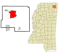 Location of Booneville, Mississippi | |
 Booneville, Mississippi Location in the United States | |
| Coordinates: 34°39′40″N 88°33′41″W / 34.66111°N 88.56139°WCoordinates: 34°39′40″N 88°33′41″W / 34.66111°N 88.56139°W | |
| Country | United States |
| State | Mississippi |
| County | Prentiss |
| Area | |
| • Total | 25.7 sq mi (66.6 km2) |
| • Land | 25.7 sq mi (66.5 km2) |
| • Water | 0.0 sq mi (0.1 km2) |
| Elevation | 518 ft (158 m) |
| Population (2000) | |
| • Total | 8,625 |
| • Density | 335.8/sq mi (129.6/km2) |
| Time zone | Central (CST) (UTC-6) |
| • Summer (DST) | CDT (UTC-5) |
| ZIP code | 38829 |
| Area code(s) | 662 |
| FIPS code | 28-07780 |
| GNIS feature ID | 0667440 |
| Website | http://www.booneville-ms.gov/ |
Booneville is the county seat of Prentiss County, Mississippi.[1] Booneville was incorporated in 1861[2] and named after R.H. Boone, a relative of Daniel Boone. The population was 8,625 at the 2000 census.[3] It is one of 21 certified Mississippi retirement cities.[4]
History
The land of Booneville was bought by B.B. Boone, G.W. Williams, and W.P. Curlee from the Chickasaw tribesman Le-Ho-Yea. The community was named for R.H. Boone, a relative of Daniel Boone, the early American pioneer.[5]
Civil War
Geography
Booneville is located at 34°39′40″N 88°33′41″W / 34.66111°N 88.56139°W (34.661115, -88.561426).[6]
According to the United States Census Bureau, the city has a total area of 25.7 square miles (67 km2), of which 25.7 square miles (67 km2) is land and 0.04 square miles (0.10 km2) (0.16%) is water.
Climate
Climate is characterized by relatively high temperatures and evenly distributed precipitation throughout the year. The Köppen Climate Classification subtype for this climate is "Cfa" (Humid Subtropical Climate).[7]
| Climate data for Booneville, Mississippi | |||||||||||||
|---|---|---|---|---|---|---|---|---|---|---|---|---|---|
| Month | Jan | Feb | Mar | Apr | May | Jun | Jul | Aug | Sep | Oct | Nov | Dec | Year |
| Average high °C (°F) | 10 (50) |
12 (53) |
17 (63) |
22 (72) |
27 (80) |
31 (87) |
32 (90) |
32 (90) |
29 (85) |
23 (74) |
17 (62) |
11 (52) |
22 (71) |
| Average low °C (°F) | −1 (31) |
1 (33) |
5 (41) |
10 (50) |
14 (58) |
19 (66) |
21 (69) |
20 (68) |
17 (62) |
10 (50) |
4 (40) |
1 (33) |
10 (50) |
| Average precipitation mm (inches) | 132 (5.2) |
124 (4.9) |
150 (5.9) |
130 (5) |
130 (5) |
99 (3.9) |
100 (4) |
86 (3.4) |
86 (3.4) |
84 (3.3) |
117 (4.6) |
147 (5.8) |
1,384 (54.5) |
| Source: Weatherbase [8] | |||||||||||||
Demographics
| Historical population | |||
|---|---|---|---|
| Census | Pop. | %± | |
| 1870 | 458 | — | |
| 1880 | 603 | 31.7% | |
| 1890 | 748 | 24.0% | |
| 1900 | 1,050 | 40.4% | |
| 1910 | 1,337 | 27.3% | |
| 1920 | 1,495 | 11.8% | |
| 1930 | 1,703 | 13.9% | |
| 1940 | 1,893 | 11.2% | |
| 1950 | 3,295 | 74.1% | |
| 1960 | 3,480 | 5.6% | |
| 1970 | 5,895 | 69.4% | |
| 1980 | 6,199 | 5.2% | |
| 1990 | 7,955 | 28.3% | |
| 2000 | 8,625 | 8.4% | |
| 2010 | 8,743 | 1.4% | |
| Est. 2015 | 8,816 | [9] | 0.8% |
As of the census[11] of 2000, there were 8,625 people, 3,302 households, and 2,205 families residing in the city. The population density was 335.8 people per square mile (129.6/km²). There were 3,625 housing units at an average density of 141.1 per square mile (54.5/km²). The racial makeup of the city was 79.88% White, 18.49% African American, 0.30% Native American, 0.31% Asian, 0.15% from other races, and 0.86% from two or more races. Hispanic or Latino of any race were 0.71% of the population.
There were 3,302 households out of which 30.4% had children under the age of 18 living with them, 47.8% were married couples living together, 14.7% had a female householder with no husband present, and 33.2% were non-families. 30.7% of all households were made up of individuals and 16.1% had someone living alone who was 65 years of age or older. The average household size was 2.35 and the average family size was 2.93.
In the city the population was spread out with 22.2% under the age of 18, 16.6% from 18 to 24, 23.8% from 25 to 44, 20.1% from 45 to 64, and 17.3% who were 65 years of age or older. The median age was 35 years. For every 100 females there were 87.6 males. For every 100 females age 18 and over, there were 81.6 males.
The median income for a household in the city was $28,361, and the median income for a family was $38,918. Males had a median income of $29,667 versus $19,821 for females. The per capita income for the city was $15,128. About 11.2% of families and 15.2% of the population were below the poverty line, including 16.2% of those under age 18 and 17.6% of those age 65 or over.
As of the 2010 census, the population was 8,743.[12]
Education
- The City of Booneville is served by two public school districts - Booneville and Prentiss County.
- Booneville is home to Northeast Mississippi Community College, which has an annual enrollment in excess of 6,000 students. The community college serves five counties: Prentiss, Tippah, Alcorn, Union, and Tishomingo.[3]
Media
Newspapers
- Banner Independent
- Prentiss County Progress
Television stations
Radio stations
- WBIP AM 1400 Hometown Radio
Transportation
The Booneville/Baldwyn Airport is owned by the cities of Booneville and Baldwyn. It is located in Prentiss County, six nautical miles (7 mi, 11 km) southwest of Booneville's central business district.[13]
Notable people
- Cecil Bolton, Major League Baseball first baseman for the Cleveland Indians
- George E. Allen, American political figure and head football coach for 1 game at Cumberland University
- Harold Bishop, Jr., professional football player
- Travis Childers, former congressman
- Jamie Davis, Southern rock musician
- Gene Kelton, singer-songwriter, blues musician, and band leader of Mean Gene Kelton & The Die Hards
- Stephanie McAfee, author of Diary of a Mad Fat Girl, a New York Times e-book fiction bestseller.[14][15]
References
- ↑ "Find a County". National Association of Counties. Retrieved 2011-06-07.
- ↑ History of Booneville
- 1 2 About Booneville
- ↑ http://www.visitmississippi.org/retire/default.htm
- ↑ http://www.stoppingpoints.com/mississippi/Prentiss/Booneville/
- ↑ "US Gazetteer files: 2010, 2000, and 1990". United States Census Bureau. 2011-02-12. Retrieved 2011-04-23.
- ↑ Climate Summary for Boonevill, Mississippi
- ↑ "Weatherbase.com". Weatherbase. 2013. Retrieved on August 16, 2013.
- ↑ "Annual Estimates of the Resident Population for Incorporated Places: April 1, 2010 to July 1, 2015". Retrieved July 2, 2016.
- ↑ "Census of Population and Housing". Census.gov. Retrieved June 4, 2015.
- ↑ "American FactFinder". United States Census Bureau. Retrieved 2008-01-31.
- ↑ http://censusviewer.com/city/MS/Booneville
- ↑ FAA Airport Master Record for 8M1 (Form 5010 PDF). Federal Aviation Administration. Effective 30 June 2011.
- ↑ Krug, Nora (February 7, 2012). "New in Paperback: Stephanie McAfee's 'Diary of a Mad Fat Girl'". Washington Post.
- ↑ Sappington, Brant (June 23, 2013). "Fat Girl Returns" (PDF). Daily Corinthian.
External links
- Prentiss County Voice - Booneville
- Baptist Memorial Hospital - Booneville
- Chamber of Commerce - Booneville
- The Banner Independent
Municipalities and communities of Prentiss County, Mississippi, United States | ||
|---|---|---|
| Cities | 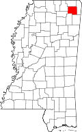 | |
| Towns | ||
| Unincorporated communities | ||
| Footnotes | ‡This populated place also has portions in an adjacent county or counties | |