Booral, Queensland
| Booral Hervey Bay, Queensland | |||||||||||||
|---|---|---|---|---|---|---|---|---|---|---|---|---|---|
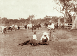 Booral horse station, circa 1898 | |||||||||||||
| Population | 1,449 (2011)[1] | ||||||||||||
| Postcode(s) | 4655 | ||||||||||||
| LGA(s) | Fraser Coast Region | ||||||||||||
| State electorate(s) | Hervey Bay | ||||||||||||
| Federal Division(s) | Hinkler | ||||||||||||
| |||||||||||||
Booral is a locality within the Fraser Coast Region, Queensland, Australia.[2] In the 2011 census, Booral had a population of 1,449 people.[1]
History
The name Booral is a Kabi language word meaning either tall (relating to the sky god Beiral) or burrall meaning place of shell mounds.[2] Many shell mounds have been found along the coastline, arising from Aboriginal people feasting on shellfish. Aboriginal people travelled from the Bunya Mountains to trade bunya nuts for shellfish. It is believed Aboriginal people inhabited the area for over 6,000 years.[3]
Edgar Thomas Aldridge established the Booral Homestead in the 1850s.[4]
Economy
The proximity to the Great Sandy Strait enables salt water aquaculture, including the farming of fish, sea cucumbers and soft shell crabs.[5]
Community associations
The Booral Community Association Inc is a group of volunteers who seek to promote the interests of the community at all levels of government. A major issue for the group has been the restriction of foreshore access to only certain property holders rather than to the general public.[6]
References
- 1 2 Australian Bureau of Statistics (31 October 2012). "Booral (SSC)". 2011 Census QuickStats. Retrieved 28 April 2014.
- 1 2 "Booral (entry 46633)". Queensland Place Names. Queensland Government. Retrieved 28 April 2014.
- ↑ "A Brief History of Booral". Wendy Reed. Retrieved 28 April 2014.
- ↑ "Booral". Queensland Places. Centre for the Government of Queensland, University of Queensland. Retrieved 28 April 2014.
- ↑ Mcrae, Toni (10 September 2010). "Fish farmer can hatch new plan". Fraser Coast Chronicle. Retrieved 28 April 2014.
- ↑ "Booral Identities". Wendy Reed. Retrieved 28 April 2014.
External links
- "Booral". Queensland Places. Centre for the Government of Queensland, University of Queensland.
Coordinates: 25°21′14″S 152°53′23″E / 25.35389°S 152.88972°E