Boreen Point, Queensland
| Boreen Point Noosa, Queensland | |||||||||||||
|---|---|---|---|---|---|---|---|---|---|---|---|---|---|
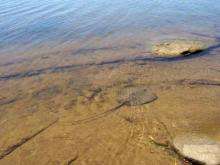
 Main Beach, Boreen Point (Note dark Tannin discolouration of the water) | |||||||||||||
| Population | 264 (2011 census)[1] | ||||||||||||
| • Density | 660/km2 (1,710/sq mi) | ||||||||||||
| Postcode(s) | 4565 | ||||||||||||
| Area | 0.4 km2 (0.2 sq mi) | ||||||||||||
| Location | 26 km (16 mi) NW of Noosa Heads | ||||||||||||
| LGA(s) | Shire of Noosa | ||||||||||||
| State electorate(s) | Noosa | ||||||||||||
| Federal Division(s) | Wide Bay | ||||||||||||
| |||||||||||||
Coordinates: 26°17′06″S 152°59′35″E / 26.285°S 152.993°E
Boreen Point is a small town north of Tewantin on the Sunshine Coast, Queensland, Australia. It is within the local government area of Shire of Noosa (between 2008 and 2013 it was within Sunshine Coast Region). At the 2011 Australian Census Boreen Point recorded a population of 264.[1]
History
The name comes from an Aboriginal word from the tribes around Moreton Bay which refers to the pathway that led between two bora rings.[2]
Boreen Point is home to the Apollonian Hotel, a historic inn that was moved from Gympie, Queensland and rebuilt in Boreen Point.
Geography
One of Boreen Point's major attractions is Lake Cootharaba, a very large, shallow lake that is recognised nationally for its fantastic weather for sailing and windsurfing. The lake leads from the Noosa River and also up to national parks.
References
- 1 2 Australian Bureau of Statistics (31 October 2012). "Boreen Point (State Suburb)". 2011 Census QuickStats. Retrieved 29 August 2015.
- ↑ South East Queensland - Place Names Archived 22 August 2006 at the Wayback Machine. 16 December 2006
External links
| Wikimedia Commons has media related to Boreen Point, Queensland. |