Breña Baja
| Breña Baja | |||
|---|---|---|---|
| Municipality | |||
| |||
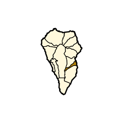 | |||
 Breña Baja Location in Canary Islands | |||
| Coordinates: ES 28°38′N 17°46′W / 28.633°N 17.767°WCoordinates: ES 28°38′N 17°46′W / 28.633°N 17.767°W | |||
| Country |
| ||
| Autonomous community |
| ||
| Province |
| ||
| Island |
| ||
| Area[1] | |||
| • Total | 14.2 km2 (5.5 sq mi) | ||
| Elevation[1] | 300 m (1,000 ft) | ||
| Population (2013)[2] | |||
| • Total | 5,523 | ||
| • Density | 390/km2 (1,000/sq mi) | ||


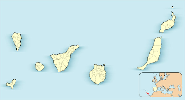
Breña Baja (Spanish for Lower Breña) is a municipality on the eastern side of the island of La Palma, in the province of Santa Cruz de Tenerife, in the Canary Islands. The ayuntamiento (municipal office) is in the town of San José with an elevation of 300 m. Until the 17th century the area was known as Breña, but was then divided into Breña Alta and Breña Baja.
La Palma's second largest resort, Los Cancajos, is on the coast. Part of La Palma Airport (formerly Mazo Airport) is located in the municipality.
Subdivisions
The municipality has 8 subdivisions, or "parishes" (population figures from 2005):
- San Antonio (1,128 persons)
- San José (1,042 persons)
- La Polvacera (672 persons)
- Los Cancajos (467 persons)
- Las Ledas (321 persons)
- El Socorro (309 persons)
- La Montaña (257 persons)
- El Fuerte (159 persons)
Historical population
| Year | Population[3] |
|---|---|
| 1900 | 1,816 |
| 1910 | 2,001 |
| 1920 | 1,859 |
| 1930 | 2,042 |
| 1940 | 2,364 |
| 1950 | 2,405 |
| 1960 | 2,505 |
| 1970 | 2,632 |
| 1980 | 3,363 |
| 1990 | 3,418 |
| 1991 | 3,354 |
| 1996 | 3,746 |
| 2001 | 3,621 |
| 2002 | 4,113 |
| 2003 | 4,187 |
| 2004 | 4,186 |
| 2005 | 4,355 |
| 2006 | 4,470 |
| 2007 | 4,708 |
| 2013 | 5,523 |

La Palma's Airport
See also
References
- 1 2 "SUPERFICIE, PERÍMETRO Y ALTITUD DE LOS MUNICIPIOS DE CANARIAS." (in Spanish). Instituto Canario de Estadística (ISTAC).
- ↑ "Población en Canarias. La Palma. 1-1-2013" (in Spanish). Instituto Canario de Estadística (ISTAC). Archived from the original on 2014-04-19.
- ↑ "ISTAC "Instituto Canario de Estadistica"" (in Spanish). Retrieved 7 October 2008.
 |
Breña Alta | | ||
| El Paso | |
Atlantic Ocean | ||
| ||||
| | ||||
| Villa de Mazo |
This article is issued from Wikipedia - version of the 11/8/2016. The text is available under the Creative Commons Attribution/Share Alike but additional terms may apply for the media files.