Brenibba
| Brenibba | |
|---|---|
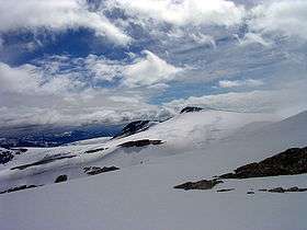 Seen from north, under Veslekåpa | |
| Highest point | |
| Elevation | 2,018 m (6,621 ft) |
| Prominence | 300 m (980 ft) |
| Coordinates | 61°45′52″N 7°11′39″E / 61.76444°N 7.19417°ECoordinates: 61°45′52″N 7°11′39″E / 61.76444°N 7.19417°E |
| Geography | |
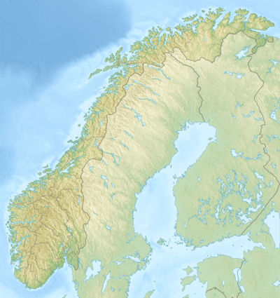 Brenibba Norway | |
| Location | Luster, Sogn og Fjordane, Norway |
| Parent range | Breheimen |
| Topo map | 1418 IV Lodalskåpa |
Brenibba is a nunatak protruding from the north end of the Jostedalsbreen glacier in the Breheimen mountain range. It is located in the municipality of Luster in Sogn og Fjordane county, Norway. Brenibba is 2.5 kilometres (1.6 mi) south of Lodalskåpa and 12 kilometres (7.5 mi) northeast of Høgste Breakulen. It is part of the Jostedalsbreen National Park. The lakes Austdalsvatnet and Styggevatnet are located 11 kilometres (6.8 mi) west of Brenibba.[1]
Name
The first element is bre which means "glacier" and the last element is the finite form of nibbe which means "mountain peak".
References
- ↑ "Brenibba". Scandinavian Mountains. Retrieved 2010-09-09.
This article is issued from Wikipedia - version of the 8/18/2015. The text is available under the Creative Commons Attribution/Share Alike but additional terms may apply for the media files.