Brighstone Down
| Brighstone Down | |
|---|---|
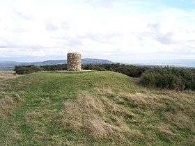 Toposcope on the summit | |
| Highest point | |
| Elevation | 214 m (702 ft) |
| Prominence | c. 150 m |
| Parent peak | St Boniface Down |
| Listing | Marilyn |
| Geography | |
| Location | Isle of Wight, England |
| OS grid | SZ432847 |
| Topo map | OS Landranger 196 |
Brighstone Down is a chalk down on the Isle of Wight. It is located close to the village of Brighstone, in the southwest of the island (the Back of the Wight), and rises to 214 metres (702 ft) at its highest point,[1] northeast of the village of Mottistone. Towards the west part is called Mottistone Down, to the East, Shorwell Down.
The Northern part is covered by Brighstone Forest the largest forest on the Island. [2]
Isle of Wight Portal | |
| Unitary authorities | |
| Major settlements | |
| Rivers | |
| Topics | |
Coordinates: 50°39′37″N 1°23′25″W / 50.66038°N 1.39018°W
Notes
- ↑ "Brighstone Down". Peakery. Retrieved 8 August 2015.
- ↑ http://www.iwpaths.co.uk/sota/actual_sota_brighstone_down.php[]
This article is issued from Wikipedia - version of the 11/8/2016. The text is available under the Creative Commons Attribution/Share Alike but additional terms may apply for the media files.