Brinsmade, North Dakota
| Brinsmade, North Dakota | |
|---|---|
| City | |
|
Sign in Brinsmade | |
 Location of Brinsmade, North Dakota | |
| Coordinates: 48°11′0″N 99°19′22″W / 48.18333°N 99.32278°WCoordinates: 48°11′0″N 99°19′22″W / 48.18333°N 99.32278°W | |
| Country | United States |
| State | North Dakota |
| County | Benson |
| Area[1] | |
| • Total | 0.23 sq mi (0.60 km2) |
| • Land | 0.23 sq mi (0.60 km2) |
| • Water | 0 sq mi (0 km2) |
| Elevation | 1,562 ft (476 m) |
| Population (2010)[2] | |
| • Total | 35 |
| • Estimate (2014)[3] | 35 |
| • Density | 152.2/sq mi (58.8/km2) |
| Time zone | Central (CST) (UTC-6) |
| • Summer (DST) | CDT (UTC-5) |
| ZIP code | 58351 |
| Area code(s) | 701 |
| FIPS code | 38-09460 |
| GNIS feature ID | 1028134[4] |

Brinsmade is a city in Benson County, North Dakota, United States. The population was 35 at the 2010 census.[5] Brinsmade was founded in 1889.
History
Brinsmade was platted on October 7, 1889, when a Northern Pacific Railway branch line was extended from Minnewaukan to Leeds. The village was incorporated April 4, 1904.[6] The city was named in honor of one Reverend S. Brinsmade.[7]
Geography
Brinsmade is located at 48°11′0″N 99°19′22″W / 48.18333°N 99.32278°W.[8]
According to the United States Census Bureau, the city has a total area of 0.23 square miles (0.60 km2), all of it land.[1]
Demographics
| Historical population | |||
|---|---|---|---|
| Census | Pop. | %± | |
| 1910 | 203 | — | |
| 1920 | 191 | −5.9% | |
| 1930 | 199 | 4.2% | |
| 1940 | 206 | 3.5% | |
| 1950 | 136 | −34.0% | |
| 1960 | 110 | −19.1% | |
| 1970 | 36 | −67.3% | |
| 1980 | 54 | 50.0% | |
| 1990 | 21 | −61.1% | |
| 2000 | 29 | 38.1% | |
| 2010 | 35 | 20.7% | |
| Est. 2015 | 35 | [9] | 0.0% |
| U.S. Decennial Census[10] 2014 Estimate[3] | |||
2010 census
As of the census[2] of 2010, there were 35 people, 13 households, and 8 families residing in the city. The population density was 152.2 inhabitants per square mile (58.8/km2). There were 20 housing units at an average density of 87.0 per square mile (33.6/km2). The racial makeup of the city was 100.0% White.
There were 13 households of which 46.2% had children under the age of 18 living with them, 38.5% were married couples living together, 15.4% had a female householder with no husband present, 7.7% had a male householder with no wife present, and 38.5% were non-families. 23.1% of all households were made up of individuals and 7.7% had someone living alone who was 65 years of age or older. The average household size was 2.69 and the average family size was 2.50.
The median age in the city was 33.3 years. 40% of residents were under the age of 18; 0.0% were between the ages of 18 and 24; 31.5% were from 25 to 44; 25.7% were from 45 to 64; and 2.9% were 65 years of age or older. The gender makeup of the city was 42.9% male and 57.1% female.
2000 census
At the 2000 census, there were 29 people, 14 households and 9 families residing in the city. The population density was 129.4 per square mile (50.9/km²). There were 24 housing units at an average density of 107.1 per square mile (42.1/km²). The racial makeup of the city was 100.00% White.
There were 14 households of which 21.4% had children under the age of 18 living with them, 64.3% were married couples living together, and 35.7% were non-families. 35.7% of all households were made up of individuals and none had someone living alone who was 65 years of age or older. The average household size was 2.07 and the average family size was 2.67.
17.2% of the population were under the age of 18, 3.4% from 18 to 24, 37.9% from 25 to 44, 20.7% from 45 to 64, and 20.7% who were 65 years of age or older. The median age was 40 years. For every 100 females there were 93.3 males. For every 100 females age 18 and over, there were 118.2 males.
The median household income was $30,500 and the median family income was $30,625. Males had a median income of $21,250 versus $11,250 for females. The per capita income for the city was $14,100. None of the population and none of the families were below the poverty line.
References
- 1 2 "US Gazetteer files 2010". United States Census Bureau. Archived from the original on 2012-01-24. Retrieved 2012-06-14.
- 1 2 "American FactFinder". United States Census Bureau. Retrieved 2012-06-14.
- 1 2 "Population Estimates". United States Census Bureau. Retrieved July 8, 2015.
- ↑ "US Board on Geographic Names". United States Geological Survey. 2007-10-25. Retrieved 2008-01-31.
- ↑ "2010 Census Redistricting Data (Public Law 94-171) Summary File". American FactFinder. United States Census Bureau. Archived from the original on 21 July 2011. Retrieved 2 May 2011.
- ↑ Brinsmade Star. 1915 Benson County North Dakota Genealogy
- ↑ Federal Writers' Project (1938). North Dakota, a Guide to the Northern Prairie State. WPA. p. 204. ISBN 978-1-62376-033-5.
- ↑ "US Gazetteer files: 2010, 2000, and 1990". United States Census Bureau. 2011-02-12. Retrieved 2011-04-23.
- ↑ "Annual Estimates of the Resident Population for Incorporated Places: April 1, 2010 to July 1, 2015". Retrieved July 2, 2016.
- ↑ United States Census Bureau. "Census of Population and Housing". Archived from the original on May 11, 2015. Retrieved June 17, 2014.
External links
Municipalities and communities of Benson County, North Dakota, United States | ||
|---|---|---|
| Cities | 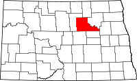 | |
| Townships |
| |
| CDP | ||
| Unincorporated communities | ||