Brown Township, Carroll County, Ohio
| Brown Township, Carroll County, Ohio | |
|---|---|
| Township | |
|
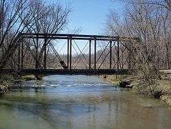
W&LE rail bridge over Sandy Creek in Oneida | |
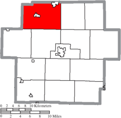 Location of Brown Township in Carroll County | |
| Coordinates: 40°41′47″N 81°9′12″W / 40.69639°N 81.15333°WCoordinates: 40°41′47″N 81°9′12″W / 40.69639°N 81.15333°W | |
| Country | United States |
| State | Ohio |
| County | Carroll |
| Area | |
| • Total | 42.8 sq mi (110.9 km2) |
| • Land | 42.0 sq mi (108.8 km2) |
| • Water | 0.8 sq mi (2.1 km2) |
| Elevation[1] | 1,004 ft (306 m) |
| Population (2010) | |
| • Total | 7,935 |
| • Density | 189/sq mi (72.9/km2) |
| Time zone | Eastern (EST) (UTC-5) |
| • Summer (DST) | EDT (UTC-4) |
| FIPS code | 39-09400[2] |
| GNIS feature ID | 1085825[1] |
| Website |
www |
Brown Township is one of the fourteen townships of Carroll County, Ohio, United States. As of the 2010 census the township had a population of 7,935.[3]
Geography
Located in the northwestern corner of the county, it borders the following townships:
- Paris Township, Stark County - north
- West Township, Columbiana County - northeast corner
- Augusta Township - east
- Washington Township - southeast corner
- Harrison Township - south
- Rose Township - southwest
- Sandy Township, Stark County - west
- Osnaburg Township, Stark County - northwest
Two incorporated villages are located in Brown Township: Malvern in the center, and part of Minerva in the northeast. The unincorporated community of Lake Mohawk, a census-designated place, is in the southwest part of the township.
Ohio State Route 43 passes through the township, leading west then north from Malvern 16 miles (26 km) to the center of Canton and southeast 10 miles (16 km) to Carrollton, the county seat. Ohio State Route 183 leads northeast from OH 43 4 miles (6 km) to Minerva.
Malvern and Minerva are in the valley of Sandy Creek, a west-flowing tributary of the Tuscarawas River, part of the Ohio River watershed.
Name and history
It is one of eight Brown Townships statewide.[4]
This township was named for John Brown, who then resided at Pekin, and who built the first mill in that part of Carroll County. Brown Township was made an independent township in 1815 while a part of Stark County. [5] With the formation of Carroll County in 1833, two miles off the east side of Sandy Township were annexed to the west side of Brown Township, creating an eight mile wide township.[6]
Government
| Historical population | |||
|---|---|---|---|
| Census | Pop. | %± | |
| 1820 | 365 | — | |
| 1830 | 906 | 148.2% | |
| 1840 | 2,165 | 139.0% | |
| 1850 | 2,099 | −3.0% | |
| 1860 | 2,022 | −3.7% | |
| 1870 | 2,022 | 0.0% | |
| 1880 | 2,305 | 14.0% | |
| 1890 | 2,665 | 15.6% | |
| 1900 | 2,599 | −2.5% | |
| 1910 | 2,655 | 2.2% | |
| 1920 | 3,629 | 36.7% | |
| 1930 | 4,141 | 14.1% | |
| 1940 | 4,301 | 3.9% | |
| 1950 | 4,974 | 15.6% | |
| 1960 | 5,267 | 5.9% | |
| 1970 | 5,662 | 7.5% | |
| 1980 | 7,568 | 33.7% | |
| 1990 | 7,958 | 5.2% | |
| 2000 | 8,300 | 4.3% | |
| 2010 | 7,935 | −4.4% | |
| [7] | |||
The township is governed by a three-member board of trustees, who are elected in November of odd-numbered years to a four-year term beginning on the following January 1. Two are elected in the year after the presidential election and one is elected in the year before it. There is also an elected township fiscal officer,[8] who serves a four-year term beginning on April 1 of the year after the election, which is held in November of the year before the presidential election. Vacancies in the fiscal officership or on the board of trustees are filled by the remaining trustees.
Education
Students attend the Minerva Local School District in the eastern part and Brown Local School District in the center and west part.[9]
References
- 1 2 "US Board on Geographic Names". United States Geological Survey. 2007-10-25. Retrieved 2008-01-31.
- ↑ "American FactFinder". United States Census Bureau. Archived from the original on 2013-09-11. Retrieved 2008-01-31.
- ↑ "Geographic Identifiers: 2010 Demographic Profile Data (G001): Brown township, Carroll County, Ohio". U.S. Census Bureau, American Factfinder. Retrieved January 7, 2015.
- ↑ "Detailed map of Ohio" (PDF). United States Census Bureau. 2000. Retrieved 2007-02-16.
- ↑ Eckley, H.J.; Perry, W.T. (1921). History of Carroll and Harrison Counties. The Lewis Publishing Co. p. 169.
- ↑ Perrin, William Henry, ed. (1881). History of Stark County, with an outline sketch of Ohio. Chicago: Baskin and Battey. p. 469. OCLC 23276454.
- ↑ census data: 1820 : 1820 page 137 , 1830 : Kilbourn, John (1831). The Ohio gazetteer: or, Topographical dictionary: describing the several ... in the State of Ohio. self. p. 332. , 1840, 1880 : Howe, Henry (1907). Historical Collections of Ohio, The Ohio Centennial Edition. The State of Ohio. p. 359. , 1850 : 1850 page 14 , 1860 : 1860 page 12 , 1870 : 1870 page 24 , 1890,1900 : Hunt, William C. (1901). Population of the United States by states and territories, counties, and minor Civil Divisions, as returned at the Twelfth Census: 1900. United States Census Printing Office. p. 306. , 1900,1910,1920 : Austin, William Lane; Teele, Ray Palmer (1921). Fourteenth census of the United States, Volume 1. Government Printing Office. p. 561. , 1930 : 1930 page 40 , 1940 : 1940 page 83 , 1950 : 1950 page 14 , 1960 : 1960 page 16 , 1970 : 1970 page 124 , 1980 : 1980 & 1990 Census Information, at reference desk, Carroll County District Library , 1990 : 1990 , 2000 : 2000, 2010 :
- ↑ §503.24, §505.01, and §507.01 of the Ohio Revised Code. Accessed 4/30/2009.
- ↑ PUC Ohio map of School Districts
External links
Municipalities and communities of Carroll County, Ohio, United States | ||
|---|---|---|
| Villages | 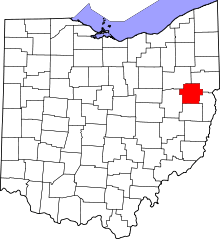 | |
| Townships | ||
| CDP | ||
| Unincorporated communities | ||
| Footnotes | ‡This populated place also has portions in an adjacent county or counties | |