Buckley, Michigan
| Buckley, Michigan | |
|---|---|
| Village | |
 Location of Buckley within Wexford County, Michigan | |
| Coordinates: 44°30′12″N 85°40′18″W / 44.50333°N 85.67167°WCoordinates: 44°30′12″N 85°40′18″W / 44.50333°N 85.67167°W | |
| Country | United States |
| State | Michigan |
| County | Wexford |
| Area[1] | |
| • Total | 1.84 sq mi (4.77 km2) |
| • Land | 1.78 sq mi (4.61 km2) |
| • Water | 0.06 sq mi (0.16 km2) |
| Elevation | 1,050 ft (320 m) |
| Population (2010)[2] | |
| • Total | 697 |
| • Estimate (2012[3]) | 696 |
| • Density | 391.6/sq mi (151.2/km2) |
| Time zone | Eastern (EST) (UTC-5) |
| • Summer (DST) | EDT (UTC-4) |
| ZIP code | 49620 |
| Area code(s) | 231 |
| FIPS code | 26-11480[4] |
| GNIS feature ID | 2397486[5] |
Buckley is a village in Wexford County in the U.S. state of Michigan. The population was 697 at the 2010 census. The village is located in the northwest part of Hanover Township on M-37. It was established in 1905. The Buckley post office first opened March 31, 1906.[6]
Geography
According to the United States Census Bureau, the village has a total area of 1.84 square miles (4.77 km2), of which 1.78 square miles (4.61 km2) is land and 0.06 square miles (0.16 km2) is water.[1]
Demographics
| Historical population | |||
|---|---|---|---|
| Census | Pop. | %± | |
| 1910 | 464 | — | |
| 1920 | 352 | −24.1% | |
| 1930 | 236 | −33.0% | |
| 1940 | 217 | −8.1% | |
| 1950 | 194 | −10.6% | |
| 1960 | 247 | 27.3% | |
| 1970 | 244 | −1.2% | |
| 1980 | 357 | 46.3% | |
| 1990 | 402 | 12.6% | |
| 2000 | 550 | 36.8% | |
| 2010 | 697 | 26.7% | |
| Est. 2015 | 705 | [7] | 1.1% |
2010 census
As of the census[2] of 2010, there were 697 people, 246 households, and 175 families residing in the village. The population density was 391.6 inhabitants per square mile (151.2/km2). There were 300 housing units at an average density of 168.5 per square mile (65.1/km2). The racial makeup of the village was 95.3% White, 0.7% African American, 0.9% Native American, 0.1% Asian, 0.9% Pacific Islander, 0.1% from other races, and 2.0% from two or more races. Hispanic or Latino of any race were 2.0% of the population.
There were 246 households of which 42.7% had children under the age of 18 living with them, 51.6% were married couples living together, 16.7% had a female householder with no husband present, 2.8% had a male householder with no wife present, and 28.9% were non-families. 20.3% of all households were made up of individuals and 3.6% had someone living alone who was 65 years of age or older. The average household size was 2.83 and the average family size was 3.23.
The median age in the village was 30.2 years. 31.3% of residents were under the age of 18; 8% were between the ages of 18 and 24; 32% were from 25 to 44; 21.4% were from 45 to 64; and 7.2% were 65 years of age or older. The gender makeup of the village was 50.2% male and 49.8% female.
2000 census
As of the census[4] of 2000, there were 550 people, 185 households, and 145 families residing in the village. The population density was 309.4 per square mile (119.3/km²). There were 212 housing units at an average density of 119.3 per square mile (46.0/km²). The racial makeup of the village was 93.64% White, 0.73% African American, 2.36% Native American, 0.36% Asian, 1.27% from other races, and 1.64% from two or more races. Hispanic or Latino of any race were 3.64% of the population.
There were 185 households out of which 42.7% had children under the age of 18 living with them, 61.1% were married couples living together, 12.4% had a female householder with no husband present, and 21.1% were non-families. 13.0% of all households were made up of individuals and 4.9% had someone living alone who was 65 years of age or older. The average household size was 2.94 and the average family size was 3.18.
In the village the population was spread out with 31.5% under the age of 18, 10.0% from 18 to 24, 31.5% from 25 to 44, 18.9% from 45 to 64, and 8.2% who were 65 years of age or older. The median age was 31 years. For every 100 females there were 91.0 males. For every 100 females age 18 and over, there were 94.3 males.
The median income for a household in the village was $36,667, and the median income for a family was $37,212. Males had a median income of $28,750 versus $19,167 for females. The per capita income for the village was $14,258. About 5.2% of families and 7.3% of the population were below the poverty line, including 4.7% of those under age 18 and 13.6% of those age 65 or over.
References
- 1 2 "US Gazetteer files 2010". United States Census Bureau. Archived from the original on 2012-07-14. Retrieved 2012-11-25.
- 1 2 "American FactFinder". United States Census Bureau. Retrieved 2012-11-25.
- ↑ "Population Estimates". United States Census Bureau. Archived from the original on 2013-06-17. Retrieved 2013-06-03.
- 1 2 "American FactFinder". United States Census Bureau. Archived from the original on 2013-09-11. Retrieved 2008-01-31.
- ↑ U.S. Geological Survey Geographic Names Information System: Buckley, Michigan
- ↑ U.S. Geological Survey Geographic Names Information System: Buckley Post Office
- ↑ "Annual Estimates of the Resident Population for Incorporated Places: April 1, 2010 to July 1, 2015". Retrieved July 2, 2016.
- ↑ "Census of Population and Housing". Census.gov. Archived from the original on May 11, 2015. Retrieved June 4, 2015.
Municipalities and communities of Wexford County, Michigan, United States | ||
|---|---|---|
| Cities | 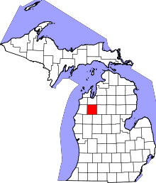 | |
| Villages | ||
| Charter township | ||
| General law townships | ||
| CDPs | ||
| Other unincorporated communities | ||