Burgess, Missouri
| Burgess, Missouri | |
|---|---|
| Village | |
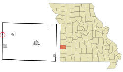 Location of Burgess, Missouri | |
| Coordinates: 37°33′21″N 94°36′57″W / 37.55583°N 94.61583°WCoordinates: 37°33′21″N 94°36′57″W / 37.55583°N 94.61583°W | |
| Country | United States |
| State | Missouri |
| County | Barton |
| Area[1] | |
| • Total | 0.07 sq mi (0.18 km2) |
| • Land | 0.07 sq mi (0.18 km2) |
| • Water | 0 sq mi (0 km2) |
| Elevation | 892 ft (272 m) |
| Population (2010)[2] | |
| • Total | 57 |
| • Estimate (2012[3]) | 57 |
| • Density | 814.3/sq mi (314.4/km2) |
| Time zone | Central (CST) (UTC-6) |
| • Summer (DST) | CDT (UTC-5) |
| FIPS code | 29-09802[4] |
| GNIS feature ID | 0715070[5] |
Burgess is a village in Barton County, Missouri, United States. The population was 57 at the 2010 census.
History
The village was named after a businessperson in the mining industry.[6]
Geography
Burgess is located at 37°33′21″N 94°36′57″W / 37.55583°N 94.61583°W (37.555890, -94.615703).[7]
According to the United States Census Bureau, the village has a total area of 0.07 square miles (0.18 km2), all of it land.[1] Burgess is located adjacent to Mulberry, Kansas just across the state line. The only paved roads into Burgess are through Kansas.
Demographics
| Historical population | |||
|---|---|---|---|
| Census | Pop. | %± | |
| 1910 | 249 | — | |
| 1920 | 364 | 46.2% | |
| 1930 | 212 | −41.8% | |
| 1940 | 164 | −22.6% | |
| 1950 | 123 | −25.0% | |
| 1960 | 86 | −30.1% | |
| 1970 | 69 | −19.8% | |
| 1980 | 98 | 42.0% | |
| 1990 | 97 | −1.0% | |
| 2000 | 70 | −27.8% | |
| 2010 | 57 | −18.6% | |
| Est. 2015 | 55 | [8] | −3.5% |
2010 census
As of the census[2] of 2010, there were 57 people, 24 households, and 15 families residing in the village. The population density was 814.3 inhabitants per square mile (314.4/km2). There were 34 housing units at an average density of 485.7 per square mile (187.5/km2). The racial makeup of the village was 98.2% White and 1.8% from two or more races. Hispanic or Latino of any race were 5.3% of the population.
There were 24 households of which 33.3% had children under the age of 18 living with them, 54.2% were married couples living together, 8.3% had a male householder with no wife present, and 37.5% were non-families. 33.3% of all households were made up of individuals and 8.3% had someone living alone who was 65 years of age or older. The average household size was 2.38 and the average family size was 3.13.
The median age in the village was 31.8 years. 24.6% of residents were under the age of 18; 10.5% were between the ages of 18 and 24; 22.9% were from 25 to 44; 28.1% were from 45 to 64; and 14% were 65 years of age or older. The gender makeup of the village was 54.4% male and 45.6% female.
2000 census
As of the census[4] of 2000, there were 70 people, 25 households, and 18 families residing in the town. The population density was 932.2 people per square mile (337.8/km²). There were 33 housing units at an average density of 439.5 per square mile (159.3/km²). The racial makeup of the town was 98.57% White and 1.43% Native American.
There were 25 households out of which 48.0% had children under the age of 18 living with them, 64.0% were married couples living together, 8.0% had a female householder with no husband present, and 28.0% were non-families. 20.0% of all households were made up of individuals and 8.0% had someone living alone who was 65 years of age or older. The average household size was 2.80 and the average family size was 3.39.
In the town the population was spread out with 28.6% under the age of 18, 10.0% from 18 to 24, 28.6% from 25 to 44, 20.0% from 45 to 64, and 12.9% who were 65 years of age or older. The median age was 36 years. For every 100 females there were 118.8 males. For every 100 females age 18 and over, there were 108.3 males.
The median income for a household in the town was $19,375, and the median income for a family was $21,250. Males had a median income of $13,750 versus $8,750 for females. The per capita income for the town was $7,409. There were 20.0% of families and 17.4% of the population living below the poverty line, including 15.8% of under eighteens and none of those over 64.
References
- 1 2 "US Gazetteer files 2010". United States Census Bureau. Archived from the original on 2012-01-24. Retrieved 2012-07-08.
- 1 2 "American FactFinder". United States Census Bureau. Retrieved 2012-07-08.
- ↑ "Population Estimates". United States Census Bureau. Archived from the original on 2013-06-17. Retrieved 2013-05-30.
- 1 2 "American FactFinder". United States Census Bureau. Archived from the original on 2013-09-11. Retrieved 2008-01-31.
- ↑ "US Board on Geographic Names". United States Geological Survey. 2007-10-25. Retrieved 2008-01-31.
- ↑ "Barton County Place Names, 1928-1945 (archived)". The State Historical Society of Missouri. Archived from the original on 24 June 2016. Retrieved 31 August 2016.
- ↑ "US Gazetteer files: 2010, 2000, and 1990". United States Census Bureau. 2011-02-12. Retrieved 2011-04-23.
- ↑ "Annual Estimates of the Resident Population for Incorporated Places: April 1, 2010 to July 1, 2015". Retrieved July 2, 2016.
- ↑ "Census of Population and Housing". Census.gov. Archived from the original on May 11, 2015. Retrieved June 4, 2015.
Municipalities and communities of Barton County, Missouri, United States | ||
|---|---|---|
| Cities | 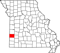 | |
| Villages | ||
| Townships | ||
| CDP | ||
| Other unincorporated communities | ||
| Ghost towns | ||