Burlingame, Kansas
| Burlingame, Kansas | |
|---|---|
| City | |
|
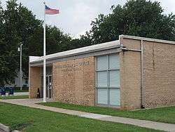
U.S. post office in Burlingame (2009) | |
 Location within Osage County and Kansas | |
 KDOT map of Osage County (legend) | |
| Coordinates: 38°45′3″N 95°50′9″W / 38.75083°N 95.83583°WCoordinates: 38°45′3″N 95°50′9″W / 38.75083°N 95.83583°W[1] | |
| Country | United States |
| State | Kansas |
| County | Osage |
| Government | |
| • Type | Mayor–Council |
| • Mayor | Ray Hovestadt[2] |
| • City Clerk | Patti Gilbert[2] |
| Area[3] | |
| • Total | 0.89 sq mi (2.31 km2) |
| • Land | 0.89 sq mi (2.31 km2) |
| • Water | 0 sq mi (0 km2) |
| Elevation | 1,073 ft (327 m) |
| Population (2010)[4] | |
| • Total | 934 |
| • Estimate (2012[5]) | 916 |
| • Density | 1,000/sq mi (400/km2) |
| Time zone | Central (CST) (UTC-6) |
| • Summer (DST) | CDT (UTC-5) |
| ZIP code | 66413 |
| Area code | 785 |
| FIPS code | 20-09350 [6] |
| GNIS feature ID | 0479434 [7] |
| Website | burlingameks.com |
Burlingame is a city in Osage County, Kansas, United States. As of the 2010 census, the city population was 934.[8]
History

Burlingame was originally established as Council City and was an important stop on the Santa Fe Trail. The Council City post office was opened on April 30, 1855.[9] The wide brick main street, Santa Fe Avenue, was built wide enough for an oxen team to be able to make a U-turn. The city and post office name was changed from Council City to Burlingame on January 30, 1858, in honor of Anson Burlingame.[10]
During the Civil War the townspeople constructed a stone fort in the town center. Burlingame's Fort was torn down after the war.
Geography
Burlingame is located on U.S. Route 56, about 20 miles (32 km) south of Topeka. According to the United States Census Bureau, the city has a total area of 0.89 square miles (2.31 km2), all of it land.[3]
Climate
The climate in this area is characterized by hot, humid summers and generally mild to cool winters. According to the Köppen Climate Classification system, Burlingame has a humid subtropical climate, abbreviated "Cfa" on climate maps.[11]
Demographics
| Historical population | |||
|---|---|---|---|
| Census | Pop. | %± | |
| 1870 | 655 | — | |
| 1880 | 1,370 | 109.2% | |
| 1890 | 1,472 | 7.4% | |
| 1900 | 1,436 | −2.4% | |
| 1910 | 1,422 | −1.0% | |
| 1920 | 1,330 | −6.5% | |
| 1930 | 1,127 | −15.3% | |
| 1940 | 1,019 | −9.6% | |
| 1950 | 1,065 | 4.5% | |
| 1960 | 1,151 | 8.1% | |
| 1970 | 999 | −13.2% | |
| 1980 | 1,239 | 24.0% | |
| 1990 | 1,074 | −13.3% | |
| 2000 | 1,017 | −5.3% | |
| 2010 | 934 | −8.2% | |
| Est. 2015 | 892 | [12] | −4.5% |
| U.S. Decennial Census | |||
Burlingame is part of the Topeka, Kansas Metropolitan Statistical Area.
2010 census
As of the census[4] of 2010, there were 934 people, 404 households, and 250 families residing in the city. The population density was 1,049.4 inhabitants per square mile (405.2/km2). There were 501 housing units at an average density of 562.9 per square mile (217.3/km2). The racial makeup of the city was 97.1% White, 0.1% African American, 0.4% Native American, 0.5% from other races, and 1.8% from two or more races. Hispanic or Latino of any race were 1.1% of the population.
There were 404 households of which 32.9% had children under the age of 18 living with them, 43.1% were married couples living together, 11.6% had a female householder with no husband present, 7.2% had a male householder with no wife present, and 38.1% were non-families. 32.7% of all households were made up of individuals and 14.8% had someone living alone who was 65 years of age or older. The average household size was 2.31 and the average family size was 2.90.
The median age in the city was 36.9 years. 27.7% of residents were under the age of 18; 7.6% were between the ages of 18 and 24; 23.9% were from 25 to 44; 25.3% were from 45 to 64; and 15.5% were 65 years of age or older. The gender makeup of the city was 47.2% male and 52.8% female.
2000 census
As of the census[6] of 2000, there were 1,017 people, 428 households, and 267 families residing in the city. The population density was 1,150.1 people per square mile (446.2/km²). There were 481 housing units at an average density of 543.9 per square mile (211.0/km²). The racial makeup of the city was 98.43% White, 0.29% African American, 0.10% Native American, 0.49% from other races, and 0.69% from two or more races. Hispanic or Latino of any race were 0.59% of the population.
There were 428 households out of which 26.4% had children under the age of 18 living with them, 50.7% were married couples living together, 7.7% had a female householder with no husband present, and 37.6% were non-families. 34.3% of all households were made up of individuals and 21.5% had someone living alone who was 65 years of age or older. The average household size was 2.31 and the average family size was 2.94.
In the city the population was spread out with 23.5% under the age of 18, 6.9% from 18 to 24, 24.0% from 25 to 44, 23.1% from 45 to 64, and 22.5% who were 65 years of age or older. The median age was 42 years. For every 100 females there were 87.3 males. For every 100 females age 18 and over, there were 85.7 males.
The median income for a household in the city was $31,845, and the median income for a family was $42,500. Males had a median income of $26,711 versus $24,250 for females. The per capita income for the city was $17,465. About 3.8% of families and 7.6% of the population were below the poverty line, including 9.9% of those under age 18 and 13.2% of those age 65 or over.
Government
The Burlingame government consists of a mayor and five council members. The council meets the 1st and 3rd Monday of each month at 7PM.[2]
- City Hall, 101 E Santa Fe Ave.
Education
Burlingame Public Schools (USD 454) operates a high school, junior high, and elementary school. Allen Community College has maintained a campus in Burlingame since 1991.
Notable people
- Maurice Mehl (1887-1966), paleontologist, was born in Burlingame, Kansas
- Victor Murdock, U.S. Representative from Kansas
- Kenny Starr, Country and Western singer
- Earl Sutherland, Jr., winner of the 1971 Nobel Prize in physiology and medicine.
- Ron Thornburgh, former Kansas Secretary of State (1994-2010).
References
- ↑ "US Gazetteer files: 2010, 2000, and 1990". United States Census Bureau. 2011-02-12. Retrieved 2011-04-23.
- 1 2 3 Burlingame - Directory of Public Officials Archived May 5, 2011, at the Wayback Machine.
- 1 2 "US Gazetteer files 2010". United States Census Bureau. Archived from the original on 2012-01-24. Retrieved 2012-07-06.
- 1 2 "American FactFinder". United States Census Bureau. Retrieved 2012-07-06.
- ↑ "Population Estimates". United States Census Bureau. Archived from the original on 2013-06-17. Retrieved 2013-05-29.
- 1 2 "American FactFinder". United States Census Bureau. Archived from the original on 2013-09-11. Retrieved 2008-01-31.
- ↑ "US Board on Geographic Names". United States Geological Survey. 2007-10-25. Retrieved 2008-01-31.
- ↑ "2010 City Population and Housing Occupancy Status". U.S. Census Bureau. Archived from the original on July 21, 2011. Retrieved April 6, 2011.
- ↑ "Kansas Post Offices Database", The Kansas Historical Society
- ↑ Blackmar, Frank Wilson (1912). Kansas: A Cyclopedia of State History, Embracing Events, Institutions, Industries, Counties, Cities, Towns, Prominent Persons, Etc. Standard Publishing Company. p. 255.
- ↑ Climate Summary for Burlingame, Kansas
- ↑ "Annual Estimates of the Resident Population for Incorporated Places: April 1, 2010 to July 1, 2015". Retrieved July 2, 2016.
External links
| Wikimedia Commons has media related to Burlingame, Kansas. |
- City
- Schools
- USD 454, local school district
- Newspaper
- Historical
- Maps
- Burlingame City Map, KDOT
Municipalities and communities of Osage County, Kansas, United States | ||
|---|---|---|
| Cities | 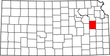 | |
| CDP | ||
| Unincorporated communities | ||
| Townships |
| |