Burnham-on-Sea Low lighthouse
 Burnham-on-Sea Low Lighthouse | |
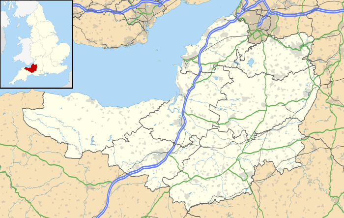 Somerset | |
| Location |
Burnham-on-Sea Somerset England |
|---|---|
| Coordinates | 51°14′54″N 3°00′21″W / 51.248387°N 3.005822°WCoordinates: 51°14′54″N 3°00′21″W / 51.248387°N 3.005822°W |
| Year first constructed | 1832 |
| Deactivated | 1969-1996 |
| Construction | wooden tower |
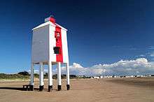
| Tower shape | square tower on nine pilings |
| Markings / pattern | white tower with a red vertical stripe on seaward side |
| Height | 9 metres (30 ft) |
| Focal height |
7 metres (23 ft) 4 metres (13 ft) (directional light) |
| Range |
white 12 nautical miles (22 km; 14 mi) red, green: 10 nautical miles (19 km; 12 mi) |
| Characteristic |
Fl W 7.5s. F WRG (directional light) |
| Fog signal | none |
| Admiralty number | A5570 |
| NGA number | 6172 |
| ARLHS number | ENG-019[1] |
| Managing agent | Sedgemoor District Council[2] |
The Low lighthouse is one of three lighthouses in Burnham-on-Sea, Somerset, England and the only one which is still active. It is a Grade II listed building.[3]
Burnham-on-Sea is notable for its beach and mudflats, which are characteristic of Bridgwater Bay and the rest of the Bristol Channel where the tide can recede for over 1.5 miles (2.4 km). Burnham is close to the estuary of the River Parrett where it flows into the Bristol Channel, which has the second highest tidal range in the world of 15 metres (49 ft),[4] second only to Bay of Fundy in Eastern Canada.[5][6] The constantly shifting sands have always been a significant risk to shipping in the area.
The low wooden pile lighthouse or Lighthouse on legs is 36 feet (11 m) high; the light being at 23 feet (7.0 m) was built by Joseph Nelson in 1832, in conjunction with the High Lighthouse to replace the original Round Tower Lighthouse, which itself had been built to replace the light kept burning in the tower of St Andrews Church to guide fishing boats into the harbour.[7]
It stands on nine wooden piers, some with plate metal reinforcement. The structure is whitewashed with a vertical red stripe on the seaward side.[3][8]
The lights were inactive between 1969 and 1993 and were re-established when the High Lighthouse lights were permanently discontinued. They have a focal plane of 7 metres (23 ft) and provide a white flash every 7.5s plus a directional light (white, red, or green depending on direction) at a focal plane of 4 m.[7] It is operated by Sedgemoor District Council.[9]
References
- ↑ List of Lights - British Isles, English Channel and North Sea. 114. Bethesda: National Geospatial-Intelligence Agency. 2009. p. 97.
- ↑ Burnham-on-Sea Low The Lighthouse Directory. University of North Carolina at Chapel Hill. Retrieved April 28, 2016
- 1 2 "Burnham Low Lighthouse". Images of England. Retrieved 10 December 2006.
- ↑ "Severn Estuary Barrage" (PDF). UK Environment Agency. 7 May 2008. Archived from the original (PDF) on 30 September 2007. Retrieved 3 September 2007.
- ↑ Chan, Marjorie A.; Archer, Allen William (2003). Extreme Depositional Environments: Mega End Members in Geologic Time. Boulder, Colorado: Geological Society of America. p. 151. ISBN 0-8137-2370-1.
- ↑ "Coast: Bristol Channel". BBC. Retrieved 27 August 2007.
- 1 2 "Lighthouses". Burnham on Sea.com. Retrieved 5 April 2010.
- ↑ "Burnham Low Lighthouse on foreshore off Gore Road, Gore Road (West side), Burnham-on-Sea". Somerset Historic Environment Record. Somerset County Council. Retrieved 5 April 2010.
- ↑ Rowlett, Russ. "Lighthouses of Western England". The Lighthouse Directory. University of North Carolina at Chapel Hill. Retrieved 2 January 2015.
| Wikimedia Commons has media related to Burnham Low Lighthouse. |