Cabarita, New South Wales
| Cabarita Sydney, New South Wales | |||||||||||||
|---|---|---|---|---|---|---|---|---|---|---|---|---|---|
 Cape Cabarita | |||||||||||||
| Population | 1,928 (2011 census)[1] | ||||||||||||
| Postcode(s) | 2137 | ||||||||||||
| Location | 16 km (10 mi) west of Sydney CBD | ||||||||||||
| LGA(s) | City of Canada Bay | ||||||||||||
| State electorate(s) | Drummoyne | ||||||||||||
| Federal Division(s) | Reid | ||||||||||||
| |||||||||||||
Cabarita is a suburb in the Inner West[2] of Sydney, in the state of New South Wales, Australia. Cabarita is located 16 kilometres west of the Sydney central business district, in the local government area of the City of Canada Bay.
Cabarita is a picturesque suburb, on the Parramatta River, north of Concord.
History
Cabarita is an Aboriginal word meaning by the water.[3]
David Anderson, a private soldier in the NSW Corps was granted land in this area in 1795. An area of Cabarita Point was reserved for public recreation in 1856. The reserve was expanded in 1880 with the addition of 9.7 hectares of adjoining land, known as Correy's Garden.[3] The pavilion from which Governor-General Lord Hopetoun proclaimed the Federation of Australia in 1901 was later moved from Centennial Park to Cabarita Park.
In the past, the suburb consisted of swampland and heavy industry (only the Bushell's coffee and tea factory/warehouse remains). Housing developments replaced the industry and the swamps were reclaimed to create golf courses. Until 1948, an electric tramway ran down Cabarita Road to connect the suburb with Burwood, Enfield and Ashfield via Cabarita Junction near the corner of Mortlake Street.
Demographics
According to the 2011 census of Population, there were 1,928 residents in Cabarita. In Cabarita, 60.8% of people were born in Australia. The most common countries of birth were China (excludes SARs and Taiwan) 5.2%, Korea, Republic of (South) 4.2% and Italy 2.9%. 62.0% of people only spoke English at home. Other languages spoken at home included Cantonese 5.8%, Korean 5.3% and Italian 4.5%. The most common responses for religion in Cabarita were Catholic 34.4%, No Religion 16.2% and Anglican 15.2%. [1]
Transport
A ferry wharf at Cabarita provides access to the Parramatta River ferry services.
 Federation Pavilion, Cabarita Park
 Federation Pavilion, Cabarita Park
 William Beach monument, Cabarita Park
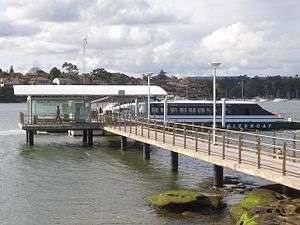 Cabarita wharf and Rivercat ferry
Housing
Cabarita and the adjacent Breakfast Point have many new housing communities along the waterfront, such as Cape Cabarita and Breakfast Point housing villages. These developments feature many recreational facilities such as playing fields, gymnasiums, golf courses and some restaurants. Prince Edward Park sits beside Cape Cabarita.
 Cape Cabarita
 Cape Cabarita wharf
 Prince Edward Park
 Home in Old English style
References
- 1 2 Australian Bureau of Statistics (31 October 2012). "Cabarita (State Suburb)". 2011 Census QuickStats. Retrieved 29 April 2013.
- ↑ Australian Suburb Guide: Sydney Inner West Archived 26 December 2012 at the Wayback Machine. Retrieved 7 August 2013.
- 1 2 Blaxell, Gregory (2007). The River: Sydney Cove to Parramatta. Halstead Press. p. 123. ISBN 9781920831738.
| Wikimedia Commons has media related to Cabarita, New South Wales. |
Coordinates: 33°50′53″S 151°06′53″E / 33.84802°S 151.11485°E