Carrascal, Surigao del Sur
| Carrascal | |
|---|---|
| Municipality | |
 Map of Surigao del Sur with Carrascal highlighted | |
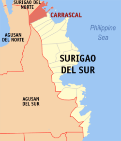
.svg.png) Carrascal Location within the Philippines | |
| Coordinates: 09°22′N 125°56′E / 9.367°N 125.933°ECoordinates: 09°22′N 125°56′E / 9.367°N 125.933°E | |
| Country | Philippines |
| Region | Caraga (Region XIII) |
| Province | Surigao del Sur |
| District | 1st district of Surigao del Sur |
| Barangays | 14 |
| Government[1] | |
| • Mayor-elect | Vicente H. Pimentel III |
| Area[2] | |
| • Total | 265.80 km2 (102.63 sq mi) |
| Population (2010)[3] | |
| • Total | 16,529 |
| • Density | 62/km2 (160/sq mi) |
| Time zone | PST (UTC+8) |
| ZIP code | 8318 |
| Dialing code | +63 (0)86 |
| Income class | 4th |
Carrascal is a fourth class municipality in the province of Surigao del Sur, Philippines. According to the 2010 census, it has a population of 16,529 people.[3]
Unique physical features of Carrascal are the uneven distribution of its lowlands and rolling hills.[4] Carrascal is the boundary town of Surigao del Sur with Surigao del Norte.
Barangays
Carrascal is politically subdivided into 14 barangays.[2] Babuyan, Dahican and Caglayag were converted into a barrio in 1956.[5]
- Adlay
- Babuyan
- Bacolod
- Baybay (Pob.)
- Bon-ot
- Caglayag
- Dahican
- Doyos (Pob.)
- Embarcadero (Pob.)
- Gamuton
- Panikian
- Pantukan
- Saca (Pob.)
- Tag-Anito
Demographics
| Population census of Carrascal | ||
|---|---|---|
| Year | Pop. | ±% p.a. |
| 1990 | 12,693 | — |
| 1995 | 12,018 | −1.02% |
| 2000 | 13,157 | +1.96% |
| 2007 | 14,283 | +1.14% |
| 2010 | 16,529 | +5.46% |
| Source: National Statistics Office[3] | ||
Special areas of economic considerations
The ideal candidate site of proposed wind power projects is located approximately 300 meter masl in the mining area near Carrascal. It is accessible from a highway under perpetual reconstruction and further made accessible by exploration roads constructed by mining companies. The terrain is mostly flat, with minimal vegetation, causing minimal turbulence to wind flow in the area. It overlooks the Philippine Sea from the southeast and the north-west directions. Some permanent deformations of small trees indicate that the wind typically comes from the north-east direction. Ground measurements yielded wind speeds of 8–11 m/s, which, by industry standards has excellent wind power potential. However, further validation studies of at least one year of wind data gathered from the site is nonexistent. Transmission lines of the local cooperative pass through this wind power candidate site, making it more attractive for wind and/ solar energy development to alleviate badly needed energy infrastructure to sustain large scale industrialization and its lofty bid to become the northernmost "city" of Surigao del Sur.[6]
References
- ↑ "Official City/Municipal 2013 Election Results". Intramuros, Manila, Philippines: Commission on Elections (COMELEC). 1 July 2013. Retrieved 5 September 2013.
- 1 2 "Province: SURIGAO DEL SUR". PSGC Interactive. Makati City, Philippines: National Statistical Coordination Board. Archived from the original on 1 January 1970. Retrieved 1 April 2014.
- 1 2 3 "Total Population by Province, City, Municipality and Barangay: as of May 1, 2010" (PDF). 2010 Census of Population and Housing. National Statistics Office. Archived from the original (PDF) on 26 June 2013. Retrieved 1 April 2014.
- ↑ http://www.carrascal.gov.ph/content.php?id=1&sub_id=4
- ↑ "An Act Converting into Barrios Certain Sitios in the Province of Surigao, and Dividing the Barrio of Macalaya into Two Barrios, Municipality of Placer, in the Same Province". LawPH.com. Retrieved 2011-04-12.
- ↑ http://www.wwf.org.uk/filelibrary/pdf/philprojects.pdf
External links
- Philippine Standard Geographic Code
- Philippine Census Information
- Local Governance Performance Management System
- The Municipality of Carrascal, Philippines
- eCarCanMadCarLan Portal
- CarCanMadCarLan Association USA
 |
Claver, Surigao del Norte | | ||
| Claver, Surigao del Norte Jabonga, Agusan del Norte |
|
Philippine Sea | ||
| ||||
| | ||||
| Santiago, Agusan del Norte | Cantilan |
Tandag (capital) | |
| Municipalities | |
| Component cities | |