Castlewood State Park
| Castlewood State Park | |
| Missouri State Park | |
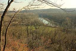 View from bluff of river, meadow, and forest in Castlewood State Park | |
| Country | United States |
|---|---|
| State | Missouri |
| County | St. Louis |
| Elevation | 417 ft (127 m) [1] |
| Coordinates | 38°32′50″N 90°32′38″W / 38.54722°N 90.54389°WCoordinates: 38°32′50″N 90°32′38″W / 38.54722°N 90.54389°W [1] |
| Area | 1,818.3 acres (736 ha) [2] |
| Established | 1974 |
| Management | Missouri Department of Natural Resources |
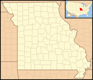 Location in Missouri
| |
| Website: Castlewood State Park | |
The Castlewood State park is located in St. Louis County, Missouri. The 1,818-acre (7.36 km2) park was established in 1974. The most visited section of the park lies on the north side of the Meramec River, but it includes significant acreage on the south side of the river that is accessed from Lone Elk County Park. The south section of the park includes the World Bird Sanctuary.[3]
Activities and amenities
The park offers fishing and boating on the Meramec River plus a variety of trails hiking, mountain biking and equestrian use:
| Trail | Length | Uses | Notes |
|---|---|---|---|
| Cedar Bluff Loop | 2 miles (3.2 km) | Hiking and biking | Accessed from Stinging Nettle Loop |
| Chubb Trail Castlewood Loop | 3 miles (4.8 km) | Hiking, biking, equestrian | Accessed from the Lone Elk County Park trailhead on south side of river. Chubb Trail is a 7-mile (11 km) linear trail between Lone Elk and West Tyson county parks that crosses a portion of Castlewood State Park. |
| Grotpeter Trail | 3 miles (4.8 km) | Hiking, biking, equestrian | |
| Lone Wolf Trail | 1.5 miles (2.4 km) | Biking, hiking | |
| River Scene Trail | 3 miles (4.8 km) | Hiking, biking | Only hiking allowed on the section atop the bluffs; hiking and biking on the bottomland section |
| Stinging Nettle Loop | 3 miles (4.8 km) | Hiking, biking | Trailhead in Sherman Beach County Park |
| Al Foster Trail | Hiking, biking | A cooperative partnership with the Dept. of Natural Resources that when complete will become a segment of the Ozark Trail. Located in the Rock Hollow (western) unit of the park, it will connect to trails in Sherman Beach County Park. |
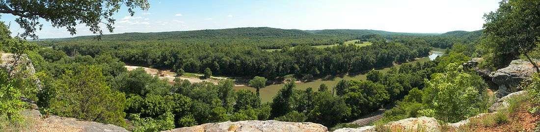
View of the Meramec River valley from Castlwood's bluffs
References
- 1 2 "Castlewood State Park". Geographic Names Information System. United States Geological Survey.
- ↑ "State parks...estimated acres" (PDF). Revised Statewide Comprehensive Outdoor Recreation Plan: 2008-2012. Missouri Department of Natural Resources. pp. 142–143. Retrieved September 9, 2014.
- ↑ "Castlewood State Park". Missouri State Parks. Missouri Department of Natural Resources. Retrieved October 1, 2014.
External links
| Wikimedia Commons has media related to Castlewood State Park. |
- Castlewood State Park Missouri Department of Natural Resources
This article is issued from Wikipedia - version of the 11/9/2015. The text is available under the Creative Commons Attribution/Share Alike but additional terms may apply for the media files.