Towosahgy State Historic Site
| Towosahgy State Historic Site | |
| Missouri State Historic Site | |
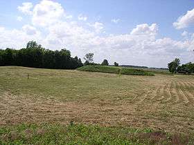 Towosahgy Site main platform mound | |
| Country | United States |
|---|---|
| State | Missouri |
| County | Mississippi |
| Elevation | 299 ft (91 m) [1] |
| Coordinates | 36°41′36″N 89°14′08″W / 36.69333°N 89.23556°WCoordinates: 36°41′36″N 89°14′08″W / 36.69333°N 89.23556°W [1] |
| Area | 64 acres (26 ha) [2] |
| Established | 1967 [3] |
| Management | Missouri Department of Natural Resources |
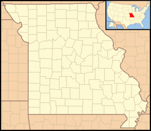 Location in Missouri | |
| Website: Towosahgy State Historic Site | |
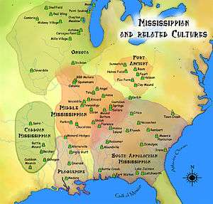
Towosahgy State Historic Site (23MI2), also known as "Beckwith's Fort," is a large Mississippian earthwork mound site with a Woodland period Baytown culture component located in Mississippi County, Missouri. It is believed to have been inhabited from c. 400-1350.[4] The site is maintained by the Missouri Department of Natural Resources as a state historic site. The name Towosahgy is an Osage word which means "old town." It is not known if members of the historic Osage, who dominated a large area of present-day Missouri at the beginning of encounter with European colonizers, occupied the site.[5]
History of Towosahgy
The earliest portion of Towosahgy State Historic Site is in the southern half, where a Late Woodland village once stood. Wilkie dates this component to about 400 to 700.[4]
Later the site was fortified and built up as a Mississippian site with seven earthwork mounds, most surrounding a central plaza. During this time, the site was surrounded by a palisade wall of vertical logs and a moat.[6] Like other Mississippian mound centers, Towosahgy also had a borrow pit, where earth was removed to create the mounds. The largest remaining mound is Mound 2, also known as the "temple mound." Excavations on this part of the site were conducted in 1989 by James Price.[7] The site was abandoned during the late fourteenth century for unknown reasons, as were many similar Mississippian sites in the region.
Ceramics from the site represent typical pottery found in the Missouri Bootheel region. Sherds from the Woodland occupation are typically grog tempered. The later Mississippian pottery is shell tempered. Type varieties identified include Baytown Plain and Mulberry Creek Cordmarked. Mississippian ceramics were also both plain and decorated. Punctuated, incised, fabric impressed, and red, black, and brown painted/slipped sherds, typical decorating methods, are all present.[4][7] A large collection of ceramic vessels from the site are part of the Beckwith Collection displayed at the Rosemary Berkel and Harry L. Crisp II Museum at Southeast Missouri State University.
References
- 1 2 "Towosahgy State Park". Geographic Names Information System. United States Geological Survey.
- ↑ "Missouri State Park Advisory Board Annual Report 2008". Missouri Department of Natural Resources. Retrieved November 4, 2015.
- ↑ "State Park Land Acquisition Summary". Missouri State Parks. Retrieved November 4, 2015.
- 1 2 3 Duncan Wilkie (1988). Field Work at Towosahgy State Historic Site. Cape Girardeau, Mo.: The Center for Regional History and Cultural Heritage, Southeast Missouri State University. OCLC 68738164.
- ↑ "Towosahgy State Historic Site". Missouri State Parks. Missouri Department of Natural Resources. Retrieved September 4, 2014.
- ↑ John W. Cottier and Michael D. Southard (1977). An Introduction to the Archaeology of Towosahgy State Archaeological Site. Missouri Archaeologist. pp. 230–268.
- 1 2 James E. Price and Cynthia R. Price (1990). Archaeological Investigations in Three Areas of the Towosahgy State Historic Site, 23MI2, Mississippi County, Missouri, 1989. Columbia, Mo.: University of Missouri-Columbia. OCLC 68738170.
External links
- Towosahgy State Historic Site Missouri Department of Natural Resources
- Beckwith Collection. Rosemary Berkel and Harry L. Crisp II Museum, Southeast Missouri State University
- The Wilkie Collection, Southeast Missouri State University Special Collections and Archive
| Wikimedia Commons has media related to Towosahgy site. |
| Archaeological cultures |
|
|---|---|
| Archaeological sites |
|
| Human remains | |
| Miscellaneous |
|
| |