Cedar Falls, Iowa
| Cedar Falls, Iowa | |
|---|---|
| City | |
|
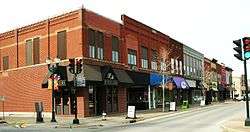
Downtown Main Street, 2010 | |
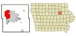 Location of Cedar Falls, Iowa | |
 Cedar Falls, Iowa Location in the United States | |
| Coordinates: 42°31′25″N 92°26′47″W / 42.523520°N 92.446402°WCoordinates: 42°31′25″N 92°26′47″W / 42.523520°N 92.446402°W | |
| Country | United States |
| State | Iowa |
| County | Black Hawk |
| Government | |
| • Mayor | Jim Brown as of 2016 |
| Area[1] | |
| • Total | 29.61 sq mi (76.69 km2) |
| • Land | 28.75 sq mi (74.46 km2) |
| • Water | 0.86 sq mi (2.23 km2) |
| Elevation | 879 ft (268 m) |
| Population (2010)[2] | |
| • Total | 39,260 |
| • Estimate (2013[3]) | 40,566 |
| • Density | 1,365.6/sq mi (527.3/km2) |
| Time zone | Central (CST) (UTC−6) |
| • Summer (DST) | CDT (UTC−5) |
| ZIP code | 50613 |
| Area code(s) | 319 |
| FIPS code | 19-11755 |
| GNIS feature ID | 0455240 |
| Website | City Website |
Cedar Falls is a city in Black Hawk County, Iowa, United States. As of the 2010 census, the city population was 39,260[4][5] and has the smaller population of the two principal cities in the Waterloo-Cedar Falls metropolitan area. It is home to the University of Northern Iowa, a public university.
History
Cedar Falls was founded in 1845 by William Sturgis. It was originally named Sturgis Falls, for the first family who settled the site. The Sturgis family moved on within a few years and the city was renamed Cedar Falls because of its proximity to the Cedar River. However the city's founders are honored each year with a three-day community-wide celebration named in their honor – the Sturgis Falls Celebration.[6]
Because of the availability of water power, Cedar Falls developed as a milling and industrial center prior to the Civil War. The establishment of the Civil War Soldiers' Orphans Home in Cedar Falls changed the direction in which the city developed when, following the war, it became the first building on the campus of the Iowa State Normal School (now the University of Northern Iowa).
Geography
Cedar Falls is located at 42°31′24″N 92°26′45″W / 42.52333°N 92.44583°W (42.523520, −92.446402).[7] According to the United States Census Bureau, the city has a total area of 29.61 square miles (76.69 km2), of which, 28.75 square miles (74.46 km2) is land and 0.86 square miles (2.23 km2) is water.[1]
Natural forest, prairie and wetland areas are found within the city limits at the Hartman Reserve Nature Center.
Demographics
| Historical population | |||
|---|---|---|---|
| Census | Pop. | %± | |
| 1870 | 3,070 | — | |
| 1880 | 3,020 | −1.6% | |
| 1890 | 3,459 | 14.5% | |
| 1900 | 5,319 | 53.8% | |
| 1910 | 5,012 | −5.8% | |
| 1920 | 6,316 | 26.0% | |
| 1930 | 7,362 | 16.6% | |
| 1940 | 9,349 | 27.0% | |
| 1950 | 14,334 | 53.3% | |
| 1960 | 21,195 | 47.9% | |
| 1970 | 29,597 | 39.6% | |
| 1980 | 36,322 | 22.7% | |
| 1990 | 34,298 | −5.6% | |
| 2000 | 36,145 | 5.4% | |
| 2010 | 39,260 | 8.6% | |
| Est. 2015 | 41,255 | [8] | 5.1% |
| U.S. Decennial Census[5] | |||
2010 census
As of the census[2] of 2010, there were 39,260 people, 14,608 households, and 8,091 families residing in the city. The population density was 1,365.6 inhabitants per square mile (527.3/km2). There were 15,477 housing units at an average density of 538.3 per square mile (207.8/km2). The racial makeup of the city was 93.4% White, 2.1% African American, 0.2% Native American, 2.3% Asian, 0.5% from other races, and 1.7% from two or more races. Hispanic or Latino of any race were 2.0% of the population.
There were 14,608 households of which 24.8% had children under the age of 18 living with them, 45.5% were married couples living together, 7.2% had a female householder with no husband present, 2.7% had a male householder with no wife present, and 44.6% were non-families. 28.0% of all households were made up of individuals and 10.4% had someone living alone who was 65 years of age or older. The average household size was 2.37 and the average family size was 2.88.
The median age in the city was 26.8 years. 17.3% of residents were under the age of 18; 29.7% were between the ages of 18 and 24; 20.5% were from 25 to 44; 20.1% were from 45 to 64; and 12.4% were 65 years of age or older. The gender makeup of the city was 48.1% male and 51.9% female.
2000 census
As of the census[9] of 2000, there were 36,145 people, 12,833 households, and 7,558 families residing in the city. The population density was 1,277.2 people per square mile (493.1/km²). There were 13,271 housing units at an average density of 468.9 per square mile (181.1/km²). The racial makeup of the city was 95.14% White, 1.57% Black or African American, 0.15% Native American, 1.61% Asian, 0.02% Pacific Islander, 0.41% from other races, and 1.09% from two or more races. 1.08% of the population were Hispanic or Latino of any race.
There were 12,833 households out of which 26.9% had children under the age of 18 living with them, 48.9% were married couples living together, 7.5% had a female householder with no husband present, and 41.1% were non-families. 25.5% of all households were made up of individuals and 9.4% had someone living alone who was 65 years of age or older. The average household size was 2.45 and the average family size was 2.91.
Age spread: 18.0% under the age of 18, 30.6% from 18 to 24, 20.5% from 25 to 44, 19.0% from 45 to 64, and 11.9% who were 65 years of age or older. The median age was 26 years. For every 100 females there were 88.5 males. For every 100 females age 18 and over, there were 85.7 males.
The median income for a household in the city was $70,226, and the median income for a family was $85,158. Males had a median income of $60,235 versus $50,312 for females. The per capita income for the city was $27,140. About 5.6% of families and 4.7% of the population were below the poverty line, including 8.5% of those under age 18, and 6.1% of those age 65 or over.
Arts and culture
In 1986, the City of Cedar Falls established the Cedar Falls Art and Culture Board,[10] which oversees the operation of the City's Cultural Division and the James & Meryl Hearst Center for the Arts.
Library
The Cedar Falls Public Library is housed in the Adele Whitenach Davis building located at 524 Main Street. The 47,000 square foot (4,400 m²) structure, designed by Struxture Architects, replaced the Carniege-Dayton building in early 2004. As of the 2016 fiscal year, the library's holdings included approximately 8,000 audio materials, 12,000 video materials, and 104,000 books and periodicals for a grand total of approximately 124,000 items. Patrons made 245,000 visits which took advantage of circulation services, adult, teen, and youth programming. Circulation of library materials for fiscal year 2016 was 543,134. The library also provides public access to more than 30 public computers which provide Internet access, office software suites, high resolution color printing, wi-fi, and various games.
The mission of the Cedar Falls Public Library is to promote literacy and provide open access to resources which facilitate lifelong learning. The library is a member of the Cedar Valley Library Consortium(CVLC). Cedar Falls Public Library shares an Integrated Library System (SirsiDynix Symphony) with the Waterloo Public Library. Library management is provided by Sheryl McGovern MLS, Director of the Cedar Falls Public Library.
Historical Society
The Cedar Falls Historical Society has its offices in the Victorian Home and Carriage House Museum. It preserves Cedar Falls' history through its five museums, collection, archives, and public programs. Besides the Victorian House, the Society operates the Cedar Falls Ice House, Little Red Schoolhouse, and Behrens-Rapp Station.
Education

Besides hosting one of the three Iowa public universities, University of Northern Iowa (UNI), Cedar Falls is home to two high schools: Valley Lutheran High School, a private Christian school, and Cedar Falls High School, which is part of the public school district. The public school district, Cedar Falls Community Schools, includes two junior high schools and six elementary schools. There is also a private Catholic elementary school at St. Patricks Church. The Malcolm Price Lab School/Northern University High School, was a private K-12 school run by the university. It closed in 2012 following cuts at UNI.
In 2000, the for-profit Hamilton College now Kaplan University established its sixth campus of seven in Cedar Falls by acquiring the American Institute of Commerce.
Utilities and Internet access
The city owns its power, gas, water and cable TV service. As such Cedar Falls Utilities provides gigabit speeds to residents as highlighted by President Barack Obama on January 14, 2015. Cedar Falls has the power to do so because unlike 19 other states, Iowa does not have any Comcast supported legislation which prohibits municipal broadband to compete with the private cable TV monopoly.
Media
- FM radio
- 88.1 KBBG
- 88.9 KWVI
- 89.5 KHKE
- 90.9 KUNI (FM)
- 92.3 KKHQ – Licensed to Oelwein with main studios in Waterloo
- 93.5 KCVM
- 94.5 KULT-LP
- 97.7 KCRR – Licensed to Grundy Center with main studios in Waterloo
- 98.5 KOEL-FM
- 99.3 KWAY-FM – Located in Waverly
- 100.1 KBOL-LP
- 101.9 KNWS-FM
- 105.1 KCFI
- 105.7 KOKZ
- 107.9 KFMW
- AM radio
- 600 WMT – Located in Cedar Rapids
- 640 WOI – Located in Ames
- 950 KOEL – Located in Oelwein
- 1040 WHO – Located in Des Moines
- 1090 KNWS
- 1250 KCFI
- 1330 KPTY
- 1540 KXEL
- 1650 KCNZ
- Broadcast television
- 2 KGAN 2 (CBS) – Located in Cedar Rapids
- 7 KWWL 7 (NBC, This TV on DT2, Me-TV on DT3)
- 9 KCRG 9 (ABC) – Located in Cedar Rapids
- 12 KIIN 12 (PBS/IPTV) – Located in Iowa City
- 17 K17ET 17 / K44FK 44 (TBN)
- 20 KWKB 20 (The CW) – Located in Iowa City
- 22 KWWF 22 (Untamed Sports TV)
- 28 KFXA 28 (Fox) – Located in Cedar Rapids
- 32 KRIN 32 (PBS/IPTV)
- 40 KFXB-TV 40 (CTN) – Located in Dubuque
- The Courier, daily newspaper
- The Cedar Falls Times, weekly newspaper
- The Cedar Valley What Not, weekly advertiser
- Music
The underground music scene in the Cedar Falls area from 1977 to present day is well documented. The Wartburg College Art Gallery in Waverly, Iowa hosted a collaborative history of the bands, record labels, and music venues involved in the Cedar Falls music scene which ran from March 17 to April 14, 2007. This effort has been continued as a wiki style website called The Secret History of the Cedar Valley.[11]
Notable people
See UNI notable alumni for notable people from the University of Northern Iowa.
- Actors
- Annabeth Gish – actress
- Gary Kroeger – actor, Saturday Night Live 1982–1985
- Michael Mosley - actor, Scrubs
- Mark Steines – co-host, Entertainment Tonight, alumnus of University of Northern Iowa
- Joe Trotter -— actor/comedian, Andersonville
- Athletes
- Trev Alberts – football player, 1993 Butkus Award (for best linebacker in NCAA Division I), All-American at Nebraska; a No. 1 draft choice of Indianapolis Colts, broadcaster, Director of Athletics at University of Nebraska-Omaha
- Don Denkinger - Major League Baseball umpire, made controversial call in 1985 World Series
- Travis Fulton – UFC fighter
- David Johnson - running back for NFL's Arizona Cardinals, UNI alumnus
- Bryce Paup - NFL player, UNI alumnus
- Chad Rinehart - NFL player, Boone High School, UNI
- Nick Ring - UFC fighter
- Edgar Seymour - Olympic bobsledder
- Terry Stotts - NBA player and coach
- Dedric Ward - NFL wide receiver, UNI alumnus
- Kurt Warner - NFL quarterback for St. Louis Rams, New York Giants and Arizona Cardinals, Super Bowl champion, UNI alumnus
- Military
- Robert Hibbs – Medal of Honor recipient
- Musicians
- Former Thieves – punk/blues Mathcore band
- Giants - instrumental post-rock band
- Karen Holvik – classical soprano, currently on the faculty of the Eastman School of Music
- House of Large Sizes – an alternative rock band
- Bonnie Koloc – folk singer, songwriter and musician, born in Waterloo, Iowa, attended UNI
- Spirit of the Stairway - Mathcore band
- Bill Stewart - jazz drummer and composer, attended UNI
- Take Control - hardcore punk band
- Win the Fight - hardcore punk band
- Politicians
- Marv Diemer – Iowa state legislator
- Charles Grassley – U.S. Senator, attended UNI
- Gil Gutknecht – former Minnesota congressman
- Roger Jepsen – former U.S. Senator
- Scientists
- Gerald Guralnik – physicist, co-discoverer of the "Higgs Mechanism"
- Writers
- Bess Streeter Aldrich (1881–1954) – novelist
- R.V. Cassill – novelist and short story writer
- James Hearst – poet, farmer, professor of creative writing at UNI between 1941 and 1975
- Helen Markley Miller (1896 – 1984), writer of historical and biographical fiction for children about the Western United States.[12][13]
- Ruth Suckow Nuhn (1892–1960) – author of short stories and novels (including Country People, The Folks, New Hope)
- Ferner Nuhn (1903–1989) – literary critic, author of articles and essays, artist, Quaker activist
- Nancy Price - author of Sleeping with the Enemy
- Leland Sage - professor at UNI and historian
- Robert James Waller - author of The Bridges of Madison County, attended UNI
- Diverse notability
- Marc Andreessen – co-founder, Netscape Corporation
- John H. Livingston - aviator and air racer
- Randy & Vicki Weaver – parents, John Deere Employee, Ruby Ridge incident
Sister cities
Cedar Falls has no sister
See also
- Black Hawk Hotel
- Cedar Falls Ice House
- Cedar Falls Utilities
- University of Northern Iowa Teaching and Research Greenhouse
- The Cedar Falls, Waterloo and Evansdale metro area has more than 80 miles (130 km) of paved trails for walking, running or bicycling.
References
- 1 2 "US Gazetteer files 2010". United States Census Bureau. Archived from the original on January 24, 2012. Retrieved May 11, 2012.
- 1 2 "American FactFinder". United States Census Bureau. Retrieved May 11, 2012.
- ↑ "Population Estimates". United States Census Bureau. Archived from the original on June 17, 2013. Retrieved May 23, 2013.
- ↑ "Population & Housing Occupancy Status 2010". United States Census Bureau American FactFinder. Archived from the original on July 21, 2011. Retrieved August 6, 2011.
- 1 2 "Data from the 2010 Census". State Data Center of Iowa. Archived from the original on July 18, 2011. Retrieved August 6, 2011.
- ↑ http://www.sturgisfalls.org/history
- ↑ "US Gazetteer files: 2010, 2000, and 1990". United States Census Bureau. 2011-02-12. Retrieved 2011-04-23.
- ↑ "Annual Estimates of the Resident Population for Incorporated Places: April 1, 2010 to July 1, 2015". Retrieved July 2, 2016.
- ↑ "American FactFinder". United States Census Bureau. Archived from the original on September 11, 2013. Retrieved 2008-01-31.
- ↑ "The Cedar Falls Art and Culture Board". Retrieved June 28, 2012.
- ↑ "The Secret History of the Cedar Valley". Main page. Retrieved November 28, 2010.
- ↑ School libraries: 29. 1964.
A superb story-teller who makes the pioneer life of the American frontier leap into being, Helen Markley Miller has written many books ...
Missing or empty|title=(help)
Further reading
- Brian C. Collins. Images of America: Cedar Falls, Iowa. Arcadia Publishing, Inc. 1998. ISBN 0-7524-1358-9 ISBN 0-7385-4582-1
External links
| Wikimedia Commons has media related to Cedar Falls, Iowa. |
| Wikivoyage has a travel guide for Cedar Falls. |
| Wikisource has the text of the 1911 Encyclopædia Britannica article Cedar Falls. |
- City of Cedar Falls
- Cedar Falls Chamber of Commerce
- Cedar Falls Tourism and Visitors Bureau
- Cedar Falls Historical Society
- Hearst Center for the Arts
- John Page: Cedar River Series
Municipalities and communities of Black Hawk County, Iowa, United States | ||
|---|---|---|
| Cities | ||
| Townships | ||
| CDP | ||
| Other unincorporated communities | ||
| Footnotes | ‡This populated place also has portions in an adjacent county or counties | |