Centerburg, Ohio
| Centerburg, Ohio | |
|---|---|
| Village | |
|
| |
| Nickname(s): The heart of ohio. Douglas land | |
 Location of Centerburg, Ohio | |
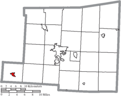 Location of Centerburg in Knox County | |
| Coordinates: 40°18′16″N 82°41′44″W / 40.30444°N 82.69556°WCoordinates: 40°18′16″N 82°41′44″W / 40.30444°N 82.69556°W | |
| Country | United States |
| State | Ohio |
| County | Knox |
| Government | |
| • Mayor | Diana Stockmaster |
| Area[1] | |
| • Total | 0.90 sq mi (2.33 km2) |
| • Land | 0.90 sq mi (2.33 km2) |
| • Water | 0 sq mi (0 km2) |
| Elevation[2] | 1,220 ft (372 m) |
| Population (2010)[3] | |
| • Total | 1,773 |
| • Estimate (2012[4]) | 1,861 |
| • Density | 1,970.0/sq mi (760.6/km2) |
| Time zone | Eastern (EST) (UTC-5) |
| • Summer (DST) | EDT (UTC-4) |
| ZIP code | 43011 |
| Area code(s) | 740 |
| FIPS code | 39-13036[5] |
| GNIS feature ID | 1060936[2] |
| Website | http://www.centerburgoh.org/ |

Centerburg is a village in Knox County, Ohio, United States, along the North Fork of the Licking River. As of the 2010 census, the village population was 1,773. Centerburg is the geographical center of Ohio.
History
Centerburg (formerly rendered Centreburgh) was laid out in 1830.[6] The village was so named on account of its location near Ohio's geographical center.[7] A post office has been in operation at Centerburg since 1835.[8]
Geography
Centerburg is located at 40°18′16″N 82°41′44″W / 40.304377°N 82.695580°W.[9]
According to the United States Census Bureau, the village has a total area of 0.90 square miles (2.33 km2), all land.[1]
Demographics
| Historical population | |||
|---|---|---|---|
| Census | Pop. | %± | |
| 1880 | 400 | — | |
| 1890 | 588 | 47.0% | |
| 1900 | 706 | 20.1% | |
| 1910 | 723 | 2.4% | |
| 1920 | 775 | 7.2% | |
| 1930 | 761 | −1.8% | |
| 1940 | 779 | 2.4% | |
| 1950 | 887 | 13.9% | |
| 1960 | 963 | 8.6% | |
| 1970 | 1,038 | 7.8% | |
| 1980 | 1,275 | 22.8% | |
| 1990 | 1,323 | 3.8% | |
| 2000 | 1,432 | 8.2% | |
| 2010 | 1,773 | 23.8% | |
| Est. 2015 | 2,052 | [10] | 15.7% |
2010 census
As of the census[3] of 2010, there were 1,773 people, 622 households, and 431 families residing in the village. The population density was 1,970.0 inhabitants per square mile (760.6/km2). There were 679 housing units at an average density of 754.4 per square mile (291.3/km2). The racial makeup of the village was 96.9% White, 1.2% African American, 0.1% Native American, 0.3% Asian, 0.1% from other races, and 1.4% from two or more races. Hispanic or Latino of any race were 0.2% of the population.
There were 622 households of which 42.6% had children under the age of 18 living with them, 46.9% were married couples living together, 16.7% had a female householder with no husband present, 5.6% had a male householder with no wife present, and 30.7% were non-families. 26.4% of all households were made up of individuals and 12.1% had someone living alone who was 65 years of age or older. The average household size was 2.63 and the average family size was 3.19.
The median age in the village was 36.2 years. 28.5% of residents were under the age of 18; 8.5% were between the ages of 18 and 24; 26% were from 25 to 44; 22.6% were from 45 to 64; and 14.3% were 65 years of age or older. The gender makeup of the village was 47.3% male and 52.7% female.
2000 census
As of the census[5] of 2000, there were 1,432 people, 504 households, and 363 families residing in the village. The population density was 2,228.5 people per square mile (863.9/km2). There were 537 housing units at an average density of 835.7 per square mile (324.0/km2). The racial makeup of the village was 97.91% White, 0.49% African American, 0.35% Native American, 0.28% Asian, 0.07% from other races, and 0.91% from two or more races. Hispanic or Latino of any race were 0.07% of the population.
There were 504 households out of which 42.7% had children under the age of 18 living with them, 57.1% were married couples living together, 11.5% had a female householder with no husband present, and 27.8% were non-families. 25.6% of all households were made up of individuals and 11.7% had someone living alone who was 65 years of age or older. The average household size was 2.63 and the average family size was 3.16.
In the village the population was spread out with 29.3% under the age of 18, 6.6% from 18 to 24, 30.4% from 25 to 44, 17.6% from 45 to 64, and 16.0% who were 65 years of age or older. The median age was 35 years. For every 100 females there were 100.0 males. For every 100 females age 18 and over, there were 90.2 males.
The median income for a household in the village was $39,750, and the median income for a family was $46,250. Males had a median income of $34,097 versus $27,353 for females. The per capita income for the village was $16,764. About 3.6% of families and 5.6% of the population were below the poverty line, including 5.7% of those under age 18 and 6.3% of those age 65 or over.
Notable people
- Doug Davis - lineman for the Minnesota Vikings during the 1960s.
- Daniel H. Reynolds - Confederate Brigadier General.
- Earl Griffith - newspaper publisher
- Robert McCloskey - artist and children's book author. His Centerburg Tales books are based in this town.
References
- 1 2 "US Gazetteer files 2010". United States Census Bureau. Archived from the original on 2012-01-24. Retrieved 2013-01-06.
- 1 2 "US Board on Geographic Names". United States Geological Survey. 2007-10-25. Retrieved 2008-01-31.
- 1 2 "American FactFinder". United States Census Bureau. Retrieved 2013-01-06.
- ↑ "Population Estimates". United States Census Bureau. Archived from the original on 2013-06-17. Retrieved 2013-06-17.
- 1 2 "American FactFinder". United States Census Bureau. Archived from the original on 2013-09-11. Retrieved 2008-01-31.
- ↑ Graham, Albert Adams (1881). History of Knox County, Ohio: Its Past and Present, Containing a Condensed, Comprehensive History of Ohio. A. A. Graham & Company. p. 485.
- ↑ Dorgan, Howard (1997). In the Hands of a Happy God: The "no-hellers" of Central Appalachia. Univ. of Tennessee Press. p. 157. ISBN 978-0-87049-962-3.
- ↑ "Knox County". Jim Forte Postal History. Archived from the original on 24 February 2016. Retrieved 29 December 2015.
- ↑ "US Gazetteer files: 2010, 2000, and 1990". United States Census Bureau. 2011-02-12. Retrieved 2011-04-23.
- ↑ "Annual Estimates of the Resident Population for Incorporated Places: April 1, 2010 to July 1, 2015". Retrieved July 2, 2016.
- ↑ "Census of Population and Housing". Census.gov. Archived from the original on May 11, 2015. Retrieved June 4, 2015.
Municipalities and communities of Knox County, Ohio, United States | ||
|---|---|---|
| City | 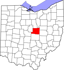 | |
| Villages | ||
| Townships | ||
| CDPs | ||
| Unincorporated communities | ||
| Ghost town | ||
| Footnotes | ‡This populated place also has portions in an adjacent county or counties | |