Cerro Bravo
| Cerro Bravo | |
|---|---|
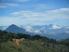 Cerro Bravo in June 2010 | |
| Highest point | |
| Elevation | 4,000+ metres (13,123+ ft) [1] |
| Listing | List of volcanoes in Colombia |
| Coordinates | 5°05′31″N 75°18′00″W / 5.092°N 75.30°WCoordinates: 5°05′31″N 75°18′00″W / 5.092°N 75.30°W [1] |
| Geography | |
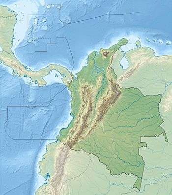 Cerro Bravo Location within Colombia | |
| Location | Tolima Department, Colombia |
| Parent range | Cordillera Central |
| Geology | |
| Mountain type | Stratovolcano |
| Last eruption | 1720 ± 150 years |
Cerro Bravo is a stratovolcano located in Tolima Department, Colombia, north of the Nevado del Ruiz volcano.
Eruptive history
As with many volcanoes in the region, Bravo's eruptions are often characterized by a central vent (caldera) eruption, followed by an explosive eruption and pyroclastic flows. However, it is unique in the fact that its eruption have also produced lava domes in its caldera. Such eruptions occurred in 1720 ± 150 years, 1050 ± 75 years, and 750 AD ± 150 years (through radiocarbon dating). Eruptions consisting of just a central vent eruption and subsequent explosive eruption took place in 1330 ± 75 years, 1310 BC ± 150 years, 1050 BC ± 200 years and 4280 BC ± 150 years.[2]
See also
References
Treasures of Colombia | |||||||||||||||||||||||||||||||||||||||||||||||||||||
|---|---|---|---|---|---|---|---|---|---|---|---|---|---|---|---|---|---|---|---|---|---|---|---|---|---|---|---|---|---|---|---|---|---|---|---|---|---|---|---|---|---|---|---|---|---|---|---|---|---|---|---|---|---|
Archaeological sites · Colombia magia salvaje · National monuments · National parks · World Heritage sites | |||||||||||||||||||||||||||||||||||||||||||||||||||||
| |||||||||||||||||||||||||||||||||||||||||||||||||||||
| |||||||||||||||||||||||||||||||||||||||||||||||||||||
| |||||||||||||||||||||||||||||||||||||||||||||||||||||
Source: Wills, Fernando et al. 2001. Nuestro patrimonio - 100 tesoros de Colombia - Our heritage - 100 treasures of Colombia, 1-311. El Tiempo. | |||||||||||||||||||||||||||||||||||||||||||||||||||||
This article is issued from Wikipedia - version of the 11/16/2016. The text is available under the Creative Commons Attribution/Share Alike but additional terms may apply for the media files.