Caño Paujil, Caquetá
For other uses, see Caño Paujil.
| Caño Paujil | |
|---|---|
 | |
| Location |
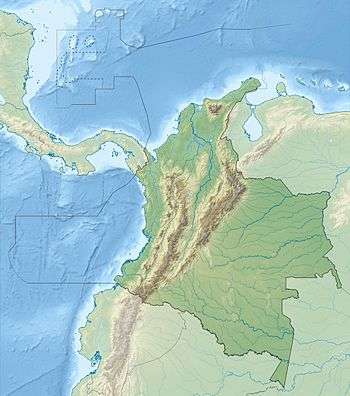
Araracuara Caquetá |
| Coordinates | 0°34′05″S 72°26′26″W / 0.56806°S 72.44056°WCoordinates: 0°34′05″S 72°26′26″W / 0.56806°S 72.44056°W |
| Elevation | 122 m (400 ft) |
| Number of drops | 1 |
| Watercourse | Caquetá River |
Caño Paujil is a waterfall in the Colombian department of Caquetá. It is located at an altitude of 122 metres (400 ft) in the Caquetá River, close to the municipalities Araracuara, Caquetá and Puerto Santander, Amazonas.[1][2]
Description
The waters of Caño Paujil originate from the Serranía de Chiribiquete. The climate around the waterfall is tropical, with average temperatures of 30 °C (86 °F).[3] The fauna is Amazonian; jaguars, tapirs, anacondas, parrots and turtles. During the first half of the twentieth century, the area around Caño Paujil was important for the rubber production.[3]
References
- ↑ Caño Paujil, Caquetá - Geonames.org
- ↑ Wills et al., 2001, p.268
- 1 2 (Spanish) Caño Paujil - Colparques
Bibliography
- Wills, Fernando et al. 2001. Nuestro patrimonio - 100 tesoros de Colombia - Our heritage - 100 treasures of Colombia, 1-311. El Tiempo.
Treasures of Colombia | |||||||||||||||||||||||||||||||||||||||||||||||||||||
|---|---|---|---|---|---|---|---|---|---|---|---|---|---|---|---|---|---|---|---|---|---|---|---|---|---|---|---|---|---|---|---|---|---|---|---|---|---|---|---|---|---|---|---|---|---|---|---|---|---|---|---|---|---|
Archaeological sites · Colombia magia salvaje · National monuments · National parks · World Heritage sites | |||||||||||||||||||||||||||||||||||||||||||||||||||||
| |||||||||||||||||||||||||||||||||||||||||||||||||||||
| |||||||||||||||||||||||||||||||||||||||||||||||||||||
| |||||||||||||||||||||||||||||||||||||||||||||||||||||
Source: Wills, Fernando et al. 2001. Nuestro patrimonio - 100 tesoros de Colombia - Our heritage - 100 treasures of Colombia, 1-311. El Tiempo. | |||||||||||||||||||||||||||||||||||||||||||||||||||||
This article is issued from Wikipedia - version of the 11/28/2016. The text is available under the Creative Commons Attribution/Share Alike but additional terms may apply for the media files.